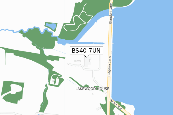
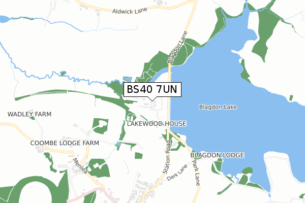
BS40 7UN is located in the Blagdon & Churchill electoral ward, within the unitary authority of North Somerset and the English Parliamentary constituency of Weston-Super-Mare. The Sub Integrated Care Board (ICB) Location is NHS Bristol, North Somerset and South Gloucestershire ICB - 15C and the police force is Avon and Somerset. This postcode has been in use since December 1997.


GetTheData
Source: OS Open Zoomstack (Ordnance Survey)
Licence: Open Government Licence (requires attribution)
Attribution: Contains OS data © Crown copyright and database right 2024
Source: Open Postcode Geo
Licence: Open Government Licence (requires attribution)
Attribution: Contains OS data © Crown copyright and database right 2024; Contains Royal Mail data © Royal Mail copyright and database right 2024; Source: Office for National Statistics licensed under the Open Government Licence v.3.0
| Easting | 350291 |
| Northing | 160011 |
| Latitude | 51.337004 |
| Longitude | -2.714963 |
GetTheData
Source: Open Postcode Geo
Licence: Open Government Licence
| Country | England |
| Postcode District | BS40 |
| ➜ BS40 open data dashboard ➜ See where BS40 is on a map | |
GetTheData
Source: Land Registry Price Paid Data
Licence: Open Government Licence
Elevation or altitude of BS40 7UN as distance above sea level:
| Metres | Feet | |
|---|---|---|
| Elevation | 40m | 131ft |
Elevation is measured from the approximate centre of the postcode, to the nearest point on an OS contour line from OS Terrain 50, which has contour spacing of ten vertical metres.
➜ How high above sea level am I? Find the elevation of your current position using your device's GPS.
GetTheData
Source: Open Postcode Elevation
Licence: Open Government Licence
| Ward | Blagdon & Churchill |
| Constituency | Weston-super-mare |
GetTheData
Source: ONS Postcode Database
Licence: Open Government Licence
| Seymour Arms (High Street) | Blagdon | 1,116m |
| Seymour Arms (High Street) | Blagdon | 1,119m |
| Church Street (Bath Road) | Blagdon | 1,364m |
| Church Street (Bath Road) | Blagdon | 1,367m |
| Dipland Grove (Bath Road) | Blagdon | 1,611m |
GetTheData
Source: NaPTAN
Licence: Open Government Licence
GetTheData
Source: ONS Postcode Database
Licence: Open Government Licence


➜ Get more ratings from the Food Standards Agency
GetTheData
Source: Food Standards Agency
Licence: FSA terms & conditions
| Last Collection | |||
|---|---|---|---|
| Location | Mon-Fri | Sat | Distance |
| Bellevue | 15:30 | 08:00 | 1,558m |
| Butcombe | 16:00 | 08:45 | 1,994m |
| Burrington Combe | 15:00 | 09:45 | 2,772m |
GetTheData
Source: Dracos
Licence: Creative Commons Attribution-ShareAlike
| Facility | Distance |
|---|---|
| Blagdon Cricket Club Bath Road, Blagdon Grass Pitches | 1.2km |
| Wrington Recreation Ground Silver Street, Wrington Grass Pitches, Outdoor Tennis Courts | 3.9km |
| Wrington Primary School School Road, Wrington, Bristol Grass Pitches | 4.3km |
GetTheData
Source: Active Places
Licence: Open Government Licence
| School | Phase of Education | Distance |
|---|---|---|
| Blagdon Primary School Bath Road, Blagdon, Bristol, BS40 7RW | Primary | 1.3km |
| Burrington Church of England Primary School Burrington, Bristol, BS40 7AD | Primary | 2.5km |
| Ubley Church of England Primary School The Street, Ubley, Bristol, BS40 6PJ | Primary | 3.2km |
GetTheData
Source: Edubase
Licence: Open Government Licence
The below table lists the International Territorial Level (ITL) codes (formerly Nomenclature of Territorial Units for Statistics (NUTS) codes) and Local Administrative Units (LAU) codes for BS40 7UN:
| ITL 1 Code | Name |
|---|---|
| TLK | South West (England) |
| ITL 2 Code | Name |
| TLK1 | Gloucestershire, Wiltshire and Bath/Bristol area |
| ITL 3 Code | Name |
| TLK12 | Bath and North East Somerset, North Somerset and South Gloucestershire |
| LAU 1 Code | Name |
| E06000024 | North Somerset |
GetTheData
Source: ONS Postcode Directory
Licence: Open Government Licence
The below table lists the Census Output Area (OA), Lower Layer Super Output Area (LSOA), and Middle Layer Super Output Area (MSOA) for BS40 7UN:
| Code | Name | |
|---|---|---|
| OA | E00074490 | |
| LSOA | E01014747 | North Somerset 024D |
| MSOA | E02003088 | North Somerset 024 |
GetTheData
Source: ONS Postcode Directory
Licence: Open Government Licence
| BS40 7UL | Station Road | 416m |
| BS40 7RQ | Lays Lane | 593m |
| BS40 7TF | Garston Lane | 672m |
| BS40 7TB | Station Road | 691m |
| BS40 7TE | Garston Lane | 718m |
| BS40 7TG | Garston Lane | 771m |
| BS40 7TD | Station Road | 777m |
| BS40 7UW | 828m | |
| BS40 7UB | Bell Square | 864m |
| BS40 7RA | High Street | 880m |
GetTheData
Source: Open Postcode Geo; Land Registry Price Paid Data
Licence: Open Government Licence