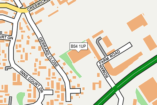
BS4 1UP is located in the Filwood electoral ward, within the unitary authority of Bristol, City of and the English Parliamentary constituency of Bristol South. The Sub Integrated Care Board (ICB) Location is NHS Bristol, North Somerset and South Gloucestershire ICB - 15C and the police force is Avon and Somerset. This postcode has been in use since June 2000.


GetTheData
Source: OS OpenMap – Local (Ordnance Survey)
Source: OS VectorMap District (Ordnance Survey)
Licence: Open Government Licence (requires attribution)
| Easting | 359070 |
| Northing | 169103 |
| Latitude | 51.419452 |
| Longitude | -2.589999 |
GetTheData
Source: Open Postcode Geo
Licence: Open Government Licence
| Country | England |
| Postcode District | BS4 |
| ➜ BS4 open data dashboard ➜ See where BS4 is on a map ➜ Where is Bristol? | |
GetTheData
Source: Land Registry Price Paid Data
Licence: Open Government Licence
Elevation or altitude of BS4 1UP as distance above sea level:
| Metres | Feet | |
|---|---|---|
| Elevation | 60m | 197ft |
Elevation is measured from the approximate centre of the postcode, to the nearest point on an OS contour line from OS Terrain 50, which has contour spacing of ten vertical metres.
➜ How high above sea level am I? Find the elevation of your current position using your device's GPS.
GetTheData
Source: Open Postcode Elevation
Licence: Open Government Licence
| Ward | Filwood |
| Constituency | Bristol South |
GetTheData
Source: ONS Postcode Database
Licence: Open Government Licence
| January 2024 | Criminal damage and arson | On or near Parking Area | 393m |
| January 2024 | Burglary | On or near Morpeth Road | 415m |
| January 2024 | Violence and sexual offences | On or near Holst Gardens | 434m |
| ➜ Get more crime data in our Crime section | |||
GetTheData
Source: data.police.uk
Licence: Open Government Licence
| Hengrove Depot (Roman Farm Road) | Hengrove | 145m |
| Hengrove Depot (Roman Farm Road) | Hengrove | 152m |
| Hengrove Leisure Park (Hengrove Way) | Hengrove | 205m |
| Hengrove Leisure Park (Hengrove Way) | Hengrove | 243m |
| Carisbrooke Road (Creswicke Road) | Inn's Court | 257m |
| Parson Street Station | 2km |
| Bedminster Station | 2.3km |
| Bristol Temple Meads Station | 3.4km |
GetTheData
Source: NaPTAN
Licence: Open Government Licence
GetTheData
Source: ONS Postcode Database
Licence: Open Government Licence


➜ Get more ratings from the Food Standards Agency
GetTheData
Source: Food Standards Agency
Licence: FSA terms & conditions
| Last Collection | |||
|---|---|---|---|
| Location | Mon-Fri | Sat | Distance |
| 3 Inns Court Avenue | 17:00 | 11:45 | 471m |
| Langhill Avenue | 17:00 | 11:45 | 616m |
| Leinster Avenue | 17:00 | 12:45 | 725m |
GetTheData
Source: Dracos
Licence: Creative Commons Attribution-ShareAlike
| Facility | Distance |
|---|---|
| Filwood Park Playing Fields Creswicke Road, Knowle, Bristol Grass Pitches | 241m |
| Filwood Swimming Pool (Closed) Filwood Broadway, Bristol Swimming Pool | 606m |
| The Florence Brown Community School (Closed) Leinster Avenue, Knowle West, Bristol Grass Pitches, Sports Hall, Swimming Pool | 656m |
GetTheData
Source: Active Places
Licence: Open Government Licence
| School | Phase of Education | Distance |
|---|---|---|
| School of Christ The King Catholic Primary Hartcliffe Road, Filwood Park, Bristol, BS4 1HD | Primary | 568m |
| Knowle DGE Academy Leinster Avenue, Knowle, Bristol, BS4 1NN | Not applicable | 656m |
| Greenfield E-ACT Primary Academy Novers Lane, Knowle West, Bristol, BS4 1QW | Primary | 666m |
GetTheData
Source: Edubase
Licence: Open Government Licence
The below table lists the International Territorial Level (ITL) codes (formerly Nomenclature of Territorial Units for Statistics (NUTS) codes) and Local Administrative Units (LAU) codes for BS4 1UP:
| ITL 1 Code | Name |
|---|---|
| TLK | South West (England) |
| ITL 2 Code | Name |
| TLK1 | Gloucestershire, Wiltshire and Bath/Bristol area |
| ITL 3 Code | Name |
| TLK11 | Bristol, City of |
| LAU 1 Code | Name |
| E06000023 | Bristol, City of |
GetTheData
Source: ONS Postcode Directory
Licence: Open Government Licence
The below table lists the Census Output Area (OA), Lower Layer Super Output Area (LSOA), and Middle Layer Super Output Area (MSOA) for BS4 1UP:
| Code | Name | |
|---|---|---|
| OA | E00073659 | |
| LSOA | E01014581 | Bristol 045C |
| MSOA | E02003056 | Bristol 045 |
GetTheData
Source: ONS Postcode Directory
Licence: Open Government Licence
| BS4 1UH | Gerrard Close | 110m |
| BS4 1XN | Wilbye Grove | 153m |
| BS4 1XP | Delius Grove | 159m |
| BS4 1XL | Coates Walk | 171m |
| BS4 1XT | Purcell Walk | 211m |
| BS4 1UG | Creswicke Road | 221m |
| BS4 1TX | Inns Court Green | 232m |
| BS4 1XW | Travers Close | 243m |
| BS4 1UJ | Roman Farm Road | 249m |
| BS4 1XJ | Sullivan Close | 254m |
GetTheData
Source: Open Postcode Geo; Land Registry Price Paid Data
Licence: Open Government Licence