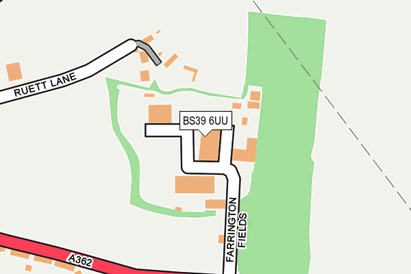
BS39 6UU is located in the High Littleton electoral ward, within the unitary authority of Bath and North East Somerset and the English Parliamentary constituency of North East Somerset. The Sub Integrated Care Board (ICB) Location is NHS Bath and North East Somerset, Swindon and Wiltshire ICB - 92 and the police force is Avon and Somerset. This postcode has been in use since December 1997.


GetTheData
Source: OS OpenMap – Local (Ordnance Survey)
Source: OS VectorMap District (Ordnance Survey)
Licence: Open Government Licence (requires attribution)
| Easting | 364172 |
| Northing | 155482 |
| Latitude | 51.297329 |
| Longitude | -2.515254 |
GetTheData
Source: Open Postcode Geo
Licence: Open Government Licence
| Country | England |
| Postcode District | BS39 |
| ➜ BS39 open data dashboard ➜ See where BS39 is on a map ➜ Where is Farrington Gurney? | |
GetTheData
Source: Land Registry Price Paid Data
Licence: Open Government Licence
Elevation or altitude of BS39 6UU as distance above sea level:
| Metres | Feet | |
|---|---|---|
| Elevation | 120m | 394ft |
Elevation is measured from the approximate centre of the postcode, to the nearest point on an OS contour line from OS Terrain 50, which has contour spacing of ten vertical metres.
➜ How high above sea level am I? Find the elevation of your current position using your device's GPS.
GetTheData
Source: Open Postcode Elevation
Licence: Open Government Licence
| Ward | High Littleton |
| Constituency | North East Somerset |
GetTheData
Source: ONS Postcode Database
Licence: Open Government Licence
| June 2022 | Violence and sexual offences | On or near Hill View | 493m |
| February 2022 | Public order | On or near Hill View | 493m |
| January 2022 | Public order | On or near Hill View | 493m |
| ➜ Get more crime data in our Crime section | |||
GetTheData
Source: data.police.uk
Licence: Open Government Licence
| Miners Arms (A362) | Farrington Gurney | 559m |
| Miners Arms (A362) | Farrington Gurney | 575m |
| Manor Farm (A362) | Farrington Gurney | 731m |
| Manor Farm (A362) | Farrington Gurney | 738m |
| Specklemead | Paulton | 799m |
GetTheData
Source: NaPTAN
Licence: Open Government Licence
GetTheData
Source: ONS Postcode Database
Licence: Open Government Licence


➜ Get more ratings from the Food Standards Agency
GetTheData
Source: Food Standards Agency
Licence: FSA terms & conditions
| Last Collection | |||
|---|---|---|---|
| Location | Mon-Fri | Sat | Distance |
| Paulton Post Office | 17:15 | 11:30 | 1,369m |
| Hallatrow S O | 17:15 | 11:45 | 1,775m |
| White Cross | 16:15 | 08:45 | 1,916m |
GetTheData
Source: Dracos
Licence: Creative Commons Attribution-ShareAlike
| Facility | Distance |
|---|---|
| Miners Welfare Recreation Ground Tennis Court Road, Paulton, Bristol Grass Pitches | 875m |
| Farrington Recreation Ground & Memorial Hall Church Lane, Farrington Gurney, Bristol Sports Hall, Grass Pitches, Outdoor Tennis Courts | 1.1km |
| Curves For Women (Midsomer Norton) (Closed) Old Mills Industrial Estate, Old Mills, Paulton, Bristol Health and Fitness Gym | 1.1km |
GetTheData
Source: Active Places
Licence: Open Government Licence
| School | Phase of Education | Distance |
|---|---|---|
| Farrington Gurney Church of England Primary School Church Lane, Farrington Gurney, Bristol, BS39 6TY | Primary | 950m |
| Paulton Infant School Plumptre Close, Paulton, Bristol, BS39 7QY | Primary | 1.2km |
| Paulton Junior School Plumptre Close, Paulton, BS39 7QY | Primary | 1.2km |
GetTheData
Source: Edubase
Licence: Open Government Licence
The below table lists the International Territorial Level (ITL) codes (formerly Nomenclature of Territorial Units for Statistics (NUTS) codes) and Local Administrative Units (LAU) codes for BS39 6UU:
| ITL 1 Code | Name |
|---|---|
| TLK | South West (England) |
| ITL 2 Code | Name |
| TLK1 | Gloucestershire, Wiltshire and Bath/Bristol area |
| ITL 3 Code | Name |
| TLK12 | Bath and North East Somerset, North Somerset and South Gloucestershire |
| LAU 1 Code | Name |
| E06000022 | Bath and North East Somerset |
GetTheData
Source: ONS Postcode Directory
Licence: Open Government Licence
The below table lists the Census Output Area (OA), Lower Layer Super Output Area (LSOA), and Middle Layer Super Output Area (MSOA) for BS39 6UU:
| Code | Name | |
|---|---|---|
| OA | E00072695 | |
| LSOA | E01014394 | Bath and North East Somerset 023B |
| MSOA | E02003007 | Bath and North East Somerset 023 |
GetTheData
Source: ONS Postcode Directory
Licence: Open Government Licence
| BS39 6UP | Ruett Lane | 144m |
| BS39 6UN | Main Street | 300m |
| BS39 6UW | Ruett Lane | 367m |
| BS39 6UJ | Hill View | 482m |
| BS39 6UL | Main Street | 493m |
| BS39 6UH | The Crescent | 616m |
| BS39 7ST | Old Mills Lane | 711m |
| BS39 7SR | Old Mills | 755m |
| BS39 7ND | Specklemead | 762m |
| BS39 7LZ | Tennis Court Avenue | 810m |
GetTheData
Source: Open Postcode Geo; Land Registry Price Paid Data
Licence: Open Government Licence