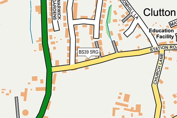
BS39 5RG is located in the Clutton & Farmborough electoral ward, within the unitary authority of Bath and North East Somerset and the English Parliamentary constituency of North East Somerset. The Sub Integrated Care Board (ICB) Location is NHS Bath and North East Somerset, Swindon and Wiltshire ICB - 92 and the police force is Avon and Somerset. This postcode has been in use since December 1997.


GetTheData
Source: OS OpenMap – Local (Ordnance Survey)
Source: OS VectorMap District (Ordnance Survey)
Licence: Open Government Licence (requires attribution)
| Easting | 362080 |
| Northing | 159174 |
| Latitude | 51.330386 |
| Longitude | -2.545653 |
GetTheData
Source: Open Postcode Geo
Licence: Open Government Licence
| Country | England |
| Postcode District | BS39 |
| ➜ BS39 open data dashboard ➜ See where BS39 is on a map ➜ Where is Clutton? | |
GetTheData
Source: Land Registry Price Paid Data
Licence: Open Government Licence
Elevation or altitude of BS39 5RG as distance above sea level:
| Metres | Feet | |
|---|---|---|
| Elevation | 140m | 459ft |
Elevation is measured from the approximate centre of the postcode, to the nearest point on an OS contour line from OS Terrain 50, which has contour spacing of ten vertical metres.
➜ How high above sea level am I? Find the elevation of your current position using your device's GPS.
GetTheData
Source: Open Postcode Elevation
Licence: Open Government Licence
| Ward | Clutton & Farmborough |
| Constituency | North East Somerset |
GetTheData
Source: ONS Postcode Database
Licence: Open Government Licence
| June 2022 | Anti-social behaviour | On or near Upper Bristol Road | 188m |
| June 2022 | Public order | On or near Upper Bristol Road | 188m |
| April 2022 | Violence and sexual offences | On or near Upper Bristol Road | 188m |
| ➜ Get more crime data in our Crime section | |||
GetTheData
Source: data.police.uk
Licence: Open Government Licence
| The Mead (Station Road) | Clutton | 40m |
| The Mead (Station Road) | Clutton | 43m |
| Station Road (Upper Bristol Road) | Clutton | 146m |
| Station Road (Bristol Road) | Clutton | 188m |
| Rogers Close (Upper Bristol Road) | Clutton | 256m |
GetTheData
Source: NaPTAN
Licence: Open Government Licence
| Percentage of properties with Next Generation Access | 100.0% |
| Percentage of properties with Superfast Broadband | 100.0% |
| Percentage of properties with Ultrafast Broadband | 0.0% |
| Percentage of properties with Full Fibre Broadband | 0.0% |
Superfast Broadband is between 30Mbps and 300Mbps
Ultrafast Broadband is > 300Mbps
| Percentage of properties unable to receive 2Mbps | 0.0% |
| Percentage of properties unable to receive 5Mbps | 0.0% |
| Percentage of properties unable to receive 10Mbps | 0.0% |
| Percentage of properties unable to receive 30Mbps | 0.0% |
GetTheData
Source: Ofcom
Licence: Ofcom Terms of Use (requires attribution)
GetTheData
Source: ONS Postcode Database
Licence: Open Government Licence

➜ Get more ratings from the Food Standards Agency
GetTheData
Source: Food Standards Agency
Licence: FSA terms & conditions
| Last Collection | |||
|---|---|---|---|
| Location | Mon-Fri | Sat | Distance |
| Clutton Post Office | 17:00 | 12:00 | 390m |
| Cholwell | 17:00 | 08:45 | 625m |
| Tiledown | 16:15 | 10:30 | 907m |
GetTheData
Source: Dracos
Licence: Creative Commons Attribution-ShareAlike
| Facility | Distance |
|---|---|
| Clutton Football Club Upper Bristol Road, Clutton, Bristol Grass Pitches | 347m |
| Temple Cloud Cricket Club Stowey Road, Clutton, Bristol Grass Pitches | 850m |
| Cameley Village Hall Brandown Close, Temple Cloud, Bristol Sports Hall, Grass Pitches | 1.2km |
GetTheData
Source: Active Places
Licence: Open Government Licence
| School | Phase of Education | Distance |
|---|---|---|
| Clutton Primary School Station Road, Clutton, Bristol, BS39 5RA | Primary | 327m |
| Cameley CEVC Primary School Meadway, Temple Cloud, Bristol, BS39 5BD | Primary | 1.2km |
| High Littleton CofE VC Primary School Church Hill, High Littleton, Bristol, BS39 6HF | Primary | 2.7km |
GetTheData
Source: Edubase
Licence: Open Government Licence
The below table lists the International Territorial Level (ITL) codes (formerly Nomenclature of Territorial Units for Statistics (NUTS) codes) and Local Administrative Units (LAU) codes for BS39 5RG:
| ITL 1 Code | Name |
|---|---|
| TLK | South West (England) |
| ITL 2 Code | Name |
| TLK1 | Gloucestershire, Wiltshire and Bath/Bristol area |
| ITL 3 Code | Name |
| TLK12 | Bath and North East Somerset, North Somerset and South Gloucestershire |
| LAU 1 Code | Name |
| E06000022 | Bath and North East Somerset |
GetTheData
Source: ONS Postcode Directory
Licence: Open Government Licence
The below table lists the Census Output Area (OA), Lower Layer Super Output Area (LSOA), and Middle Layer Super Output Area (MSOA) for BS39 5RG:
| Code | Name | |
|---|---|---|
| OA | E00072663 | |
| LSOA | E01014386 | Bath and North East Somerset 020B |
| MSOA | E02003004 | Bath and North East Somerset 020 |
GetTheData
Source: ONS Postcode Directory
Licence: Open Government Licence
| BS39 5RQ | The Mead | 35m |
| BS39 5RF | The Mead | 46m |
| BS39 5RE | Cooks Hill | 64m |
| BS39 5RD | Cooks Hill | 126m |
| BS39 5RX | Rogers Close | 137m |
| BS39 5RU | Rogers Close | 141m |
| BS39 5RT | Rogers Close | 148m |
| BS39 5SB | Furnleaze | 154m |
| BS39 5TB | Upper Bristol Road | 157m |
| BS39 5TE | Upper Bristol Road | 197m |
GetTheData
Source: Open Postcode Geo; Land Registry Price Paid Data
Licence: Open Government Licence