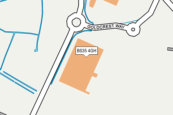
BS35 4GH is located in the Pilning & Severn Beach electoral ward, within the unitary authority of South Gloucestershire and the English Parliamentary constituency of Filton and Bradley Stoke. The Sub Integrated Care Board (ICB) Location is NHS Bristol, North Somerset and South Gloucestershire ICB - 15C and the police force is Avon and Somerset. This postcode has been in use since April 2012.


GetTheData
Source: OS OpenMap – Local (Ordnance Survey)
Source: OS VectorMap District (Ordnance Survey)
Licence: Open Government Licence (requires attribution)
| Easting | 355647 |
| Northing | 183015 |
| Latitude | 51.544276 |
| Longitude | -2.640977 |
GetTheData
Source: Open Postcode Geo
Licence: Open Government Licence
| Country | England |
| Postcode District | BS35 |
➜ See where BS35 is on a map | |
GetTheData
Source: Land Registry Price Paid Data
Licence: Open Government Licence
Elevation or altitude of BS35 4GH as distance above sea level:
| Metres | Feet | |
|---|---|---|
| Elevation | 10m | 33ft |
Elevation is measured from the approximate centre of the postcode, to the nearest point on an OS contour line from OS Terrain 50, which has contour spacing of ten vertical metres.
➜ How high above sea level am I? Find the elevation of your current position using your device's GPS.
GetTheData
Source: Open Postcode Elevation
Licence: Open Government Licence
| Ward | Pilning & Severn Beach |
| Constituency | Filton And Bradley Stoke |
GetTheData
Source: ONS Postcode Database
Licence: Open Government Licence
| Govier Way | Severn Beach | 683m |
| Pilning Road (B4055) | Marsh Common | 821m |
| Pilning Road | Marsh Common | 828m |
| Swanmoor Bridge (B4055) | Marsh Common | 857m |
| Swanmoor Bridge | Marsh Common | 969m |
| Pilning Station | 1.7km |
| Severn Beach Station | 2.4km |
| St Andrews Road Station | 5.2km |
GetTheData
Source: NaPTAN
Licence: Open Government Licence
GetTheData
Source: ONS Postcode Database
Licence: Open Government Licence


➜ Get more ratings from the Food Standards Agency
GetTheData
Source: Food Standards Agency
Licence: FSA terms & conditions
| Last Collection | |||
|---|---|---|---|
| Location | Mon-Fri | Sat | Distance |
| Swan Moor | 17:00 | 10:00 | 904m |
| Easter Compton Post Office | 17:15 | 11:00 | 1,668m |
| Pilning Station | 15:00 | 09:30 | 1,810m |
GetTheData
Source: Dracos
Licence: Creative Commons Attribution-ShareAlike
| Risk of BS35 4GH flooding from rivers and sea | Low |
| ➜ BS35 4GH flood map | |
GetTheData
Source: Open Flood Risk by Postcode
Licence: Open Government Licence
The below table lists the International Territorial Level (ITL) codes (formerly Nomenclature of Territorial Units for Statistics (NUTS) codes) and Local Administrative Units (LAU) codes for BS35 4GH:
| ITL 1 Code | Name |
|---|---|
| TLK | South West (England) |
| ITL 2 Code | Name |
| TLK1 | Gloucestershire, Wiltshire and Bath/Bristol area |
| ITL 3 Code | Name |
| TLK12 | Bath and North East Somerset, North Somerset and South Gloucestershire |
| LAU 1 Code | Name |
| E06000025 | South Gloucestershire |
GetTheData
Source: ONS Postcode Directory
Licence: Open Government Licence
The below table lists the Census Output Area (OA), Lower Layer Super Output Area (LSOA), and Middle Layer Super Output Area (MSOA) for BS35 4GH:
| Code | Name | |
|---|---|---|
| OA | E00075556 | |
| LSOA | E01014953 | South Gloucestershire 005C |
| MSOA | E02003094 | South Gloucestershire 005 |
GetTheData
Source: ONS Postcode Directory
Licence: Open Government Licence
| BS35 4GG | Western Approach Distribution Park | 702m |
| BS35 4JU | Marsh Common Road | 816m |
| BS35 5RY | Vimpennys Lane | 909m |
| BS35 4JT | Station Road | 1070m |
| BS35 5SF | Spaniorum View | 1157m |
| BS35 5RD | The Lane | 1306m |
| BS35 5SG | Berwick Close | 1323m |
| BS35 5RX | Berwick Lane | 1349m |
| BS35 5RA | Main Road | 1354m |
| BS35 4JY | Marsh Common Road | 1358m |
GetTheData
Source: Open Postcode Geo; Land Registry Price Paid Data
Licence: Open Government Licence