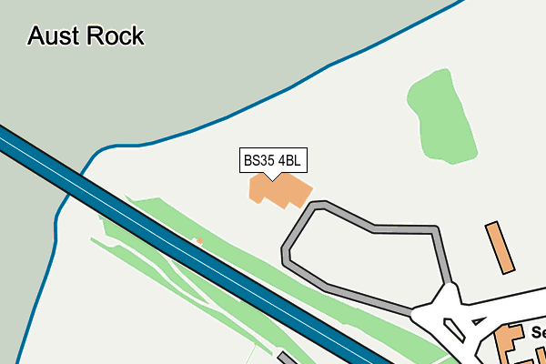
BS35 4BL is located in the Severn Vale electoral ward, within the unitary authority of South Gloucestershire and the English Parliamentary constituency of Thornbury and Yate. The Sub Integrated Care Board (ICB) Location is NHS Bristol, North Somerset and South Gloucestershire ICB - 15C and the police force is Avon and Somerset. This postcode has been in use since December 2001.


GetTheData
Source: OS OpenMap – Local (Ordnance Survey)
Source: OS VectorMap District (Ordnance Survey)
Licence: Open Government Licence (requires attribution)
| Easting | 356815 |
| Northing | 189796 |
| Latitude | 51.605334 |
| Longitude | -2.624967 |
GetTheData
Source: Open Postcode Geo
Licence: Open Government Licence
| Country | England |
| Postcode District | BS35 |
| ➜ BS35 open data dashboard ➜ See where BS35 is on a map | |
GetTheData
Source: Land Registry Price Paid Data
Licence: Open Government Licence
Elevation or altitude of BS35 4BL as distance above sea level:
| Metres | Feet | |
|---|---|---|
| Elevation | 40m | 131ft |
Elevation is measured from the approximate centre of the postcode, to the nearest point on an OS contour line from OS Terrain 50, which has contour spacing of ten vertical metres.
➜ How high above sea level am I? Find the elevation of your current position using your device's GPS.
GetTheData
Source: Open Postcode Elevation
Licence: Open Government Licence
| Ward | Severn Vale |
| Constituency | Thornbury And Yate |
GetTheData
Source: ONS Postcode Database
Licence: Open Government Licence
| June 2022 | Other theft | On or near Pedestrian Subway | 56m |
| May 2022 | Shoplifting | On or near Pedestrian Subway | 56m |
| April 2022 | Violence and sexual offences | On or near Pedestrian Subway | 56m |
| ➜ Get more crime data in our Crime section | |||
GetTheData
Source: data.police.uk
Licence: Open Government Licence
| M48 Interchange | Aust | 676m |
| M48 Interchange | Aust | 724m |
| Lay-by (A403) | Aust | 747m |
| The Boars Head | Aust | 1,043m |
| Chepstow Station | 5.1km |
GetTheData
Source: NaPTAN
Licence: Open Government Licence
GetTheData
Source: ONS Postcode Database
Licence: Open Government Licence


➜ Get more ratings from the Food Standards Agency
GetTheData
Source: Food Standards Agency
Licence: FSA terms & conditions
| Last Collection | |||
|---|---|---|---|
| Location | Mon-Fri | Sat | Distance |
| Aust Ferry | 16:00 | 09:00 | 921m |
| Aust Village | 16:30 | 09:45 | 953m |
| Ingst | 15:45 | 08:00 | 2,426m |
GetTheData
Source: Dracos
Licence: Creative Commons Attribution-ShareAlike
| Facility | Distance |
|---|---|
| Beachley Barracks Road From Buttington Terrace To The Old Ferry Inn, Beachley Grass Pitches | 2.5km |
| Oldbury On Severn Playing Fields Westmarsh Lane, Oldbury-on-severn, Bristol Grass Pitches, Outdoor Tennis Courts | 4.6km |
| Offa's Mead Academy Beachley Road, Sedbury, Cas-gwent Grass Pitches | 4.8km |
GetTheData
Source: Active Places
Licence: Open Government Licence
| School | Phase of Education | Distance |
|---|---|---|
| Thornwell Primary School Thornwell Road, Bulwark, Chepstow, NP16 5NT | Not applicable | 3.8km |
| Olveston Church of England Primary School Elberton Road, Olveston, Bristol, BS35 4DB | Primary | 4.1km |
| Pembroke Primary School Fairfield Road, Bulwark, Chepstow, Monmouthshire, NP6 5JN | Not applicable | 4.6km |
GetTheData
Source: Edubase
Licence: Open Government Licence
The below table lists the International Territorial Level (ITL) codes (formerly Nomenclature of Territorial Units for Statistics (NUTS) codes) and Local Administrative Units (LAU) codes for BS35 4BL:
| ITL 1 Code | Name |
|---|---|
| TLK | South West (England) |
| ITL 2 Code | Name |
| TLK1 | Gloucestershire, Wiltshire and Bath/Bristol area |
| ITL 3 Code | Name |
| TLK12 | Bath and North East Somerset, North Somerset and South Gloucestershire |
| LAU 1 Code | Name |
| E06000025 | South Gloucestershire |
GetTheData
Source: ONS Postcode Directory
Licence: Open Government Licence
The below table lists the Census Output Area (OA), Lower Layer Super Output Area (LSOA), and Middle Layer Super Output Area (MSOA) for BS35 4BL:
| Code | Name | |
|---|---|---|
| OA | E00075589 | |
| LSOA | E01014963 | South Gloucestershire 004D |
| MSOA | E02003093 | South Gloucestershire 004 |
GetTheData
Source: ONS Postcode Directory
Licence: Open Government Licence
| BS35 4BD | Passage Road | 678m |
| BS35 4BA | Main Road | 853m |
| BS35 4BG | Passage Road | 858m |
| BS35 4AZ | Main Road | 867m |
| BS35 4AU | Sandy Lane | 929m |
| BS35 4BB | Orchard Drive | 938m |
| BS35 4AY | The Row | 969m |
| BS35 4AX | Main Road | 1111m |
| NP16 7HH | 1858m | |
| NP16 7HJ | Church Cottages | 2285m |
GetTheData
Source: Open Postcode Geo; Land Registry Price Paid Data
Licence: Open Government Licence