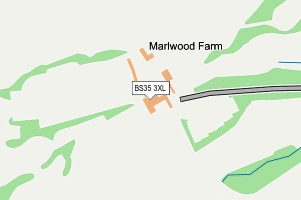
BS35 3XL is located in the Thornbury electoral ward, within the unitary authority of South Gloucestershire and the English Parliamentary constituency of Thornbury and Yate. The Sub Integrated Care Board (ICB) Location is NHS Bristol, North Somerset and South Gloucestershire ICB - 15C and the police force is Avon and Somerset. This postcode has been in use since December 1997.


GetTheData
Source: OS OpenMap – Local (Ordnance Survey)
Source: OS VectorMap District (Ordnance Survey)
Licence: Open Government Licence (requires attribution)
| Easting | 362850 |
| Northing | 189210 |
| Latitude | 51.600497 |
| Longitude | -2.537767 |
GetTheData
Source: Open Postcode Geo
Licence: Open Government Licence
| Country | England |
| Postcode District | BS35 |
| ➜ BS35 open data dashboard ➜ See where BS35 is on a map | |
GetTheData
Source: Land Registry Price Paid Data
Licence: Open Government Licence
Elevation or altitude of BS35 3XL as distance above sea level:
| Metres | Feet | |
|---|---|---|
| Elevation | 80m | 262ft |
Elevation is measured from the approximate centre of the postcode, to the nearest point on an OS contour line from OS Terrain 50, which has contour spacing of ten vertical metres.
➜ How high above sea level am I? Find the elevation of your current position using your device's GPS.
GetTheData
Source: Open Postcode Elevation
Licence: Open Government Licence
| Ward | Thornbury |
| Constituency | Thornbury And Yate |
GetTheData
Source: ONS Postcode Database
Licence: Open Government Licence
| Leisure Centre | Thornbury | 745m |
| Leisure Centre (Bristol Road) | Thornbury | 772m |
| Marlwood School | Alveston | 813m |
| Strode Common | Alveston | 969m |
| Tesco | Thornbury | 975m |
GetTheData
Source: NaPTAN
Licence: Open Government Licence
GetTheData
Source: ONS Postcode Database
Licence: Open Government Licence


➜ Get more ratings from the Food Standards Agency
GetTheData
Source: Food Standards Agency
Licence: FSA terms & conditions
| Last Collection | |||
|---|---|---|---|
| Location | Mon-Fri | Sat | Distance |
| Alverston Down | 16:45 | 09:00 | 973m |
| Cooper Road | 17:30 | 11:15 | 1,085m |
| High Street | 17:30 | 11:15 | 1,100m |
GetTheData
Source: Dracos
Licence: Creative Commons Attribution-ShareAlike
| Facility | Distance |
|---|---|
| Thornbury Golf Centre Bristol Road, Thornbury, Bristol Golf | 0m |
| Thornbury Active Lifestyle Centre Alveston Hill, Thornbury, Bristol Sports Hall, Indoor Bowls, Swimming Pool, Health and Fitness Gym, Studio, Squash Courts | 744m |
| Mundy Playing Fields Kington Lane, Thornbury Grass Pitches, Outdoor Tennis Courts | 827m |
GetTheData
Source: Active Places
Licence: Open Government Licence
| School | Phase of Education | Distance |
|---|---|---|
| Marlwood School Vattingstone Lane, Alveston, Bristol, BS35 3LA | Secondary | 830m |
| Gillingstool Primary School Gillingstool, Thornbury, Bristol, BS35 2EG | Primary | 1.3km |
| St Mary's Church of England Primary School, Thornbury Church Road, Thornbury, Bristol, BS35 1HJ | Primary | 1.5km |
GetTheData
Source: Edubase
Licence: Open Government Licence
The below table lists the International Territorial Level (ITL) codes (formerly Nomenclature of Territorial Units for Statistics (NUTS) codes) and Local Administrative Units (LAU) codes for BS35 3XL:
| ITL 1 Code | Name |
|---|---|
| TLK | South West (England) |
| ITL 2 Code | Name |
| TLK1 | Gloucestershire, Wiltshire and Bath/Bristol area |
| ITL 3 Code | Name |
| TLK12 | Bath and North East Somerset, North Somerset and South Gloucestershire |
| LAU 1 Code | Name |
| E06000025 | South Gloucestershire |
GetTheData
Source: ONS Postcode Directory
Licence: Open Government Licence
The below table lists the Census Output Area (OA), Lower Layer Super Output Area (LSOA), and Middle Layer Super Output Area (MSOA) for BS35 3XL:
| Code | Name | |
|---|---|---|
| OA | E00075742 | |
| LSOA | E01014991 | South Gloucestershire 002B |
| MSOA | E02003091 | South Gloucestershire 002 |
GetTheData
Source: ONS Postcode Directory
Licence: Open Government Licence
| BS35 3JB | Thornbury Road | 744m |
| BS35 3JU | Mumbleys Lane | 771m |
| BS35 3HZ | Costers Close | 784m |
| BS35 3HY | Vilner Lane | 818m |
| BS35 3JJ | Quarry Road | 830m |
| BS35 3JA | Bristol Road | 839m |
| BS35 3JP | Quarry Road | 842m |
| BS35 3JW | Quarry Road | 890m |
| BS35 1NA | Kington Lane | 892m |
| BS35 3JL | Quarry Road | 900m |
GetTheData
Source: Open Postcode Geo; Land Registry Price Paid Data
Licence: Open Government Licence