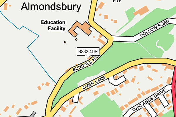
BS32 4DR is located in the Severn Vale electoral ward, within the unitary authority of South Gloucestershire and the English Parliamentary constituency of Filton and Bradley Stoke. The Sub Integrated Care Board (ICB) Location is NHS Bristol, North Somerset and South Gloucestershire ICB - 15C and the police force is Avon and Somerset. This postcode has been in use since December 1997.


GetTheData
Source: OS OpenMap – Local (Ordnance Survey)
Source: OS VectorMap District (Ordnance Survey)
Licence: Open Government Licence (requires attribution)
| Easting | 360271 |
| Northing | 183863 |
| Latitude | 51.552246 |
| Longitude | -2.574396 |
GetTheData
Source: Open Postcode Geo
Licence: Open Government Licence
| Country | England |
| Postcode District | BS32 |
| ➜ BS32 open data dashboard ➜ See where BS32 is on a map ➜ Where is Almondsbury? | |
GetTheData
Source: Land Registry Price Paid Data
Licence: Open Government Licence
Elevation or altitude of BS32 4DR as distance above sea level:
| Metres | Feet | |
|---|---|---|
| Elevation | 50m | 164ft |
Elevation is measured from the approximate centre of the postcode, to the nearest point on an OS contour line from OS Terrain 50, which has contour spacing of ten vertical metres.
➜ How high above sea level am I? Find the elevation of your current position using your device's GPS.
GetTheData
Source: Open Postcode Elevation
Licence: Open Government Licence
| Ward | Severn Vale |
| Constituency | Filton And Bradley Stoke |
GetTheData
Source: ONS Postcode Database
Licence: Open Government Licence
| June 2022 | Anti-social behaviour | On or near Oaklands Drive | 251m |
| May 2022 | Violence and sexual offences | On or near Knole Close | 426m |
| April 2022 | Criminal damage and arson | On or near Sundays Hill | 15m |
| ➜ Get more crime data in our Crime section | |||
GetTheData
Source: data.police.uk
Licence: Open Government Licence
| Almondsbury School (Sundays Hill) | Almondsbury | 123m |
| Sundays Hill | Almondsbury | 164m |
| Sundays Hill | Almondsbury | 185m |
| Over Lane | Almondsbury | 272m |
| Over Lane | Almondsbury | 272m |
| Patchway Station | 3km |
| Pilning Station | 3.7km |
| Bristol Parkway Station | 4.8km |
GetTheData
Source: NaPTAN
Licence: Open Government Licence
| Percentage of properties with Next Generation Access | 100.0% |
| Percentage of properties with Superfast Broadband | 100.0% |
| Percentage of properties with Ultrafast Broadband | 0.0% |
| Percentage of properties with Full Fibre Broadband | 0.0% |
Superfast Broadband is between 30Mbps and 300Mbps
Ultrafast Broadband is > 300Mbps
| Percentage of properties unable to receive 2Mbps | 0.0% |
| Percentage of properties unable to receive 5Mbps | 0.0% |
| Percentage of properties unable to receive 10Mbps | 0.0% |
| Percentage of properties unable to receive 30Mbps | 0.0% |
GetTheData
Source: Ofcom
Licence: Ofcom Terms of Use (requires attribution)
GetTheData
Source: ONS Postcode Database
Licence: Open Government Licence


➜ Get more ratings from the Food Standards Agency
GetTheData
Source: Food Standards Agency
Licence: FSA terms & conditions
| Last Collection | |||
|---|---|---|---|
| Location | Mon-Fri | Sat | Distance |
| The Village | 16:30 | 11:45 | 276m |
| Weavers Wood | 16:00 | 12:15 | 569m |
| Knole Park | 16:00 | 12:00 | 623m |
GetTheData
Source: Dracos
Licence: Creative Commons Attribution-ShareAlike
| Facility | Distance |
|---|---|
| Oaklands (North Bristol Rfc) Gloucester Road, Almondsbury Grass Pitches, Artificial Grass Pitch | 396m |
| Gloucestershire Fa Headquarters Gloucester Road, Oaklands Park, Almondsbury, Bristol Grass Pitches, Artificial Grass Pitch | 465m |
| Almondsbury Sports And Social Club Gloucester Road, Almondsbury, Bristol Grass Pitches, Sports Hall, Outdoor Tennis Courts | 473m |
GetTheData
Source: Active Places
Licence: Open Government Licence
| School | Phase of Education | Distance |
|---|---|---|
| Almondsbury Church of England Primary School Sundays Hill, Almondsbury, BS32 4DS | Primary | 99m |
| Patchway Community School Hempton Lane, Almondsbury, BS32 4AJ | Secondary | 1.4km |
| Holy Trinity Primary School Broad Croft, Bradley Stoke, Bristol, BS32 0BD | Primary | 1.5km |
GetTheData
Source: Edubase
Licence: Open Government Licence
The below table lists the International Territorial Level (ITL) codes (formerly Nomenclature of Territorial Units for Statistics (NUTS) codes) and Local Administrative Units (LAU) codes for BS32 4DR:
| ITL 1 Code | Name |
|---|---|
| TLK | South West (England) |
| ITL 2 Code | Name |
| TLK1 | Gloucestershire, Wiltshire and Bath/Bristol area |
| ITL 3 Code | Name |
| TLK12 | Bath and North East Somerset, North Somerset and South Gloucestershire |
| LAU 1 Code | Name |
| E06000025 | South Gloucestershire |
GetTheData
Source: ONS Postcode Directory
Licence: Open Government Licence
The below table lists the Census Output Area (OA), Lower Layer Super Output Area (LSOA), and Middle Layer Super Output Area (MSOA) for BS32 4DR:
| Code | Name | |
|---|---|---|
| OA | E00075095 | |
| LSOA | E01014862 | South Gloucestershire 005B |
| MSOA | E02003094 | South Gloucestershire 005 |
GetTheData
Source: ONS Postcode Directory
Licence: Open Government Licence
| BS32 4BL | Over Lane | 146m |
| BS32 4DS | Sundays Hill | 156m |
| BS32 4BN | Sundays Hill | 164m |
| BS32 4AB | Oaklands Drive | 265m |
| BS32 4EF | The Pound | 273m |
| BS32 4EG | The Pound | 295m |
| BS32 4DT | Church Road | 324m |
| BS32 4ED | Church Road | 328m |
| BS32 4DJ | Church View | 337m |
| BS32 4DL | Glebe Field | 342m |
GetTheData
Source: Open Postcode Geo; Land Registry Price Paid Data
Licence: Open Government Licence