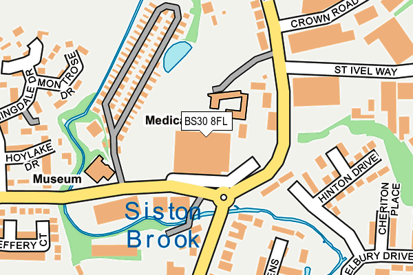
BS30 8FL is located in the Parkwall & Warmley electoral ward, within the unitary authority of South Gloucestershire and the English Parliamentary constituency of Kingswood. The Sub Integrated Care Board (ICB) Location is NHS Bristol, North Somerset and South Gloucestershire ICB - 15C and the police force is Avon and Somerset. This postcode has been in use since June 2008.


GetTheData
Source: OS OpenMap – Local (Ordnance Survey)
Source: OS VectorMap District (Ordnance Survey)
Licence: Open Government Licence (requires attribution)
| Easting | 366935 |
| Northing | 172810 |
| Latitude | 51.453299 |
| Longitude | -2.477245 |
GetTheData
Source: Open Postcode Geo
Licence: Open Government Licence
| Country | England |
| Postcode District | BS30 |
| ➜ BS30 open data dashboard ➜ See where BS30 is on a map ➜ Where is Kingswood? | |
GetTheData
Source: Land Registry Price Paid Data
Licence: Open Government Licence
Elevation or altitude of BS30 8FL as distance above sea level:
| Metres | Feet | |
|---|---|---|
| Elevation | 40m | 131ft |
Elevation is measured from the approximate centre of the postcode, to the nearest point on an OS contour line from OS Terrain 50, which has contour spacing of ten vertical metres.
➜ How high above sea level am I? Find the elevation of your current position using your device's GPS.
GetTheData
Source: Open Postcode Elevation
Licence: Open Government Licence
| Ward | Parkwall & Warmley |
| Constituency | Kingswood |
GetTheData
Source: ONS Postcode Database
Licence: Open Government Licence
| December 2023 | Robbery | On or near Tower Road South | 455m |
| October 2023 | Anti-social behaviour | On or near Belfry | 388m |
| September 2023 | Violence and sexual offences | On or near Belfry | 388m |
| ➜ Get more crime data in our Crime section | |||
GetTheData
Source: data.police.uk
Licence: Open Government Licence
| St Ivel Way (Tower Road North) | Warmley | 114m |
| St Ivel Way (Tower Road North) | Warmley | 156m |
| Gleneagles Road | Warmley Tower | 200m |
| The King William Iv (Cadbury Heath Road) | Cadbury Heath | 254m |
| The King William Iv (Cadbury Heath Road) | Cadbury Heath | 260m |
| Oldland (Avon Valley Railway) | Oldland | 1,273m |
| Keynsham Station | 4.1km |
GetTheData
Source: NaPTAN
Licence: Open Government Licence
GetTheData
Source: ONS Postcode Database
Licence: Open Government Licence


➜ Get more ratings from the Food Standards Agency
GetTheData
Source: Food Standards Agency
Licence: FSA terms & conditions
| Last Collection | |||
|---|---|---|---|
| Location | Mon-Fri | Sat | Distance |
| Goldney Avenue | 17:00 | 11:45 | 732m |
| Warmley Post Office | 17:30 | 12:00 | 737m |
| Bridgeyate | 17:00 | 11:45 | 1,021m |
GetTheData
Source: Dracos
Licence: Creative Commons Attribution-ShareAlike
| Facility | Distance |
|---|---|
| Cadbury Heath Football Club Cadbury Heath Road, Cadbury Heath Grass Pitches | 383m |
| Digitech Studio School Tower Road North, Tower Road North, Bristol Grass Pitches, Outdoor Tennis Courts | 422m |
| Grange School And Sports College (Closed) Tower Road North, Warmley, Bristol Sports Hall, Health and Fitness Gym, Artificial Grass Pitch, Grass Pitches, Squash Courts | 426m |
GetTheData
Source: Active Places
Licence: Open Government Licence
| School | Phase of Education | Distance |
|---|---|---|
| Warmley Park School Tower Road North, Warmley, Bristol, BS30 8XL | Not applicable | 415m |
| Digitech Studio School Tower Road North, Warmley, Bristol, BS30 8XQ | Secondary | 426m |
| Cadbury Heath Primary School Lintern Crescent, Warmley, Bristol, BS30 8GB | Primary | 483m |
GetTheData
Source: Edubase
Licence: Open Government Licence
The below table lists the International Territorial Level (ITL) codes (formerly Nomenclature of Territorial Units for Statistics (NUTS) codes) and Local Administrative Units (LAU) codes for BS30 8FL:
| ITL 1 Code | Name |
|---|---|
| TLK | South West (England) |
| ITL 2 Code | Name |
| TLK1 | Gloucestershire, Wiltshire and Bath/Bristol area |
| ITL 3 Code | Name |
| TLK12 | Bath and North East Somerset, North Somerset and South Gloucestershire |
| LAU 1 Code | Name |
| E06000025 | South Gloucestershire |
GetTheData
Source: ONS Postcode Directory
Licence: Open Government Licence
The below table lists the Census Output Area (OA), Lower Layer Super Output Area (LSOA), and Middle Layer Super Output Area (MSOA) for BS30 8FL:
| Code | Name | |
|---|---|---|
| OA | E00075639 | |
| LSOA | E01014972 | South Gloucestershire 029C |
| MSOA | E02003118 | South Gloucestershire 029 |
GetTheData
Source: ONS Postcode Directory
Licence: Open Government Licence
| BS30 8XU | Tower Road North | 103m |
| BS30 8BJ | Tower Road South | 169m |
| BS30 8TZ | Hinton Drive | 187m |
| BS30 8XN | Tower Road North | 205m |
| BS30 8GU | Montrose Drive | 230m |
| BS30 8GT | St Pierre Drive | 247m |
| BS30 8BQ | Roy King Gardens | 250m |
| BS30 8GS | Hoylake Drive | 254m |
| BS30 8FH | Cadbury Heath Road | 290m |
| BS30 8GW | Gleneagles Road | 295m |
GetTheData
Source: Open Postcode Geo; Land Registry Price Paid Data
Licence: Open Government Licence