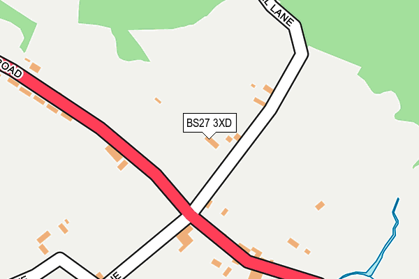
BS27 3XD is located in the Mendip West electoral ward, within the unitary authority of Somerset and the English Parliamentary constituency of Wells. The Sub Integrated Care Board (ICB) Location is NHS Somerset ICB - 11X and the police force is Avon and Somerset. This postcode has been in use since January 1980.


GetTheData
Source: OS OpenMap – Local (Ordnance Survey)
Source: OS VectorMap District (Ordnance Survey)
Licence: Open Government Licence (requires attribution)
| Easting | 348511 |
| Northing | 150382 |
| Latitude | 51.250266 |
| Longitude | -2.739126 |
GetTheData
Source: Open Postcode Geo
Licence: Open Government Licence
| Country | England |
| Postcode District | BS27 |
| ➜ BS27 open data dashboard ➜ See where BS27 is on a map ➜ Where is Rodney Stoke? | |
GetTheData
Source: Land Registry Price Paid Data
Licence: Open Government Licence
Elevation or altitude of BS27 3XD as distance above sea level:
| Metres | Feet | |
|---|---|---|
| Elevation | 50m | 164ft |
Elevation is measured from the approximate centre of the postcode, to the nearest point on an OS contour line from OS Terrain 50, which has contour spacing of ten vertical metres.
➜ How high above sea level am I? Find the elevation of your current position using your device's GPS.
GetTheData
Source: Open Postcode Elevation
Licence: Open Government Licence
| Ward | Mendip West |
| Constituency | Wells |
GetTheData
Source: ONS Postcode Database
Licence: Open Government Licence
| March 2022 | Violence and sexual offences | On or near Wells Road | 196m |
| September 2021 | Violence and sexual offences | On or near Wells Road | 196m |
| July 2021 | Public order | On or near Wells Road | 196m |
| ➜ Get more crime data in our Crime section | |||
GetTheData
Source: data.police.uk
Licence: Open Government Licence
| Smiths Close (Wells Road) | Rodney Stoke | 234m |
| The Thatched Cottage (Wells Road) | Rodney Stoke | 248m |
| The Bus Shelter (Wells Road) | Rodney Stoke | 262m |
| Wells Road (A371 Wells Road) | Rodney Stoke | 283m |
| Bucklegrove Caravan Park | Rodney Stoke | 943m |
GetTheData
Source: NaPTAN
Licence: Open Government Licence
| Percentage of properties with Next Generation Access | 100.0% |
| Percentage of properties with Superfast Broadband | 100.0% |
| Percentage of properties with Ultrafast Broadband | 0.0% |
| Percentage of properties with Full Fibre Broadband | 0.0% |
Superfast Broadband is between 30Mbps and 300Mbps
Ultrafast Broadband is > 300Mbps
| Percentage of properties unable to receive 2Mbps | 0.0% |
| Percentage of properties unable to receive 5Mbps | 0.0% |
| Percentage of properties unable to receive 10Mbps | 0.0% |
| Percentage of properties unable to receive 30Mbps | 0.0% |
GetTheData
Source: Ofcom
Licence: Ofcom Terms of Use (requires attribution)
GetTheData
Source: ONS Postcode Database
Licence: Open Government Licence


➜ Get more ratings from the Food Standards Agency
GetTheData
Source: Food Standards Agency
Licence: FSA terms & conditions
| Last Collection | |||
|---|---|---|---|
| Location | Mon-Fri | Sat | Distance |
| Draycott Post Office | 16:30 | 09:15 | 892m |
| Westbury Sub Mendip P.o. | 16:30 | 10:30 | 2,198m |
| Hollybrook | 12:00 | 11:00 | 2,909m |
GetTheData
Source: Dracos
Licence: Creative Commons Attribution-ShareAlike
| Facility | Distance |
|---|---|
| Rev Cobley Playing Field Latches Lane, Cheddar Grass Pitches | 1.5km |
| Robert Glanvile Playing Field Roughmoor Lane, Westbury Sub Mendip, Wells Grass Pitches, Outdoor Tennis Courts | 1.9km |
| Cheddar Football Club Draycott Road, Cheddar Grass Pitches | 3.4km |
GetTheData
Source: Active Places
Licence: Open Government Licence
| School | Phase of Education | Distance |
|---|---|---|
| Draycott & Rodney Stoke Church of England First School School Lane, Draycott, BS27 3SD | Primary | 1.3km |
| St Lawrence's CofE Primary School School Hill, Westbury-sub-Mendip, Wells, BA5 1HL | Primary | 2.2km |
| Fairlands Middle School Masons Way, Cheddar, BS27 3PG | Middle deemed secondary | 3.6km |
GetTheData
Source: Edubase
Licence: Open Government Licence
The below table lists the International Territorial Level (ITL) codes (formerly Nomenclature of Territorial Units for Statistics (NUTS) codes) and Local Administrative Units (LAU) codes for BS27 3XD:
| ITL 1 Code | Name |
|---|---|
| TLK | South West (England) |
| ITL 2 Code | Name |
| TLK2 | Dorset and Somerset |
| ITL 3 Code | Name |
| TLK23 | Somerset CC |
| LAU 1 Code | Name |
| E07000187 | Mendip |
GetTheData
Source: ONS Postcode Directory
Licence: Open Government Licence
The below table lists the Census Output Area (OA), Lower Layer Super Output Area (LSOA), and Middle Layer Super Output Area (MSOA) for BS27 3XD:
| Code | Name | |
|---|---|---|
| OA | E00148006 | |
| LSOA | E01029060 | Mendip 005B |
| MSOA | E02006051 | Mendip 005 |
GetTheData
Source: ONS Postcode Directory
Licence: Open Government Licence
| BS27 3XB | Wells Road | 180m |
| BS27 3XF | Smiths Close | 291m |
| BS27 3XH | Wells Road | 358m |
| BS27 3UP | Stoke Street | 366m |
| BS27 3UU | Wells Road | 415m |
| BS27 3UN | Stoke Street | 493m |
| BS27 3XA | Millway | 542m |
| BS27 3SU | Wells Road | 641m |
| BS27 3UX | Wells Road | 767m |
| BS27 3SS | Swans Lane | 786m |
GetTheData
Source: Open Postcode Geo; Land Registry Price Paid Data
Licence: Open Government Licence