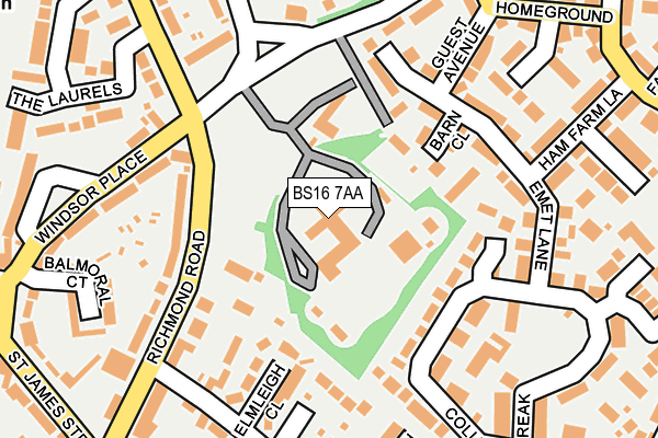
BS16 7AA is located in the Emersons Green electoral ward, within the unitary authority of South Gloucestershire and the English Parliamentary constituency of Kingswood. The Sub Integrated Care Board (ICB) Location is NHS Bristol, North Somerset and South Gloucestershire ICB - 15C and the police force is Avon and Somerset. This postcode has been in use since June 1996.


GetTheData
Source: OS OpenMap – Local (Ordnance Survey)
Source: OS VectorMap District (Ordnance Survey)
Licence: Open Government Licence (requires attribution)
| Easting | 366560 |
| Northing | 176519 |
| Latitude | 51.486625 |
| Longitude | -2.482994 |
GetTheData
Source: Open Postcode Geo
Licence: Open Government Licence
| Country | England |
| Postcode District | BS16 |
| ➜ BS16 open data dashboard ➜ See where BS16 is on a map ➜ Where is Mangotsfield? | |
GetTheData
Source: Land Registry Price Paid Data
Licence: Open Government Licence
Elevation or altitude of BS16 7AA as distance above sea level:
| Metres | Feet | |
|---|---|---|
| Elevation | 70m | 230ft |
Elevation is measured from the approximate centre of the postcode, to the nearest point on an OS contour line from OS Terrain 50, which has contour spacing of ten vertical metres.
➜ How high above sea level am I? Find the elevation of your current position using your device's GPS.
GetTheData
Source: Open Postcode Elevation
Licence: Open Government Licence
| Ward | Emersons Green |
| Constituency | Kingswood |
GetTheData
Source: ONS Postcode Database
Licence: Open Government Licence
| October 2023 | Anti-social behaviour | On or near Bissex Mead | 386m |
| October 2023 | Anti-social behaviour | On or near Emersons Green Lane | 399m |
| September 2023 | Anti-social behaviour | On or near Parking Area | 386m |
| ➜ Get more crime data in our Crime section | |||
GetTheData
Source: data.police.uk
Licence: Open Government Licence
| The Laurels | Mangotsfield | 175m |
| The Laurels (Blackhorse Road) | Mangotsfield | 191m |
| Richmond Road | Mangotsfield | 250m |
| Windsor Place | Emersons Green | 281m |
| The Lamb (St James's Street) | Mangotsfield | 299m |
| Bristol Parkway Station | 5.1km |
GetTheData
Source: NaPTAN
Licence: Open Government Licence
GetTheData
Source: ONS Postcode Database
Licence: Open Government Licence


➜ Get more ratings from the Food Standards Agency
GetTheData
Source: Food Standards Agency
Licence: FSA terms & conditions
| Last Collection | |||
|---|---|---|---|
| Location | Mon-Fri | Sat | Distance |
| Mangotsfield Post Office | 17:30 | 12:00 | 318m |
| Vinney Green | 17:15 | 09:30 | 394m |
| Mangotsfield Common | 17:15 | 12:15 | 627m |
GetTheData
Source: Dracos
Licence: Creative Commons Attribution-ShareAlike
| Facility | Distance |
|---|---|
| Vinney Green Secure Unit Emersons Green Lane, Emersons Green, Bristol Artificial Grass Pitch | 0m |
| Windsor Place (Closed) The Laurels, Mangotsfield, Bristol Grass Pitches | 368m |
| Barley Close Community Primary School Barley Close, Mangotsfield, Bristol Sports Hall, Grass Pitches, Swimming Pool | 451m |
GetTheData
Source: Active Places
Licence: Open Government Licence
| School | Phase of Education | Distance |
|---|---|---|
| Mangotsfield Church of England Primary School Church Farm Road, Emersons Green, Bristol, BS16 7EY | Primary | 342m |
| Barley Close Community Primary School Barley Close, Mangotsfield, Bristol, BS16 9DL | Primary | 451m |
| Emersons Green Primary School Guest Avenue, Emersons Green, Bristol, BS16 7GA | Primary | 551m |
GetTheData
Source: Edubase
Licence: Open Government Licence
The below table lists the International Territorial Level (ITL) codes (formerly Nomenclature of Territorial Units for Statistics (NUTS) codes) and Local Administrative Units (LAU) codes for BS16 7AA:
| ITL 1 Code | Name |
|---|---|
| TLK | South West (England) |
| ITL 2 Code | Name |
| TLK1 | Gloucestershire, Wiltshire and Bath/Bristol area |
| ITL 3 Code | Name |
| TLK12 | Bath and North East Somerset, North Somerset and South Gloucestershire |
| LAU 1 Code | Name |
| E06000025 | South Gloucestershire |
GetTheData
Source: ONS Postcode Directory
Licence: Open Government Licence
The below table lists the Census Output Area (OA), Lower Layer Super Output Area (LSOA), and Middle Layer Super Output Area (MSOA) for BS16 7AA:
| Code | Name | |
|---|---|---|
| OA | E00075634 | |
| LSOA | E01014969 | South Gloucestershire 021D |
| MSOA | E02003110 | South Gloucestershire 021 |
GetTheData
Source: ONS Postcode Directory
Licence: Open Government Licence
| BS16 7EP | Barn Close | 110m |
| BS16 9HA | Richmond Road | 114m |
| BS16 9EZ | Richmond Road | 144m |
| BS16 7BX | Emet Lane | 146m |
| BS16 9EU | Elmleigh Close | 152m |
| BS16 9EL | Oaklands Close | 154m |
| BS16 7EB | Colliers Break | 158m |
| BS16 9AD | Blackhorse Place | 191m |
| BS16 9DB | Windsor Place | 206m |
| BS16 9BY | Blackhorse Road | 209m |
GetTheData
Source: Open Postcode Geo; Land Registry Price Paid Data
Licence: Open Government Licence