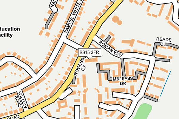
BS15 3FR is located in the Hanham electoral ward, within the unitary authority of South Gloucestershire and the English Parliamentary constituency of Kingswood. The Sub Integrated Care Board (ICB) Location is NHS Bristol, North Somerset and South Gloucestershire ICB - 15C and the police force is Avon and Somerset. This postcode has been in use since April 2014.


GetTheData
Source: OS OpenMap – Local (Ordnance Survey)
Source: OS VectorMap District (Ordnance Survey)
Licence: Open Government Licence (requires attribution)
| Easting | 364431 |
| Northing | 171613 |
| Latitude | 51.442382 |
| Longitude | -2.513159 |
GetTheData
Source: Open Postcode Geo
Licence: Open Government Licence
| Country | England |
| Postcode District | BS15 |
| ➜ BS15 open data dashboard ➜ See where BS15 is on a map ➜ Where is Kingswood? | |
GetTheData
Source: Land Registry Price Paid Data
Licence: Open Government Licence
Elevation or altitude of BS15 3FR as distance above sea level:
| Metres | Feet | |
|---|---|---|
| Elevation | 60m | 197ft |
Elevation is measured from the approximate centre of the postcode, to the nearest point on an OS contour line from OS Terrain 50, which has contour spacing of ten vertical metres.
➜ How high above sea level am I? Find the elevation of your current position using your device's GPS.
GetTheData
Source: Open Postcode Elevation
Licence: Open Government Licence
| Ward | Hanham |
| Constituency | Kingswood |
GetTheData
Source: ONS Postcode Database
Licence: Open Government Licence
| August 2023 | Violence and sexual offences | On or near Iles Close | 396m |
| June 2022 | Burglary | On or near Whittucks Road | 53m |
| June 2022 | Criminal damage and arson | On or near Gover Road | 157m |
| ➜ Get more crime data in our Crime section | |||
GetTheData
Source: data.police.uk
Licence: Open Government Licence
| Hanham Hall (Whittucks Road) | Hanham | 31m |
| Hanham Hall (Whittucks Road) | Hanham | 77m |
| Abbots Avenue (Whittucks Road) | Hanham | 251m |
| Willow Road (Whittucks Road) | Hanham | 258m |
| Willow Road (Whittucks Road) | Hanham | 291m |
| Keynsham Station | 3km |
| Lawrence Hill Station | 4km |
| Stapleton Road Station | 4.6km |
GetTheData
Source: NaPTAN
Licence: Open Government Licence
GetTheData
Source: ONS Postcode Database
Licence: Open Government Licence


➜ Get more ratings from the Food Standards Agency
GetTheData
Source: Food Standards Agency
Licence: FSA terms & conditions
| Last Collection | |||
|---|---|---|---|
| Location | Mon-Fri | Sat | Distance |
| Briaryleaze Road | 16:30 | 11:45 | 1,425m |
| Hanham Road Central | 17:45 | 13:00 | 1,573m |
| Broomhill Road Post Office | 17:00 | 10:45 | 1,665m |
GetTheData
Source: Dracos
Licence: Creative Commons Attribution-ShareAlike
| Facility | Distance |
|---|---|
| Hanham Woods Academy Memorial Road, Hanham, Bristol Sports Hall, Grass Pitches, Artificial Grass Pitch, Studio, Health and Fitness Gym | 432m |
| Hanham Tennis And Cricket Club Abbots Road, Abbots Road, Hanham, Bristol Grass Pitches, Outdoor Tennis Courts | 499m |
| Christ Church Hanham Ce Primary School Memorial Road, Hanham, Bristol Grass Pitches | 501m |
GetTheData
Source: Active Places
Licence: Open Government Licence
| School | Phase of Education | Distance |
|---|---|---|
| Hanham Abbots Junior School Abbots Avenue, Hanham, Bristol, BS15 3PN | Primary | 402m |
| Hanham Woods Academy Memorial Road, Hanham, Bristol, BS15 3LA | Secondary | 432m |
| Samuel White's Infant School Abbots Avenue, Hanham, Bristol, BS15 3PN | Primary | 450m |
GetTheData
Source: Edubase
Licence: Open Government Licence
The below table lists the International Territorial Level (ITL) codes (formerly Nomenclature of Territorial Units for Statistics (NUTS) codes) and Local Administrative Units (LAU) codes for BS15 3FR:
| ITL 1 Code | Name |
|---|---|
| TLK | South West (England) |
| ITL 2 Code | Name |
| TLK1 | Gloucestershire, Wiltshire and Bath/Bristol area |
| ITL 3 Code | Name |
| TLK12 | Bath and North East Somerset, North Somerset and South Gloucestershire |
| LAU 1 Code | Name |
| E06000025 | South Gloucestershire |
GetTheData
Source: ONS Postcode Directory
Licence: Open Government Licence
The below table lists the Census Output Area (OA), Lower Layer Super Output Area (LSOA), and Middle Layer Super Output Area (MSOA) for BS15 3FR:
| Code | Name | |
|---|---|---|
| OA | E00075360 | |
| LSOA | E01014921 | South Gloucestershire 031F |
| MSOA | E02003120 | South Gloucestershire 031 |
GetTheData
Source: ONS Postcode Directory
Licence: Open Government Licence
| BS15 3FN | Malpass Drive | 92m |
| BS15 3FP | Rogers Court | 94m |
| BS15 3FL | Kynaston View | 98m |
| BS15 3LX | Samuel White Road | 118m |
| BS15 3PT | Whittucks Road | 126m |
| BS15 3PX | Whittucks Road | 130m |
| BS15 3LY | Samuel White Road | 139m |
| BS15 3FH | Roman Way | 148m |
| BS15 3LZ | Samuel White Road | 162m |
| BS15 3JZ | Gover Road | 167m |
GetTheData
Source: Open Postcode Geo; Land Registry Price Paid Data
Licence: Open Government Licence