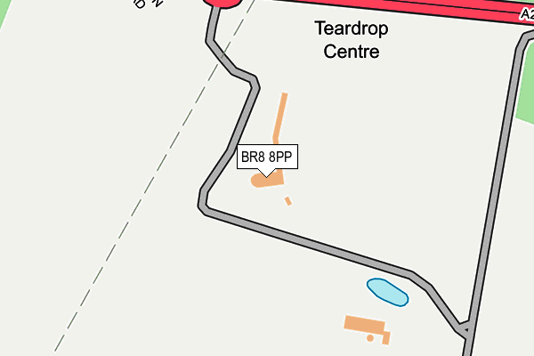
BR8 8PP lies on London Road in Swanley. BR8 8PP is located in the Farningham, Horton Kirby and South Darenth electoral ward, within the local authority district of Sevenoaks and the English Parliamentary constituency of Sevenoaks. The Sub Integrated Care Board (ICB) Location is NHS Kent and Medway ICB - 91Q and the police force is Kent. This postcode has been in use since June 1996.


GetTheData
Source: OS OpenMap – Local (Ordnance Survey)
Source: OS VectorMap District (Ordnance Survey)
Licence: Open Government Licence (requires attribution)
| Easting | 553044 |
| Northing | 167290 |
| Latitude | 51.384028 |
| Longitude | 0.197929 |
GetTheData
Source: Open Postcode Geo
Licence: Open Government Licence
| Street | London Road |
| Town/City | Swanley |
| Country | England |
| Postcode District | BR8 |
| ➜ BR8 open data dashboard ➜ See where BR8 is on a map | |
GetTheData
Source: Land Registry Price Paid Data
Licence: Open Government Licence
Elevation or altitude of BR8 8PP as distance above sea level:
| Metres | Feet | |
|---|---|---|
| Elevation | 100m | 328ft |
Elevation is measured from the approximate centre of the postcode, to the nearest point on an OS contour line from OS Terrain 50, which has contour spacing of ten vertical metres.
➜ How high above sea level am I? Find the elevation of your current position using your device's GPS.
GetTheData
Source: Open Postcode Elevation
Licence: Open Government Licence
| Ward | Farningham, Horton Kirby And South Darenth |
| Constituency | Sevenoaks |
GetTheData
Source: ONS Postcode Database
Licence: Open Government Licence
| Button Street (London Road) | Farningham | 302m |
| Button Street (London Road) | Farningham | 427m |
| Wested Lane (London Road) | Swanley | 667m |
| Wested Lane | Swanley | 711m |
| Beechenlea Corner (London Road) | Swanley | 943m |
| Swanley Station | 2.3km |
| Eynsford Station | 2.4km |
| Farningham Road Station | 3.3km |
GetTheData
Source: NaPTAN
Licence: Open Government Licence
GetTheData
Source: ONS Postcode Database
Licence: Open Government Licence

➜ Get more ratings from the Food Standards Agency
GetTheData
Source: Food Standards Agency
Licence: FSA terms & conditions
| Last Collection | |||
|---|---|---|---|
| Location | Mon-Fri | Sat | Distance |
| Button Street | 17:45 | 09:00 | 659m |
| Manse Parade (2) | 18:00 | 12:00 | 1,167m |
| St.georges Road (88) | 18:00 | 11:30 | 1,320m |
GetTheData
Source: Dracos
Licence: Creative Commons Attribution-ShareAlike
| Facility | Distance |
|---|---|
| Pedham Place Golf Centre London Road, Swanley Golf | 0m |
| Olympic Golf Driving Range (Closed) Beechenlea Lane, Swanley Golf | 1.2km |
| Parkwood Hall Co-operative Academy Beechenlea Lane, Swanley Grass Pitches | 1.3km |
GetTheData
Source: Active Places
Licence: Open Government Licence
| School | Phase of Education | Distance |
|---|---|---|
| Parkwood Hall Co-Operative Academy Beechenlea Lane, Swanley, BR8 8DR | Not applicable | 1.3km |
| Downsview Community Primary School Beech Avenue, Swanley, BR8 8AU | Primary | 1.6km |
| High Firs Primary School Court Crescent, Swanley, BR8 8NR | Primary | 1.8km |
GetTheData
Source: Edubase
Licence: Open Government Licence
The below table lists the International Territorial Level (ITL) codes (formerly Nomenclature of Territorial Units for Statistics (NUTS) codes) and Local Administrative Units (LAU) codes for BR8 8PP:
| ITL 1 Code | Name |
|---|---|
| TLJ | South East (England) |
| ITL 2 Code | Name |
| TLJ4 | Kent |
| ITL 3 Code | Name |
| TLJ46 | West Kent |
| LAU 1 Code | Name |
| E07000111 | Sevenoaks |
GetTheData
Source: ONS Postcode Directory
Licence: Open Government Licence
The below table lists the Census Output Area (OA), Lower Layer Super Output Area (LSOA), and Middle Layer Super Output Area (MSOA) for BR8 8PP:
| Code | Name | |
|---|---|---|
| OA | E00124025 | |
| LSOA | E01024433 | Sevenoaks 005C |
| MSOA | E02005091 | Sevenoaks 005 |
GetTheData
Source: ONS Postcode Directory
Licence: Open Government Licence
| BR8 8DZ | Wadard Terrace | 607m |
| DA4 0JR | Farningham Hill Road | 683m |
| BR8 8EE | Wested Lane | 688m |
| BR8 8DY | Button Street | 719m |
| BR8 8TH | London Road | 972m |
| BR8 8DS | London Road | 1030m |
| BR8 8DQ | Mead Close | 1048m |
| DA4 0JN | London Road | 1081m |
| BR8 8DP | Beechenlea Lane | 1105m |
| BR8 8DH | Wansbury Way | 1127m |
GetTheData
Source: Open Postcode Geo; Land Registry Price Paid Data
Licence: Open Government Licence