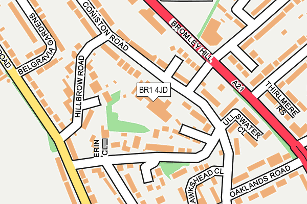
BR1 4JD is located in the Bromley Town electoral ward, within the London borough of Bromley and the English Parliamentary constituency of Bromley and Chislehurst. The Sub Integrated Care Board (ICB) Location is NHS South East London ICB - 72Q and the police force is Metropolitan Police. This postcode has been in use since January 1980.


GetTheData
Source: OS OpenMap – Local (Ordnance Survey)
Source: OS VectorMap District (Ordnance Survey)
Licence: Open Government Licence (requires attribution)
| Easting | 539300 |
| Northing | 170534 |
| Latitude | 51.416716 |
| Longitude | 0.001830 |
GetTheData
Source: Open Postcode Geo
Licence: Open Government Licence
| Country | England |
| Postcode District | BR1 |
| ➜ BR1 open data dashboard ➜ See where BR1 is on a map ➜ Where is London? | |
GetTheData
Source: Land Registry Price Paid Data
Licence: Open Government Licence
Elevation or altitude of BR1 4JD as distance above sea level:
| Metres | Feet | |
|---|---|---|
| Elevation | 60m | 197ft |
Elevation is measured from the approximate centre of the postcode, to the nearest point on an OS contour line from OS Terrain 50, which has contour spacing of ten vertical metres.
➜ How high above sea level am I? Find the elevation of your current position using your device's GPS.
GetTheData
Source: Open Postcode Elevation
Licence: Open Government Licence
| Ward | Bromley Town |
| Constituency | Bromley And Chislehurst |
GetTheData
Source: ONS Postcode Database
Licence: Open Government Licence
| January 2024 | Vehicle crime | On or near Patterdale Close | 195m |
| January 2024 | Vehicle crime | On or near Patterdale Close | 195m |
| November 2023 | Vehicle crime | On or near Patterdale Close | 195m |
| ➜ Get more crime data in our Crime section | |||
GetTheData
Source: data.police.uk
Licence: Open Government Licence
| Bromley Court Hotel (Bromley Hill) | Bromley Park | 133m |
| Bromley Court Hotel (Bromley Hill) | Bromley Park | 161m |
| Park Ave Bromley Hill (Br1) | Bromley Park | 236m |
| Bromley Hill Cemetery | Downham | 268m |
| Bromley Hill Cemetery | Downham | 297m |
| Ravensbourne Station | 0.7km |
| Shortlands Station | 1.2km |
| Sundridge Park Station | 1.4km |
GetTheData
Source: NaPTAN
Licence: Open Government Licence
GetTheData
Source: ONS Postcode Database
Licence: Open Government Licence


➜ Get more ratings from the Food Standards Agency
GetTheData
Source: Food Standards Agency
Licence: FSA terms & conditions
| Last Collection | |||
|---|---|---|---|
| Location | Mon-Fri | Sat | Distance |
| Warren Avenue (52) | 18:30 | 12:00 | 268m |
| Kings Avenue (39) | 18:30 | 12:00 | 410m |
| Arcus Road (26) | 18:00 | 12:00 | 425m |
GetTheData
Source: Dracos
Licence: Creative Commons Attribution-ShareAlike
| Facility | Distance |
|---|---|
| Millwall Fc Training Ground Calmont Road, Bromley Grass Pitches | 331m |
| Warren Avenue Playing Fields Calmont Road, Bromley Grass Pitches | 413m |
| Summerhouse Playing Fields Ravensbourne Avenue, Beckenham Grass Pitches | 598m |
GetTheData
Source: Active Places
Licence: Open Government Licence
| School | Phase of Education | Distance |
|---|---|---|
| Rangefield Primary School Glenbow Road, Downham, Rangefield Primary School, Bromley, BR1 4RP | Primary | 865m |
| Parish Church of England Primary School London Lane, Bromley, BR1 4HF | Primary | 893m |
| Burnt Ash Primary School Rangefield Road, Bromley, BR1 4QX | Primary | 923m |
GetTheData
Source: Edubase
Licence: Open Government Licence
The below table lists the International Territorial Level (ITL) codes (formerly Nomenclature of Territorial Units for Statistics (NUTS) codes) and Local Administrative Units (LAU) codes for BR1 4JD:
| ITL 1 Code | Name |
|---|---|
| TLI | London |
| ITL 2 Code | Name |
| TLI6 | Outer London - South |
| ITL 3 Code | Name |
| TLI61 | Bromley |
| LAU 1 Code | Name |
| E09000006 | Bromley |
GetTheData
Source: ONS Postcode Directory
Licence: Open Government Licence
The below table lists the Census Output Area (OA), Lower Layer Super Output Area (LSOA), and Middle Layer Super Output Area (MSOA) for BR1 4JD:
| Code | Name | |
|---|---|---|
| OA | E00003243 | |
| LSOA | E01000672 | Bromley 011A |
| MSOA | E02000137 | Bromley 011 |
GetTheData
Source: ONS Postcode Directory
Licence: Open Government Licence
| BR1 4JB | Coniston Road | 59m |
| BR1 4JH | Kirkstone Way | 64m |
| BR1 4JA | Coniston Road | 79m |
| BR1 4JE | Elstree Hill | 85m |
| BR1 4JJ | Yewdale Close | 111m |
| BR1 4LD | Tresco Close | 113m |
| BR1 4NX | Erin Close | 145m |
| BR1 4JR | Cedarhurst | 146m |
| BR1 4JL | Hillbrow Road | 169m |
| BR1 4JF | Ullswater Close | 169m |
GetTheData
Source: Open Postcode Geo; Land Registry Price Paid Data
Licence: Open Government Licence