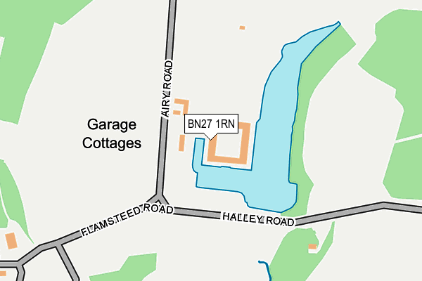
BN27 1RN is located in the Herstmonceux & Pevensey Levels electoral ward, within the local authority district of Wealden and the English Parliamentary constituency of Bexhill and Battle. The Sub Integrated Care Board (ICB) Location is NHS Sussex ICB - 97R and the police force is Sussex. This postcode has been in use since January 1980.


GetTheData
Source: OS OpenMap – Local (Ordnance Survey)
Source: OS VectorMap District (Ordnance Survey)
Licence: Open Government Licence (requires attribution)
| Easting | 564634 |
| Northing | 110389 |
| Latitude | 50.869562 |
| Longitude | 0.338369 |
GetTheData
Source: Open Postcode Geo
Licence: Open Government Licence
| Country | England |
| Postcode District | BN27 |
| ➜ BN27 open data dashboard ➜ See where BN27 is on a map | |
GetTheData
Source: Land Registry Price Paid Data
Licence: Open Government Licence
Elevation or altitude of BN27 1RN as distance above sea level:
| Metres | Feet | |
|---|---|---|
| Elevation | 10m | 33ft |
Elevation is measured from the approximate centre of the postcode, to the nearest point on an OS contour line from OS Terrain 50, which has contour spacing of ten vertical metres.
➜ How high above sea level am I? Find the elevation of your current position using your device's GPS.
GetTheData
Source: Open Postcode Elevation
Licence: Open Government Licence
| Ward | Herstmonceux & Pevensey Levels |
| Constituency | Bexhill And Battle |
GetTheData
Source: ONS Postcode Database
Licence: Open Government Licence
| September 2021 | Violence and sexual offences | On or near Church Road | 458m |
| August 2021 | Violence and sexual offences | On or near Church Road | 458m |
| April 2021 | Anti-social behaviour | On or near Church Road | 458m |
| ➜ Get more crime data in our Crime section | |||
GetTheData
Source: data.police.uk
Licence: Open Government Licence
| Herstmonceux Castle (Wartling Road) | Wartling | 737m |
| Herstmonceux Castle (Wartling Road) | Wartling | 755m |
| The Lamb Inn (Wartling Road) | Wartling | 1,631m |
| The Lamb Inn (Wartling Road) | Wartling | 1,635m |
| Wartling Road (Windmill Hill) | Windmill Hill | 1,835m |
| Normans Bay Station | 6km |
GetTheData
Source: NaPTAN
Licence: Open Government Licence
| Percentage of properties with Next Generation Access | 100.0% |
| Percentage of properties with Superfast Broadband | 0.0% |
| Percentage of properties with Ultrafast Broadband | 0.0% |
| Percentage of properties with Full Fibre Broadband | 0.0% |
Superfast Broadband is between 30Mbps and 300Mbps
Ultrafast Broadband is > 300Mbps
| Percentage of properties unable to receive 2Mbps | 0.0% |
| Percentage of properties unable to receive 5Mbps | 100.0% |
| Percentage of properties unable to receive 10Mbps | 100.0% |
| Percentage of properties unable to receive 30Mbps | 100.0% |
GetTheData
Source: Ofcom
Licence: Ofcom Terms of Use (requires attribution)
GetTheData
Source: ONS Postcode Database
Licence: Open Government Licence


➜ Get more ratings from the Food Standards Agency
GetTheData
Source: Food Standards Agency
Licence: FSA terms & conditions
| Last Collection | |||
|---|---|---|---|
| Location | Mon-Fri | Sat | Distance |
| Flowers Green | 16:15 | 08:15 | 1,491m |
| Under Road | 16:15 | 08:15 | 1,596m |
| Wartling | 16:00 | 08:30 | 1,607m |
GetTheData
Source: Dracos
Licence: Creative Commons Attribution-ShareAlike
| Facility | Distance |
|---|---|
| Pgl Childrens Activity Centre (Windmill Hill) Windmill Hill, Hailsham Indoor Tennis Centre, Golf, Swimming Pool | 1.7km |
| Lime Park Lime Park, Church Road, Herstmonceux, Hailsham Grass Pitches | 2km |
| Herstmonceux Recreation Ground Hailsham Road, Herstmonceux, Hailsham Outdoor Tennis Courts, Grass Pitches | 2.4km |
GetTheData
Source: Active Places
Licence: Open Government Licence
| School | Phase of Education | Distance |
|---|---|---|
| Herstmonceux Church of England Primary School Hailsham Road, Herstmonceux, Hailsham, BN27 4LG | Primary | 2.4km |
| Phoenix Academy Marshfoot Lane, Hailsham, BN27 2PH | Primary | 4.9km |
| Hankham Primary School Hankham Road, Hankham, Pevensey, BN24 5AY | Primary | 5.6km |
GetTheData
Source: Edubase
Licence: Open Government Licence
The below table lists the International Territorial Level (ITL) codes (formerly Nomenclature of Territorial Units for Statistics (NUTS) codes) and Local Administrative Units (LAU) codes for BN27 1RN:
| ITL 1 Code | Name |
|---|---|
| TLJ | South East (England) |
| ITL 2 Code | Name |
| TLJ2 | Surrey, East and West Sussex |
| ITL 3 Code | Name |
| TLJ22 | East Sussex CC |
| LAU 1 Code | Name |
| E07000065 | Wealden |
GetTheData
Source: ONS Postcode Directory
Licence: Open Government Licence
The below table lists the Census Output Area (OA), Lower Layer Super Output Area (LSOA), and Middle Layer Super Output Area (MSOA) for BN27 1RN:
| Code | Name | |
|---|---|---|
| OA | E00107689 | |
| LSOA | E01021199 | Wealden 014C |
| MSOA | E02004416 | Wealden 014 |
GetTheData
Source: ONS Postcode Directory
Licence: Open Government Licence
| BN27 1QJ | Church Road | 545m |
| BN27 1RR | 1047m | |
| BN27 1RL | Church Road | 1090m |
| BN27 1RX | Wartling Road | 1118m |
| BN27 1RJ | Church Road | 1344m |
| BN27 1RQ | Flowers Green | 1472m |
| BN27 1RU | Jenners Lane | 1519m |
| BN27 1QG | Lower Road | 1566m |
| BN27 1RH | Butlers Lane | 1586m |
| BN27 4RZ | 1627m |
GetTheData
Source: Open Postcode Geo; Land Registry Price Paid Data
Licence: Open Government Licence