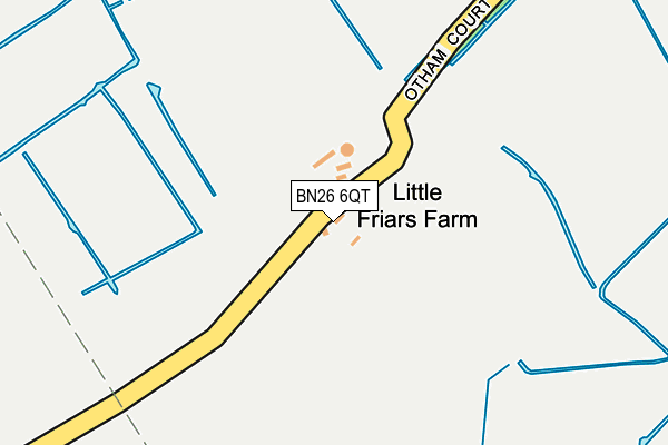
BN26 6QT is located in the Polegate North electoral ward, within the local authority district of Wealden and the English Parliamentary constituency of Lewes. The Sub Integrated Care Board (ICB) Location is NHS Sussex ICB - 97R and the police force is Sussex. This postcode has been in use since January 1980.


GetTheData
Source: OS OpenMap – Local (Ordnance Survey)
Source: OS VectorMap District (Ordnance Survey)
Licence: Open Government Licence (requires attribution)
| Easting | 559163 |
| Northing | 106146 |
| Latitude | 50.832963 |
| Longitude | 0.258868 |
GetTheData
Source: Open Postcode Geo
Licence: Open Government Licence
| Country | England |
| Postcode District | BN26 |
➜ See where BN26 is on a map | |
GetTheData
Source: Land Registry Price Paid Data
Licence: Open Government Licence
Elevation or altitude of BN26 6QT as distance above sea level:
| Metres | Feet | |
|---|---|---|
| Elevation | 10m | 33ft |
Elevation is measured from the approximate centre of the postcode, to the nearest point on an OS contour line from OS Terrain 50, which has contour spacing of ten vertical metres.
➜ How high above sea level am I? Find the elevation of your current position using your device's GPS.
GetTheData
Source: Open Postcode Elevation
Licence: Open Government Licence
| Ward | Polegate North |
| Constituency | Lewes |
GetTheData
Source: ONS Postcode Database
Licence: Open Government Licence
| Hilliers Garden Centre (Hailsham Road) | Stone Cross | 955m |
| Hilliers Garden Centre (Hailsham Road) | Stone Cross | 965m |
| Glynleigh Drive (Shepham Lane) | Polegate | 1,215m |
| Glynleigh Drive (Shepham Lane) | Polegate | 1,218m |
| Oakleaf Drive (Greenleaf Gardens) | Polegate | 1,249m |
| Polegate Station | 1.6km |
| Hampden Park (Sussex) Station | 4.3km |
| Pevensey & Westham Station | 5km |
GetTheData
Source: NaPTAN
Licence: Open Government Licence
GetTheData
Source: ONS Postcode Database
Licence: Open Government Licence


➜ Get more ratings from the Food Standards Agency
GetTheData
Source: Food Standards Agency
Licence: FSA terms & conditions
| Last Collection | |||
|---|---|---|---|
| Location | Mon-Fri | Sat | Distance |
| Western Avenue | 17:30 | 11:30 | 1,096m |
| Le Vett Avenue | 17:30 | 11:30 | 1,132m |
| Glynleigh Drive | 17:30 | 11:30 | 1,202m |
GetTheData
Source: Dracos
Licence: Creative Commons Attribution-ShareAlike
The below table lists the International Territorial Level (ITL) codes (formerly Nomenclature of Territorial Units for Statistics (NUTS) codes) and Local Administrative Units (LAU) codes for BN26 6QT:
| ITL 1 Code | Name |
|---|---|
| TLJ | South East (England) |
| ITL 2 Code | Name |
| TLJ2 | Surrey, East and West Sussex |
| ITL 3 Code | Name |
| TLJ22 | East Sussex CC |
| LAU 1 Code | Name |
| E07000065 | Wealden |
GetTheData
Source: ONS Postcode Directory
Licence: Open Government Licence
The below table lists the Census Output Area (OA), Lower Layer Super Output Area (LSOA), and Middle Layer Super Output Area (MSOA) for BN26 6QT:
| Code | Name | |
|---|---|---|
| OA | E00107758 | |
| LSOA | E01021214 | Wealden 019C |
| MSOA | E02004421 | Wealden 019 |
GetTheData
Source: ONS Postcode Directory
Licence: Open Government Licence
| BN26 6QS | Otham Court Road | 606m |
| BN26 6QX | Sayerland Lane | 634m |
| BN26 6LQ | Hythe Close | 955m |
| BN26 6LG | Dover Road | 990m |
| BN26 6QP | 1013m | |
| BN26 6ND | Dymchurch Close | 1013m |
| BN26 6HH | North Close | 1020m |
| BN26 6FW | Balmoral Mews | 1024m |
| BN26 6FH | Kensington Way | 1028m |
| BN26 6PG | Cresta Close | 1030m |
GetTheData
Source: Open Postcode Geo; Land Registry Price Paid Data
Licence: Open Government Licence