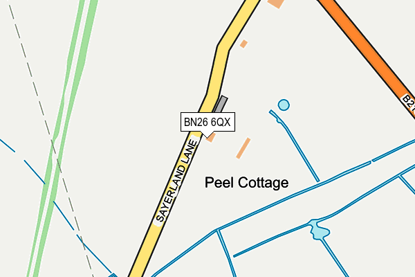
BN26 6QX lies on Sayerland Lane in Polegate. BN26 6QX is located in the Hailsham East electoral ward, within the local authority district of Wealden and the English Parliamentary constituency of Wealden. The Sub Integrated Care Board (ICB) Location is NHS Sussex ICB - 97R and the police force is Sussex. This postcode has been in use since January 1980.


GetTheData
Source: OS OpenMap – Local (Ordnance Survey)
Source: OS VectorMap District (Ordnance Survey)
Licence: Open Government Licence (requires attribution)
| Easting | 558851 |
| Northing | 106698 |
| Latitude | 50.838014 |
| Longitude | 0.254652 |
GetTheData
Source: Open Postcode Geo
Licence: Open Government Licence
| Street | Sayerland Lane |
| Town/City | Polegate |
| Country | England |
| Postcode District | BN26 |
➜ See where BN26 is on a map | |
GetTheData
Source: Land Registry Price Paid Data
Licence: Open Government Licence
Elevation or altitude of BN26 6QX as distance above sea level:
| Metres | Feet | |
|---|---|---|
| Elevation | 10m | 33ft |
Elevation is measured from the approximate centre of the postcode, to the nearest point on an OS contour line from OS Terrain 50, which has contour spacing of ten vertical metres.
➜ How high above sea level am I? Find the elevation of your current position using your device's GPS.
GetTheData
Source: Open Postcode Elevation
Licence: Open Government Licence
| Ward | Hailsham East |
| Constituency | Wealden |
GetTheData
Source: ONS Postcode Database
Licence: Open Government Licence
| Saltmarsh Lane (Hailsham Road) | Hailsham | 692m |
| Saltmarsh Lane (Hailsham Road) | Hailsham | 792m |
| Natewood (Polegate Road) | Coppards | 1,090m |
| Natewood (Polegate Road) | Coppards | 1,115m |
| Hilliers Garden Centre (Hailsham Road) | Stone Cross | 1,255m |
| Polegate Station | 2km |
| Hampden Park (Sussex) Station | 4.9km |
GetTheData
Source: NaPTAN
Licence: Open Government Licence
| Percentage of properties with Next Generation Access | 100.0% |
| Percentage of properties with Superfast Broadband | 100.0% |
| Percentage of properties with Ultrafast Broadband | 100.0% |
| Percentage of properties with Full Fibre Broadband | 100.0% |
Superfast Broadband is between 30Mbps and 300Mbps
Ultrafast Broadband is > 300Mbps
| Percentage of properties unable to receive 2Mbps | 0.0% |
| Percentage of properties unable to receive 5Mbps | 0.0% |
| Percentage of properties unable to receive 10Mbps | 0.0% |
| Percentage of properties unable to receive 30Mbps | 0.0% |
GetTheData
Source: Ofcom
Licence: Ofcom Terms of Use (requires attribution)
GetTheData
Source: ONS Postcode Database
Licence: Open Government Licence


➜ Get more ratings from the Food Standards Agency
GetTheData
Source: Food Standards Agency
Licence: FSA terms & conditions
| Last Collection | |||
|---|---|---|---|
| Location | Mon-Fri | Sat | Distance |
| Summerhill | 16:00 | 07:00 | 1,010m |
| Woodside Way | 16:00 | 07:15 | 1,383m |
| Oakleaf Drive | 17:30 | 11:30 | 1,488m |
GetTheData
Source: Dracos
Licence: Creative Commons Attribution-ShareAlike
The below table lists the International Territorial Level (ITL) codes (formerly Nomenclature of Territorial Units for Statistics (NUTS) codes) and Local Administrative Units (LAU) codes for BN26 6QX:
| ITL 1 Code | Name |
|---|---|
| TLJ | South East (England) |
| ITL 2 Code | Name |
| TLJ2 | Surrey, East and West Sussex |
| ITL 3 Code | Name |
| TLJ22 | East Sussex CC |
| LAU 1 Code | Name |
| E07000065 | Wealden |
GetTheData
Source: ONS Postcode Directory
Licence: Open Government Licence
The below table lists the Census Output Area (OA), Lower Layer Super Output Area (LSOA), and Middle Layer Super Output Area (MSOA) for BN26 6QX:
| Code | Name | |
|---|---|---|
| OA | E00170891 | |
| LSOA | E01021178 | Wealden 017A |
| MSOA | E02004419 | Wealden 017 |
GetTheData
Source: ONS Postcode Directory
Licence: Open Government Licence
| BN27 2RH | 613m | |
| BN26 6RE | Nightingale Villas | 856m |
| BN26 6QY | 895m | |
| BN27 2RG | 922m | |
| BN26 6RD | Hailsham Road | 997m |
| BN26 6QS | Otham Court Road | 1011m |
| BN26 6QP | 1084m | |
| BN26 6RF | Hailsham Road | 1140m |
| BN27 3PH | Polegate Road | 1143m |
| BN27 3PJ | Coldthorn Lane | 1219m |
GetTheData
Source: Open Postcode Geo; Land Registry Price Paid Data
Licence: Open Government Licence