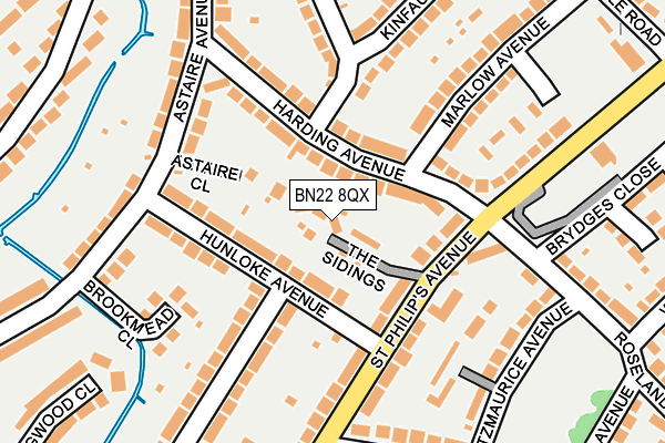
BN22 8QX lies on The Sidings in Eastbourne. BN22 8QX is located in the St Anthony's electoral ward, within the local authority district of Eastbourne and the English Parliamentary constituency of Eastbourne. The Sub Integrated Care Board (ICB) Location is NHS Sussex ICB - 97R and the police force is Sussex. This postcode has been in use since June 2009.


GetTheData
Source: OS OpenMap – Local (Ordnance Survey)
Source: OS VectorMap District (Ordnance Survey)
Licence: Open Government Licence (requires attribution)
| Easting | 561816 |
| Northing | 100561 |
| Latitude | 50.782045 |
| Longitude | 0.294051 |
GetTheData
Source: Open Postcode Geo
Licence: Open Government Licence
| Street | The Sidings |
| Town/City | Eastbourne |
| Country | England |
| Postcode District | BN22 |
| ➜ BN22 open data dashboard ➜ See where BN22 is on a map ➜ Where is Eastbourne? | |
GetTheData
Source: Land Registry Price Paid Data
Licence: Open Government Licence
Elevation or altitude of BN22 8QX as distance above sea level:
| Metres | Feet | |
|---|---|---|
| Elevation | 10m | 33ft |
Elevation is measured from the approximate centre of the postcode, to the nearest point on an OS contour line from OS Terrain 50, which has contour spacing of ten vertical metres.
➜ How high above sea level am I? Find the elevation of your current position using your device's GPS.
GetTheData
Source: Open Postcode Elevation
Licence: Open Government Licence
| Ward | St Anthony's |
| Constituency | Eastbourne |
GetTheData
Source: ONS Postcode Database
Licence: Open Government Licence
| June 2022 | Violence and sexual offences | On or near The Sidings | 69m |
| June 2022 | Violence and sexual offences | On or near The Sidings | 69m |
| June 2022 | Violence and sexual offences | On or near The Sidings | 69m |
| ➜ The Sidings crime map and outcomes | |||
GetTheData
Source: data.police.uk
Licence: Open Government Licence
| Willard Close (Bridgemere Road) | Roselands | 284m |
| Badlesmere Road (Bridgemere Road) | Roselands | 285m |
| Southbourne Road (Churchdale Road) | Roselands | 326m |
| Southbourne Road (Churchdale Road) | Roselands | 345m |
| Ringwood Close (Ringwood Road) | Roselands | 355m |
| Eastbourne Station | 1.7km |
| Hampden Park (Sussex) Station | 1.9km |
| Pevensey & Westham Station | 4.3km |
GetTheData
Source: NaPTAN
Licence: Open Government Licence
GetTheData
Source: ONS Postcode Database
Licence: Open Government Licence


➜ Get more ratings from the Food Standards Agency
GetTheData
Source: Food Standards Agency
Licence: FSA terms & conditions
| Last Collection | |||
|---|---|---|---|
| Location | Mon-Fri | Sat | Distance |
| Bridgemere Road | 17:15 | 11:00 | 303m |
| Beamsley Road | 17:15 | 11:00 | 647m |
| Norway Road | 17:30 | 11:00 | 765m |
GetTheData
Source: Dracos
Licence: Creative Commons Attribution-ShareAlike
| Facility | Distance |
|---|---|
| Roselands Recreation Ground Roselands Avenue, Eastbourne Grass Pitches | 276m |
| The Bridgemere Centre Bridgemere Road, Eastbourne Sports Hall | 376m |
| Stafford Junior School Ringwood Road, Eastbourne Sports Hall | 468m |
GetTheData
Source: Active Places
Licence: Open Government Licence
| School | Phase of Education | Distance |
|---|---|---|
| Roselands Infants' School Woodgate Road, Eastbourne, BN22 8PD | Primary | 284m |
| Stafford Junior School Ringwood Road, Eastbourne, BN22 8UA | Primary | 468m |
| St Andrew's Church of England Infants School Winchelsea Road, Eastbourne, BN22 7PP | Primary | 752m |
GetTheData
Source: Edubase
Licence: Open Government Licence
The below table lists the International Territorial Level (ITL) codes (formerly Nomenclature of Territorial Units for Statistics (NUTS) codes) and Local Administrative Units (LAU) codes for BN22 8QX:
| ITL 1 Code | Name |
|---|---|
| TLJ | South East (England) |
| ITL 2 Code | Name |
| TLJ2 | Surrey, East and West Sussex |
| ITL 3 Code | Name |
| TLJ22 | East Sussex CC |
| LAU 1 Code | Name |
| E07000061 | Eastbourne |
GetTheData
Source: ONS Postcode Directory
Licence: Open Government Licence
The below table lists the Census Output Area (OA), Lower Layer Super Output Area (LSOA), and Middle Layer Super Output Area (MSOA) for BN22 8QX:
| Code | Name | |
|---|---|---|
| OA | E00106394 | |
| LSOA | E01020953 | Eastbourne 007D |
| MSOA | E02004362 | Eastbourne 007 |
GetTheData
Source: ONS Postcode Directory
Licence: Open Government Licence
| BN22 8PJ | Harding Avenue | 45m |
| BN22 8UJ | Hunloke Avenue | 63m |
| BN22 8UL | Hunloke Avenue | 96m |
| BN22 8NA | St Philips Avenue | 97m |
| BN22 8PH | Harding Avenue | 121m |
| BN22 8PL | Harding Avenue | 124m |
| BN22 8SR | Bowood Avenue | 127m |
| BN22 8NN | St Philips Avenue | 134m |
| BN22 8LY | St Philips Avenue | 159m |
| BN22 8UQ | Moy Avenue | 162m |
GetTheData
Source: Open Postcode Geo; Land Registry Price Paid Data
Licence: Open Government Licence