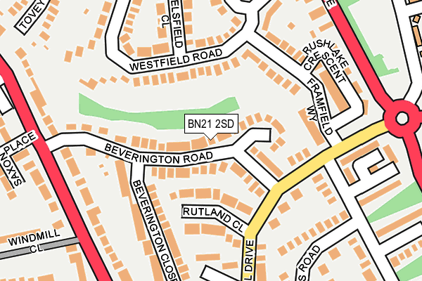
BN21 2SD lies on Beverington Road in Eastbourne. BN21 2SD is located in the Ratton electoral ward, within the local authority district of Eastbourne and the English Parliamentary constituency of Eastbourne. The Sub Integrated Care Board (ICB) Location is NHS Sussex ICB - 97R and the police force is Sussex. This postcode has been in use since January 1980.


GetTheData
Source: OS OpenMap – Local (Ordnance Survey)
Source: OS VectorMap District (Ordnance Survey)
Licence: Open Government Licence (requires attribution)
| Easting | 559787 |
| Northing | 100684 |
| Latitude | 50.783717 |
| Longitude | 0.265318 |
GetTheData
Source: Open Postcode Geo
Licence: Open Government Licence
| Street | Beverington Road |
| Town/City | Eastbourne |
| Country | England |
| Postcode District | BN21 |
➜ See where BN21 is on a map ➜ Where is Eastbourne? | |
GetTheData
Source: Land Registry Price Paid Data
Licence: Open Government Licence
Elevation or altitude of BN21 2SD as distance above sea level:
| Metres | Feet | |
|---|---|---|
| Elevation | 40m | 131ft |
Elevation is measured from the approximate centre of the postcode, to the nearest point on an OS contour line from OS Terrain 50, which has contour spacing of ten vertical metres.
➜ How high above sea level am I? Find the elevation of your current position using your device's GPS.
GetTheData
Source: Open Postcode Elevation
Licence: Open Government Licence
| Ward | Ratton |
| Constituency | Eastbourne |
GetTheData
Source: ONS Postcode Database
Licence: Open Government Licence
2025 31 JAN £375,000 |
2024 14 MAY £335,000 |
34, BEVERINGTON ROAD, EASTBOURNE, BN21 2SD 2022 18 OCT £425,000 |
2022 21 JUL £425,000 |
2022 13 JAN £410,000 |
2022 7 JAN £445,000 |
32, BEVERINGTON ROAD, EASTBOURNE, BN21 2SD 2020 4 DEC £345,000 |
2020 15 JUL £380,000 |
2018 15 JUN £318,000 |
2017 23 JUN £340,000 |
GetTheData
Source: HM Land Registry Price Paid Data
Licence: Contains HM Land Registry data © Crown copyright and database right 2025. This data is licensed under the Open Government Licence v3.0.
| Rutland Close (Rodmill Drive) | Upperton | 110m |
| Selsfield Close (Westfield Road) | Upperton | 114m |
| Selsfield Close (Westfield Road) | Upperton | 127m |
| Rutland Close (Rodmill Drive) | Upperton | 147m |
| St Clements Court (Framfield Way) | Upperton | 156m |
| Hampden Park (Sussex) Station | 1.7km |
| Eastbourne Station | 2km |
| Polegate Station | 4.4km |
GetTheData
Source: NaPTAN
Licence: Open Government Licence
| Percentage of properties with Next Generation Access | 100.0% |
| Percentage of properties with Superfast Broadband | 100.0% |
| Percentage of properties with Ultrafast Broadband | 0.0% |
| Percentage of properties with Full Fibre Broadband | 0.0% |
Superfast Broadband is between 30Mbps and 300Mbps
Ultrafast Broadband is > 300Mbps
| Median download speed | 23.8Mbps |
| Average download speed | 35.1Mbps |
| Maximum download speed | 79.18Mbps |
| Median upload speed | 9.9Mbps |
| Average upload speed | 8.6Mbps |
| Maximum upload speed | 20.00Mbps |
| Percentage of properties unable to receive 2Mbps | 0.0% |
| Percentage of properties unable to receive 5Mbps | 0.0% |
| Percentage of properties unable to receive 10Mbps | 0.0% |
| Percentage of properties unable to receive 30Mbps | 0.0% |
GetTheData
Source: Ofcom
Licence: Ofcom Terms of Use (requires attribution)
Estimated total energy consumption in BN21 2SD by fuel type, 2015.
| Consumption (kWh) | 340,733 |
|---|---|
| Meter count | 27 |
| Mean (kWh/meter) | 12,620 |
| Median (kWh/meter) | 11,053 |
| Consumption (kWh) | 88,933 |
|---|---|
| Meter count | 29 |
| Mean (kWh/meter) | 3,067 |
| Median (kWh/meter) | 2,528 |
GetTheData
Source: Postcode level gas estimates: 2015 (experimental)
Source: Postcode level electricity estimates: 2015 (experimental)
Licence: Open Government Licence
GetTheData
Source: ONS Postcode Database
Licence: Open Government Licence


➜ Get more ratings from the Food Standards Agency
GetTheData
Source: Food Standards Agency
Licence: FSA terms & conditions
| Last Collection | |||
|---|---|---|---|
| Location | Mon-Fri | Sat | Distance |
| Kings Drive | 17:30 | 11:00 | 741m |
| St Elizabeths | 17:15 | 11:00 | 767m |
| Newick Road | 17:15 | 11:00 | 772m |
GetTheData
Source: Dracos
Licence: Creative Commons Attribution-ShareAlike
The below table lists the International Territorial Level (ITL) codes (formerly Nomenclature of Territorial Units for Statistics (NUTS) codes) and Local Administrative Units (LAU) codes for BN21 2SD:
| ITL 1 Code | Name |
|---|---|
| TLJ | South East (England) |
| ITL 2 Code | Name |
| TLJ2 | Surrey, East and West Sussex |
| ITL 3 Code | Name |
| TLJ22 | East Sussex CC |
| LAU 1 Code | Name |
| E07000061 | Eastbourne |
GetTheData
Source: ONS Postcode Directory
Licence: Open Government Licence
The below table lists the Census Output Area (OA), Lower Layer Super Output Area (LSOA), and Middle Layer Super Output Area (MSOA) for BN21 2SD:
| Code | Name | |
|---|---|---|
| OA | E00106330 | |
| LSOA | E01020948 | Eastbourne 008A |
| MSOA | E02004363 | Eastbourne 008 |
GetTheData
Source: ONS Postcode Directory
Licence: Open Government Licence
| BN21 2SE | Beverington Road | 84m |
| BN21 2SG | Rodmill Drive | 125m |
| BN21 2SJ | Rutland Close | 127m |
| BN21 2RA | Framfield Way | 127m |
| BN21 2SH | Rodmill Drive | 141m |
| BN21 2QS | Westfield Road | 142m |
| BN21 2RB | Framfield Way | 145m |
| BN21 2SA | Beverington Road | 155m |
| BN21 2SN | Yieldings Close | 168m |
| BN21 2QY | Framfield Way | 169m |
GetTheData
Source: Open Postcode Geo; Land Registry Price Paid Data
Licence: Open Government Licence