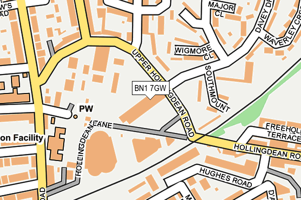
BN1 7GW is located in the Hollingdean & Fiveways electoral ward, within the unitary authority of Brighton and Hove and the English Parliamentary constituency of Brighton, Pavilion. The Sub Integrated Care Board (ICB) Location is NHS Sussex ICB - 09D and the police force is Sussex. This postcode has been in use since January 1980.


GetTheData
Source: OS OpenMap – Local (Ordnance Survey)
Source: OS VectorMap District (Ordnance Survey)
Licence: Open Government Licence (requires attribution)
| Easting | 531736 |
| Northing | 106063 |
| Latitude | 50.839109 |
| Longitude | -0.130425 |
GetTheData
Source: Open Postcode Geo
Licence: Open Government Licence
| Country | England |
| Postcode District | BN1 |
| ➜ BN1 open data dashboard ➜ See where BN1 is on a map ➜ Where is Brighton? | |
GetTheData
Source: Land Registry Price Paid Data
Licence: Open Government Licence
Elevation or altitude of BN1 7GW as distance above sea level:
| Metres | Feet | |
|---|---|---|
| Elevation | 40m | 131ft |
Elevation is measured from the approximate centre of the postcode, to the nearest point on an OS contour line from OS Terrain 50, which has contour spacing of ten vertical metres.
➜ How high above sea level am I? Find the elevation of your current position using your device's GPS.
GetTheData
Source: Open Postcode Elevation
Licence: Open Government Licence
| Ward | Hollingdean & Fiveways |
| Constituency | Brighton, Pavilion |
GetTheData
Source: ONS Postcode Database
Licence: Open Government Licence
| January 2024 | Anti-social behaviour | On or near Hollingdean Street | 357m |
| January 2024 | Anti-social behaviour | On or near Petrol Station | 436m |
| January 2024 | Public order | On or near Petrol Station | 436m |
| ➜ Get more crime data in our Crime section | |||
GetTheData
Source: data.police.uk
Licence: Open Government Licence
| Bottom Of Davey Drive (Davey Drive) | Brighton | 78m |
| Bottom Of Roedale Road (Upper Hollingdean Road) | Brighton | 87m |
| Bottom Of Roedale Road (Roedale Road) | Brighton | 121m |
| Rugby Road East (Upper Hollingdean Road) | Brighton | 211m |
| Rugby Road East (Ditchling Road) | Brighton | 215m |
| London Road (Brighton) Station | 0.5km |
| Moulsecoomb Station | 1.2km |
| Brighton Station | 1.4km |
GetTheData
Source: NaPTAN
Licence: Open Government Licence
GetTheData
Source: ONS Postcode Database
Licence: Open Government Licence

➜ Get more ratings from the Food Standards Agency
GetTheData
Source: Food Standards Agency
Licence: FSA terms & conditions
| Last Collection | |||
|---|---|---|---|
| Location | Mon-Fri | Sat | Distance |
| Upper Hollingdean Road | 16:00 | 10:45 | 190m |
| Ditchling Road Post Office | 18:45 | 12:45 | 326m |
| Florence Road | 17:45 | 12:30 | 415m |
GetTheData
Source: Dracos
Licence: Creative Commons Attribution-ShareAlike
| Facility | Distance |
|---|---|
| Blakers Park Southdown Road, Brighton Outdoor Tennis Courts | 648m |
| The Gym Group (Brighton London Road) London Road, Brighton Health and Fitness Gym | 897m |
| University Of Brighton (Moulsecoomb Campus) Lewes Road, Brighton Health and Fitness Gym, Sports Hall | 913m |
GetTheData
Source: Active Places
Licence: Open Government Licence
| School | Phase of Education | Distance |
|---|---|---|
| Downs Infant School Ditchling Road, Brighton, BN1 6JA | Primary | 247m |
| Downs Junior School Rugby Road, Brighton, BN1 6ED | Primary | 279m |
| St Joseph's Catholic Primary School Davey Drive, Hollingdean, Brighton, BN1 7BF | Primary | 450m |
GetTheData
Source: Edubase
Licence: Open Government Licence
The below table lists the International Territorial Level (ITL) codes (formerly Nomenclature of Territorial Units for Statistics (NUTS) codes) and Local Administrative Units (LAU) codes for BN1 7GW:
| ITL 1 Code | Name |
|---|---|
| TLJ | South East (England) |
| ITL 2 Code | Name |
| TLJ2 | Surrey, East and West Sussex |
| ITL 3 Code | Name |
| TLJ21 | Brighton and Hove |
| LAU 1 Code | Name |
| E06000043 | Brighton and Hove |
GetTheData
Source: ONS Postcode Directory
Licence: Open Government Licence
The below table lists the Census Output Area (OA), Lower Layer Super Output Area (LSOA), and Middle Layer Super Output Area (MSOA) for BN1 7GW:
| Code | Name | |
|---|---|---|
| OA | E00085316 | |
| LSOA | E01016905 | Brighton and Hove 008D |
| MSOA | E02003498 | Brighton and Hove 008 |
GetTheData
Source: ONS Postcode Directory
Licence: Open Government Licence
| BN1 7GR | Upper Hollingdean Road | 83m |
| BN1 7EB | Wigmore Close | 111m |
| BN1 7BD | Southmount | 121m |
| BN1 7BB | Hollingdean Lane | 136m |
| BN1 7GS | Upper Hollingdean Road | 167m |
| BN1 7ED | Dunster Close | 167m |
| BN1 7GX | Roedale Road | 172m |
| BN1 7GT | Upper Hollingdean Road | 174m |
| BN1 7GA | Upper Hollingdean Road | 175m |
| BN2 4AW | Centenary Industrial Estate | 178m |
GetTheData
Source: Open Postcode Geo; Land Registry Price Paid Data
Licence: Open Government Licence