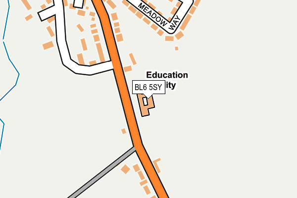
BL6 5SY is located in the Horwich South & Blackrod electoral ward, within the metropolitan district of Bolton and the English Parliamentary constituency of Bolton West. The Sub Integrated Care Board (ICB) Location is NHS Greater Manchester ICB - 00T and the police force is Greater Manchester. This postcode has been in use since January 1980.


GetTheData
Source: OS OpenMap – Local (Ordnance Survey)
Source: OS VectorMap District (Ordnance Survey)
Licence: Open Government Licence (requires attribution)
| Easting | 362264 |
| Northing | 409924 |
| Latitude | 53.584536 |
| Longitude | -2.571484 |
GetTheData
Source: Open Postcode Geo
Licence: Open Government Licence
| Country | England |
| Postcode District | BL6 |
| ➜ BL6 open data dashboard ➜ See where BL6 is on a map ➜ Where is Blackrod? | |
GetTheData
Source: Land Registry Price Paid Data
Licence: Open Government Licence
Elevation or altitude of BL6 5SY as distance above sea level:
| Metres | Feet | |
|---|---|---|
| Elevation | 130m | 427ft |
Elevation is measured from the approximate centre of the postcode, to the nearest point on an OS contour line from OS Terrain 50, which has contour spacing of ten vertical metres.
➜ How high above sea level am I? Find the elevation of your current position using your device's GPS.
GetTheData
Source: Open Postcode Elevation
Licence: Open Government Licence
| Ward | Horwich South & Blackrod |
| Constituency | Bolton West |
GetTheData
Source: ONS Postcode Database
Licence: Open Government Licence
| Manchester Rd/Primary Sch (Manchester Rd) | Blackrod | 49m |
| Manchester Rd/Primary Sch (Manchester Rd) | Blackrod | 55m |
| Greenbarn Way (Wbnd) (Greenbarn Way) | Blackrod | 113m |
| Manchester Rd/Hope St (Manchester Rd) | Scot Lane End | 233m |
| Manchester Rd/Hope St (Manchester Rd) | Scot Lane End | 248m |
| Blackrod Station | 0.8km |
| Horwich Parkway Station | 2.2km |
| Adlington (Lancs) Station | 3.8km |
GetTheData
Source: NaPTAN
Licence: Open Government Licence
GetTheData
Source: ONS Postcode Database
Licence: Open Government Licence


➜ Get more ratings from the Food Standards Agency
GetTheData
Source: Food Standards Agency
Licence: FSA terms & conditions
| Last Collection | |||
|---|---|---|---|
| Location | Mon-Fri | Sat | Distance |
| 205 Crown Lane | 17:35 | 11:20 | 612m |
| Blackrod P O | 18:30 | 11:30 | 1,012m |
| 23 Whitehall Lane | 17:30 | 11:30 | 1,335m |
GetTheData
Source: Dracos
Licence: Creative Commons Attribution-ShareAlike
| Facility | Distance |
|---|---|
| Blackrod Primary School Manchester Road, Blackrod, Bolton Grass Pitches, Sports Hall | 0m |
| Blackrod Sports And Community Centre Greenbarn Way, Greenbarn Way, Blackrod, Bolton Grass Pitches | 901m |
| Feel Good Health Club (Mercure Bolton Georgian House Hotel) Manchester Road, Blackrod, Bolton Swimming Pool, Health and Fitness Gym, Studio | 1.1km |
GetTheData
Source: Active Places
Licence: Open Government Licence
| School | Phase of Education | Distance |
|---|---|---|
| Blackrod Primary School Manchester Road, Blackrod, Manchester Road,, Blackrod, BOLTON, BL6 5SY | Primary | 0m |
| Blackrod Anglican/Methodist Primary School Vicarage Road West, Blackrod, Bolton, BL6 5DE | Primary | 1.5km |
| St Catherine's CofE Primary School Greenstone Avenue, Horwich, Bolton, BL6 5SJ | Primary | 1.6km |
GetTheData
Source: Edubase
Licence: Open Government Licence
The below table lists the International Territorial Level (ITL) codes (formerly Nomenclature of Territorial Units for Statistics (NUTS) codes) and Local Administrative Units (LAU) codes for BL6 5SY:
| ITL 1 Code | Name |
|---|---|
| TLD | North West (England) |
| ITL 2 Code | Name |
| TLD3 | Greater Manchester |
| ITL 3 Code | Name |
| TLD36 | Greater Manchester North West |
| LAU 1 Code | Name |
| E08000001 | Bolton |
GetTheData
Source: ONS Postcode Directory
Licence: Open Government Licence
The below table lists the Census Output Area (OA), Lower Layer Super Output Area (LSOA), and Middle Layer Super Output Area (MSOA) for BL6 5SY:
| Code | Name | |
|---|---|---|
| OA | E00024193 | |
| LSOA | E01004783 | Bolton 009D |
| MSOA | E02000992 | Bolton 009 |
GetTheData
Source: ONS Postcode Directory
Licence: Open Government Licence
| BL6 5SU | Manchester Road | 155m |
| BL6 5BJ | Manchester Road | 164m |
| BL6 5BR | Meadow Way | 176m |
| BL6 5BL | Manchester Road | 181m |
| BL6 5BP | Highfield Road | 230m |
| BL6 5BY | Barn Acre | 237m |
| BL6 5SS | Manchester Road | 238m |
| BL6 5ST | Hope Street | 246m |
| BL6 5TA | Greenbarn Way | 282m |
| BL6 5TD | Widford Walk | 316m |
GetTheData
Source: Open Postcode Geo; Land Registry Price Paid Data
Licence: Open Government Licence