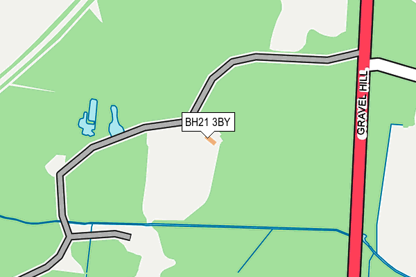
BH21 3BY is located in the Broadstone electoral ward, within the unitary authority of Bournemouth, Christchurch and Poole and the English Parliamentary constituency of Mid Dorset and North Poole. The Sub Integrated Care Board (ICB) Location is NHS Dorset ICB - 11J and the police force is Dorset. This postcode has been in use since October 2016.


GetTheData
Source: OS OpenMap – Local (Ordnance Survey)
Source: OS VectorMap District (Ordnance Survey)
Licence: Open Government Licence (requires attribution)
| Easting | 401418 |
| Northing | 97234 |
| Latitude | 50.774676 |
| Longitude | -1.981249 |
GetTheData
Source: Open Postcode Geo
Licence: Open Government Licence
| Country | England |
| Postcode District | BH21 |
| ➜ BH21 open data dashboard ➜ See where BH21 is on a map | |
GetTheData
Source: Land Registry Price Paid Data
Licence: Open Government Licence
Elevation or altitude of BH21 3BY as distance above sea level:
| Metres | Feet | |
|---|---|---|
| Elevation | 70m | 230ft |
Elevation is measured from the approximate centre of the postcode, to the nearest point on an OS contour line from OS Terrain 50, which has contour spacing of ten vertical metres.
➜ How high above sea level am I? Find the elevation of your current position using your device's GPS.
GetTheData
Source: Open Postcode Elevation
Licence: Open Government Licence
| Ward | Broadstone |
| Constituency | Mid Dorset And North Poole |
GetTheData
Source: ONS Postcode Database
Licence: Open Government Licence
| June 2022 | Anti-social behaviour | On or near Blackwater Drive | 379m |
| May 2022 | Violence and sexual offences | On or near Gravel Hill | 479m |
| May 2022 | Violence and sexual offences | On or near Gravel Hill | 479m |
| ➜ Get more crime data in our Crime section | |||
GetTheData
Source: data.police.uk
Licence: Open Government Licence
| Blackwater Drive (Gravel Hill) | Merley | 250m |
| Blackwater Drive (Gravel Hill) | Merley | 261m |
| Queen Anne Drive | Merley | 522m |
| Queen Anne Drive | Merley | 589m |
| Rempstone Road | Merley | 606m |
GetTheData
Source: NaPTAN
Licence: Open Government Licence
GetTheData
Source: ONS Postcode Database
Licence: Open Government Licence

➜ Get more ratings from the Food Standards Agency
GetTheData
Source: Food Standards Agency
Licence: FSA terms & conditions
| Last Collection | |||
|---|---|---|---|
| Location | Mon-Fri | Sat | Distance |
| Queen Anne Drive | 17:30 | 11:30 | 547m |
| Arrowsmith Road | 11:30 | 10:00 | 825m |
| Merley Road | 17:30 | 12:15 | 944m |
GetTheData
Source: Dracos
Licence: Creative Commons Attribution-ShareAlike
| Facility | Distance |
|---|---|
| Broadstone Cricket Club Gravel Hill, Wimborne Grass Pitches | 0m |
| Cobham Sports & Social Club Merley Park Road, Ashington, Wimborne Grass Pitches, Golf, Squash Courts | 1.1km |
| Fenners Playing Field Merley Lane, Poole Grass Pitches | 1.1km |
GetTheData
Source: Active Places
Licence: Open Government Licence
| School | Phase of Education | Distance |
|---|---|---|
| Broadstone Middle School Dunyeats Road, Broadstone, BH18 8AE | Middle deemed secondary | 1.2km |
| South West Regional Assessment Centre Merley House, Merley House Lane, Merley House Events, Wimborne, BH21 3AA | Not applicable | 1.2km |
| Merley First School Oakley Straight, Merley, Wimborne, BH21 1SD | Primary | 1.4km |
GetTheData
Source: Edubase
Licence: Open Government Licence
The below table lists the International Territorial Level (ITL) codes (formerly Nomenclature of Territorial Units for Statistics (NUTS) codes) and Local Administrative Units (LAU) codes for BH21 3BY:
| ITL 1 Code | Name |
|---|---|
| TLK | South West (England) |
| ITL 2 Code | Name |
| TLK2 | Dorset and Somerset |
| ITL 3 Code | Name |
| TLK24 | Bournemouth, Christchurch and Poole |
| LAU 1 Code | Name |
| E06000058 | Bournemouth, Christchurch and Poole |
GetTheData
Source: ONS Postcode Directory
Licence: Open Government Licence
The below table lists the Census Output Area (OA), Lower Layer Super Output Area (LSOA), and Middle Layer Super Output Area (MSOA) for BH21 3BY:
| Code | Name | |
|---|---|---|
| OA | E00077860 | |
| LSOA | E01015399 | Poole 003E |
| MSOA | E02003196 | Poole 003 |
GetTheData
Source: ONS Postcode Directory
Licence: Open Government Licence
| BH21 3BJ | Gravel Hill | 388m |
| BH18 8BZ | Portmore Close | 409m |
| BH21 1RS | Delph Road | 425m |
| BH21 3BH | Black Water Drive | 430m |
| BH21 1SZ | Rempstone Road | 571m |
| BH18 8DU | Greensleeves Avenue | 574m |
| BH18 8DB | Merriefield Avenue | 584m |
| BH21 1RT | Ivy Road | 604m |
| BH18 8DE | Merriefield Avenue | 612m |
| BH21 1SY | Rempstone Road | 643m |
GetTheData
Source: Open Postcode Geo; Land Registry Price Paid Data
Licence: Open Government Licence