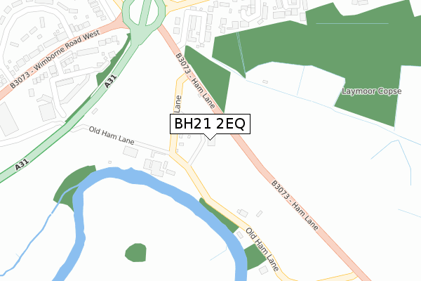
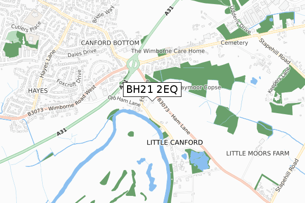
BH21 2EQ lies on Fox Lane in Stapehill, Wimborne. BH21 2EQ is located in the Ferndown North electoral ward, within the unitary authority of Dorset and the English Parliamentary constituency of Christchurch. The Sub Integrated Care Board (ICB) Location is NHS Dorset ICB - 11J and the police force is Dorset. This postcode has been in use since January 1980.


GetTheData
Source: OS Open Zoomstack (Ordnance Survey)
Licence: Open Government Licence (requires attribution)
Attribution: Contains OS data © Crown copyright and database right 2024
Source: Open Postcode Geo
Licence: Open Government Licence (requires attribution)
Attribution: Contains OS data © Crown copyright and database right 2024; Contains Royal Mail data © Royal Mail copyright and database right 2024; Source: Office for National Statistics licensed under the Open Government Licence v.3.0
| Easting | 404531 |
| Northing | 100004 |
| Latitude | 50.799580 |
| Longitude | -1.937073 |
GetTheData
Source: Open Postcode Geo
Licence: Open Government Licence
| Street | Fox Lane |
| Locality | Stapehill |
| Town/City | Wimborne |
| Country | England |
| Postcode District | BH21 |
| ➜ BH21 open data dashboard ➜ See where BH21 is on a map ➜ Where is Little Canford? | |
GetTheData
Source: Land Registry Price Paid Data
Licence: Open Government Licence
Elevation or altitude of BH21 2EQ as distance above sea level:
| Metres | Feet | |
|---|---|---|
| Elevation | 20m | 66ft |
Elevation is measured from the approximate centre of the postcode, to the nearest point on an OS contour line from OS Terrain 50, which has contour spacing of ten vertical metres.
➜ How high above sea level am I? Find the elevation of your current position using your device's GPS.
GetTheData
Source: Open Postcode Elevation
Licence: Open Government Licence
| Ward | Ferndown North |
| Constituency | Christchurch |
GetTheData
Source: ONS Postcode Database
Licence: Open Government Licence
| June 2022 | Other theft | On or near Henbest Close | 375m |
| June 2022 | Anti-social behaviour | On or near Canford Bottom | 429m |
| June 2022 | Anti-social behaviour | On or near Canford Bottom | 429m |
| ➜ Fox Lane crime map and outcomes | |||
GetTheData
Source: data.police.uk
Licence: Open Government Licence
| Fox Lane (Wimborne Road West) | Stapehill | 327m |
| Fox Lane (Wimborne Road West) | Stapehill | 342m |
| Stapehill Crescent (Wimborne Road West) | Little Canford | 464m |
| Stapehill Crescent (Wimborne Road West) | Little Canford | 475m |
| Fryers Copse (Canford Bottom) | Canford Bottom | 585m |
GetTheData
Source: NaPTAN
Licence: Open Government Licence
GetTheData
Source: ONS Postcode Database
Licence: Open Government Licence


➜ Get more ratings from the Food Standards Agency
GetTheData
Source: Food Standards Agency
Licence: FSA terms & conditions
| Last Collection | |||
|---|---|---|---|
| Location | Mon-Fri | Sat | Distance |
| Little Canford | 16:15 | 12:00 | 88m |
| Stapehill Crescent | 17:30 | 12:00 | 416m |
| Stapehill P.o. | 16:45 | 11:15 | 524m |
GetTheData
Source: Dracos
Licence: Creative Commons Attribution-ShareAlike
| Facility | Distance |
|---|---|
| St Catherines Va Primary School Cutlers Place, Wimborne Grass Pitches | 1.1km |
| Hayeswood First School Cutlers Place, Wimborne Grass Pitches | 1.2km |
| Canford Magna Golf Club (Closed) Knighton Lane, Wimborne Golf | 1.5km |
GetTheData
Source: Active Places
Licence: Open Government Licence
| School | Phase of Education | Distance |
|---|---|---|
| Hayeswood First School Cutlers Place, Colehill, Wimborne, BH21 2HN | Primary | 1.2km |
| Hampreston Church of England Voluntary Aided First School Hampreston Village, Wimborne, BH21 7LX | Primary | 1.4km |
| Colehill First School Pilford Heath Road, Colehill, Wimborne, BH21 2LZ | Primary | 1.5km |
GetTheData
Source: Edubase
Licence: Open Government Licence
The below table lists the International Territorial Level (ITL) codes (formerly Nomenclature of Territorial Units for Statistics (NUTS) codes) and Local Administrative Units (LAU) codes for BH21 2EQ:
| ITL 1 Code | Name |
|---|---|
| TLK | South West (England) |
| ITL 2 Code | Name |
| TLK2 | Dorset and Somerset |
| ITL 3 Code | Name |
| TLK25 | Dorset |
| LAU 1 Code | Name |
| E06000059 | Dorset |
GetTheData
Source: ONS Postcode Directory
Licence: Open Government Licence
The below table lists the Census Output Area (OA), Lower Layer Super Output Area (LSOA), and Middle Layer Super Output Area (MSOA) for BH21 2EQ:
| Code | Name | |
|---|---|---|
| OA | E00103413 | |
| LSOA | E01020407 | East Dorset 009D |
| MSOA | E02004251 | East Dorset 009 |
GetTheData
Source: ONS Postcode Directory
Licence: Open Government Licence
| BH21 7LP | Old Ham Lane | 177m |
| BH21 2EF | Fox Lane | 247m |
| BH21 2EJ | Wyelands Avenue | 266m |
| BH21 2DX | Wimborne Road West | 292m |
| BH21 2EN | Sycamore Place | 324m |
| BH21 2DU | Wimborne Road West | 356m |
| BH21 2EX | Henbest Close | 364m |
| BH21 2EA | Abbey Gardens | 393m |
| BH21 2DY | Wimborne Road West | 444m |
| BH21 7LU | Stour Close | 462m |
GetTheData
Source: Open Postcode Geo; Land Registry Price Paid Data
Licence: Open Government Licence