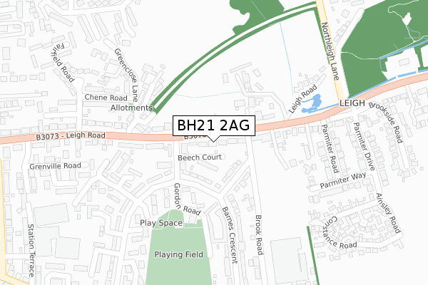
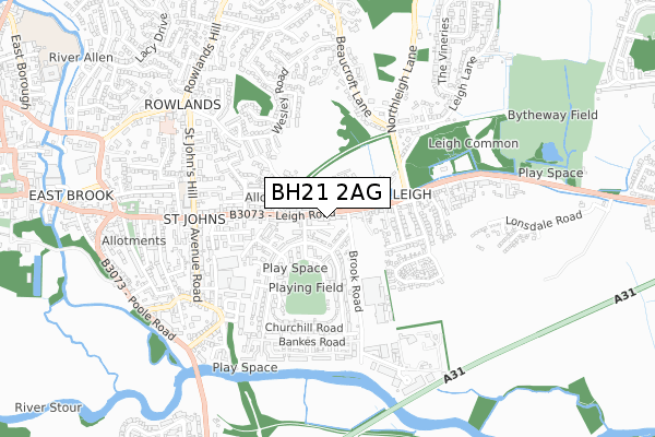
BH21 2AG lies on Leigh Road in Wimborne. BH21 2AG is located in the Wimborne Minster electoral ward, within the unitary authority of Dorset and the English Parliamentary constituency of Mid Dorset and North Poole. The Sub Integrated Care Board (ICB) Location is NHS Dorset ICB - 11J and the police force is Dorset. This postcode has been in use since January 1980.


GetTheData
Source: OS Open Zoomstack (Ordnance Survey)
Licence: Open Government Licence (requires attribution)
Attribution: Contains OS data © Crown copyright and database right 2024
Source: Open Postcode Geo
Licence: Open Government Licence (requires attribution)
Attribution: Contains OS data © Crown copyright and database right 2024; Contains Royal Mail data © Royal Mail copyright and database right 2024; Source: Office for National Statistics licensed under the Open Government Licence v.3.0
| Easting | 402152 |
| Northing | 99802 |
| Latitude | 50.797777 |
| Longitude | -1.970832 |
GetTheData
Source: Open Postcode Geo
Licence: Open Government Licence
| Street | Leigh Road |
| Town/City | Wimborne |
| Country | England |
| Postcode District | BH21 |
| ➜ BH21 open data dashboard ➜ See where BH21 is on a map ➜ Where is Wimborne Minster? | |
GetTheData
Source: Land Registry Price Paid Data
Licence: Open Government Licence
Elevation or altitude of BH21 2AG as distance above sea level:
| Metres | Feet | |
|---|---|---|
| Elevation | 20m | 66ft |
Elevation is measured from the approximate centre of the postcode, to the nearest point on an OS contour line from OS Terrain 50, which has contour spacing of ten vertical metres.
➜ How high above sea level am I? Find the elevation of your current position using your device's GPS.
GetTheData
Source: Open Postcode Elevation
Licence: Open Government Licence
| Ward | Wimborne Minster |
| Constituency | Mid Dorset And North Poole |
GetTheData
Source: ONS Postcode Database
Licence: Open Government Licence
| December 2023 | Anti-social behaviour | On or near Hardy Crescent | 341m |
| November 2023 | Violence and sexual offences | On or near Hardy Crescent | 341m |
| October 2023 | Violence and sexual offences | On or near Hardy Crescent | 341m |
| ➜ Get more crime data in our Crime section | |||
GetTheData
Source: data.police.uk
Licence: Open Government Licence
| Gordon Road (Leigh Road) | Wimborne Minster | 28m |
| Gordon Road (Leigh Road) | Wimborne Minster | 33m |
| Barnes Crescent | Wimborne Minster | 102m |
| Barnes Crescent | Wimborne Minster | 192m |
| Leigh Road | Wimborne Minster | 240m |
GetTheData
Source: NaPTAN
Licence: Open Government Licence
➜ Broadband speed and availability dashboard for BH21 2AG
| Percentage of properties with Next Generation Access | 100.0% |
| Percentage of properties with Superfast Broadband | 100.0% |
| Percentage of properties with Ultrafast Broadband | 0.0% |
| Percentage of properties with Full Fibre Broadband | 0.0% |
Superfast Broadband is between 30Mbps and 300Mbps
Ultrafast Broadband is > 300Mbps
| Median download speed | 19.4Mbps |
| Average download speed | 34.2Mbps |
| Maximum download speed | 79.98Mbps |
| Median upload speed | 1.2Mbps |
| Average upload speed | 5.9Mbps |
| Maximum upload speed | 20.00Mbps |
| Percentage of properties unable to receive 2Mbps | 0.0% |
| Percentage of properties unable to receive 5Mbps | 0.0% |
| Percentage of properties unable to receive 10Mbps | 0.0% |
| Percentage of properties unable to receive 30Mbps | 0.0% |
➜ Broadband speed and availability dashboard for BH21 2AG
GetTheData
Source: Ofcom
Licence: Ofcom Terms of Use (requires attribution)
Estimated total energy consumption in BH21 2AG by fuel type, 2015.
| Consumption (kWh) | 148,674 |
|---|---|
| Meter count | 12 |
| Mean (kWh/meter) | 12,389 |
| Median (kWh/meter) | 11,279 |
| Consumption (kWh) | 58,244 |
|---|---|
| Meter count | 12 |
| Mean (kWh/meter) | 4,854 |
| Median (kWh/meter) | 3,647 |
GetTheData
Source: Postcode level gas estimates: 2015 (experimental)
Source: Postcode level electricity estimates: 2015 (experimental)
Licence: Open Government Licence
GetTheData
Source: ONS Postcode Database
Licence: Open Government Licence


➜ Get more ratings from the Food Standards Agency
GetTheData
Source: Food Standards Agency
Licence: FSA terms & conditions
| Last Collection | |||
|---|---|---|---|
| Location | Mon-Fri | Sat | Distance |
| Leigh Park P.o. | 17:30 | 11:00 | 82m |
| Leigh Common | 17:30 | 11:30 | 309m |
| Churchill Road | 17:15 | 11:00 | 458m |
GetTheData
Source: Dracos
Licence: Creative Commons Attribution-ShareAlike
| Facility | Distance |
|---|---|
| Leigh Park Gordon Road, Wimborne Grass Pitches | 212m |
| J&b’s Stadium New Cuthbury Constance Road, Wimborne Grass Pitches, Artificial Grass Pitch | 466m |
| Colehill Sports & Social Club Wimborne Road, Colehill, Wimborne Grass Pitches | 974m |
GetTheData
Source: Active Places
Licence: Open Government Licence
| School | Phase of Education | Distance |
|---|---|---|
| St John's Church of England First School, Wimborne St John's Hill, Wimborne, BH21 1BX | Primary | 602m |
| Beaucroft Foundation School Wimborne Road, Colehill, Wimborne, BH21 2SS | Not applicable | 1.1km |
| Allenbourn Middle School East Borough, Wimborne, BH21 1PL | Middle deemed secondary | 1.2km |
GetTheData
Source: Edubase
Licence: Open Government Licence
The below table lists the International Territorial Level (ITL) codes (formerly Nomenclature of Territorial Units for Statistics (NUTS) codes) and Local Administrative Units (LAU) codes for BH21 2AG:
| ITL 1 Code | Name |
|---|---|
| TLK | South West (England) |
| ITL 2 Code | Name |
| TLK2 | Dorset and Somerset |
| ITL 3 Code | Name |
| TLK25 | Dorset |
| LAU 1 Code | Name |
| E06000059 | Dorset |
GetTheData
Source: ONS Postcode Directory
Licence: Open Government Licence
The below table lists the Census Output Area (OA), Lower Layer Super Output Area (LSOA), and Middle Layer Super Output Area (MSOA) for BH21 2AG:
| Code | Name | |
|---|---|---|
| OA | E00103504 | |
| LSOA | E01020427 | East Dorset 010B |
| MSOA | E02004252 | East Dorset 010 |
GetTheData
Source: ONS Postcode Directory
Licence: Open Government Licence
| BH21 2AD | Leigh Road | 46m |
| BH21 2TS | Beech Court | 56m |
| BH21 2AX | Livingstone Road | 80m |
| BH21 2AN | Leigh Close | 128m |
| BH21 2AP | Gordon Road | 131m |
| BH21 2AF | Leigh Road | 133m |
| BH21 2DB | Leigh Road | 194m |
| BH21 2EW | Leigh Gardens | 197m |
| BH21 2TB | Old Manor Close | 203m |
| BH21 2EL | Hardy Crescent | 206m |
GetTheData
Source: Open Postcode Geo; Land Registry Price Paid Data
Licence: Open Government Licence