BH21 1DX maps, stats, and open data
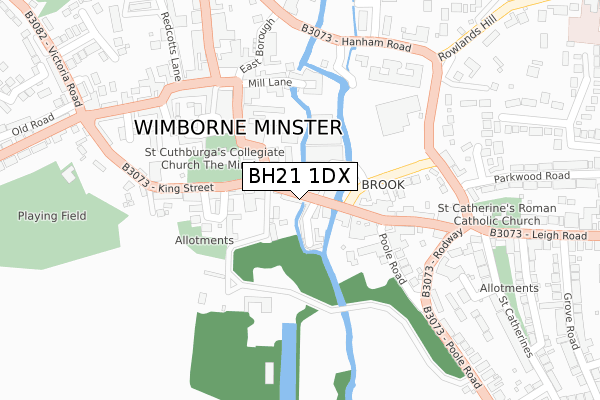
BH21 1DX lies on East Street in Wimborne. BH21 1DX is located in the Wimborne Minster electoral ward, within the unitary authority of Dorset and the English Parliamentary constituency of Mid Dorset and North Poole. The Sub Integrated Care Board (ICB) Location is NHS Dorset ICB - 11J and the police force is Dorset. This postcode has been in use since January 1980.
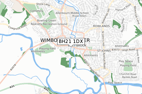
BH21 1DX maps


Licence: Open Government Licence (requires attribution)
Attribution: Contains OS data © Crown copyright and database right 2025
Source: Open Postcode Geo
Licence: Open Government Licence (requires attribution)
Attribution: Contains OS data © Crown copyright and database right 2025; Contains Royal Mail data © Royal Mail copyright and database right 2025; Source: Office for National Statistics licensed under the Open Government Licence v.3.0
BH21 1DX geodata
| Easting | 401063 |
| Northing | 99865 |
| Latitude | 50.798346 |
| Longitude | -1.986284 |
Where is BH21 1DX?
| Street | East Street |
| Town/City | Wimborne |
| Country | England |
| Postcode District | BH21 |
BH21 1DX Elevation
Elevation or altitude of BH21 1DX as distance above sea level:
| Metres | Feet | |
|---|---|---|
| Elevation | 20m | 66ft |
Elevation is measured from the approximate centre of the postcode, to the nearest point on an OS contour line from OS Terrain 50, which has contour spacing of ten vertical metres.
➜ How high above sea level am I? Find the elevation of your current position using your device's GPS.
Politics
| Ward | Wimborne Minster |
|---|---|
| Constituency | Mid Dorset And North Poole |
Transport
Nearest bus stops to BH21 1DX
| The Square (High Street) | Wimborne Minster | 197m |
| The Square | Wimborne Minster | 221m |
| The Square | Wimborne Minster | 224m |
| The Quarter Jack Surgery (Lewens Lane) | Wimborne Minster | 270m |
| The Quarter Jack Surgery (Lewens Lane) | Wimborne Minster | 287m |
Broadband
Broadband access in BH21 1DX (2020 data)
| Percentage of properties with Next Generation Access | 100.0% |
| Percentage of properties with Superfast Broadband | 100.0% |
| Percentage of properties with Ultrafast Broadband | 0.0% |
| Percentage of properties with Full Fibre Broadband | 0.0% |
Superfast Broadband is between 30Mbps and 300Mbps
Ultrafast Broadband is > 300Mbps
Broadband speed in BH21 1DX (2019 data)
Download
| Median download speed | 76.7Mbps |
| Average download speed | 58.1Mbps |
| Maximum download speed | 80.00Mbps |
Upload
| Median upload speed | 20.0Mbps |
| Average upload speed | 13.7Mbps |
| Maximum upload speed | 20.00Mbps |
Broadband limitations in BH21 1DX (2020 data)
| Percentage of properties unable to receive 2Mbps | 0.0% |
| Percentage of properties unable to receive 5Mbps | 0.0% |
| Percentage of properties unable to receive 10Mbps | 0.0% |
| Percentage of properties unable to receive 30Mbps | 0.0% |
Deprivation
33.3% of English postcodes are less deprived than BH21 1DX:Food Standards Agency
Three nearest food hygiene ratings to BH21 1DX (metres)


➜ Get more ratings from the Food Standards Agency
Nearest post box to BH21 1DX
| Last Collection | |||
|---|---|---|---|
| Location | Mon-Fri | Sat | Distance |
| Wimborne Ldo | 18:30 | 13:00 | 93m |
| The Square Post Office | 18:30 | 12:15 | 192m |
| Leigh Road | 17:45 | 12:15 | 273m |
Environment
| Risk of BH21 1DX flooding from rivers and sea | Medium |
BH21 1DX ITL and BH21 1DX LAU
The below table lists the International Territorial Level (ITL) codes (formerly Nomenclature of Territorial Units for Statistics (NUTS) codes) and Local Administrative Units (LAU) codes for BH21 1DX:
| ITL 1 Code | Name |
|---|---|
| TLK | South West (England) |
| ITL 2 Code | Name |
| TLK2 | Dorset and Somerset |
| ITL 3 Code | Name |
| TLK25 | Dorset |
| LAU 1 Code | Name |
| E06000059 | Dorset |
BH21 1DX census areas
The below table lists the Census Output Area (OA), Lower Layer Super Output Area (LSOA), and Middle Layer Super Output Area (MSOA) for BH21 1DX:
| Code | Name | |
|---|---|---|
| OA | E00103513 | |
| LSOA | E01020428 | East Dorset 010C |
| MSOA | E02004252 | East Dorset 010 |
Nearest postcodes to BH21 1DX
| BH21 1DS | East Street | 23m |
| BH21 1DW | Millstream Close | 55m |
| BH21 1HN | Eastbrook Row | 67m |
| BH21 1DU | East Street | 81m |
| BH21 1GP | Crown Mead Mews | 83m |
| BH21 1HS | High Street | 86m |
| BH21 1HT | High Street | 95m |
| BH21 1EB | King Street | 98m |
| BH21 1DT | East Street | 104m |
| BH21 1PQ | Grammar School Lane | 138m |