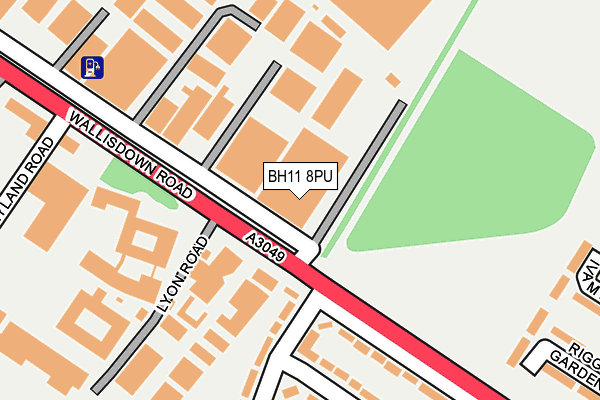
BH11 8PU is located in the Kinson electoral ward, within the unitary authority of Bournemouth, Christchurch and Poole and the English Parliamentary constituency of Bournemouth West. The Sub Integrated Care Board (ICB) Location is NHS Dorset ICB - 11J and the police force is Dorset. This postcode has been in use since January 1980.


GetTheData
Source: OS OpenMap – Local (Ordnance Survey)
Source: OS VectorMap District (Ordnance Survey)
Licence: Open Government Licence (requires attribution)
| Easting | 405332 |
| Northing | 94679 |
| Latitude | 50.751688 |
| Longitude | -1.925783 |
GetTheData
Source: Open Postcode Geo
Licence: Open Government Licence
| Country | England |
| Postcode District | BH11 |
| ➜ BH11 open data dashboard ➜ See where BH11 is on a map ➜ Where is Bournemouth? | |
GetTheData
Source: Land Registry Price Paid Data
Licence: Open Government Licence
Elevation or altitude of BH11 8PU as distance above sea level:
| Metres | Feet | |
|---|---|---|
| Elevation | 60m | 197ft |
Elevation is measured from the approximate centre of the postcode, to the nearest point on an OS contour line from OS Terrain 50, which has contour spacing of ten vertical metres.
➜ How high above sea level am I? Find the elevation of your current position using your device's GPS.
GetTheData
Source: Open Postcode Elevation
Licence: Open Government Licence
| Ward | Kinson |
| Constituency | Bournemouth West |
GetTheData
Source: ONS Postcode Database
Licence: Open Government Licence
| June 2022 | Other theft | On or near Shopping Area | 129m |
| June 2022 | Other theft | On or near Shopping Area | 129m |
| June 2022 | Violence and sexual offences | On or near Benbow Crescent | 311m |
| ➜ Get more crime data in our Crime section | |||
GetTheData
Source: data.police.uk
Licence: Open Government Licence
| Lyon Road (Wallisdown Road) | Wallisdown | 66m |
| Lyon Road (Wallisdown Road) | Wallisdown | 133m |
| Mountbatten Arms (Wallisdown Road) | Wallisdown | 365m |
| Benbow Crescent (Canford Avenue) | Wallisdown | 373m |
| Benbow Crescent (Wallisdown Road) | Wallisdown | 376m |
| Branksome Station | 2.8km |
| Parkstone (Dorset) Station | 3.6km |
| Bournemouth Station | 5.1km |
GetTheData
Source: NaPTAN
Licence: Open Government Licence
GetTheData
Source: ONS Postcode Database
Licence: Open Government Licence


➜ Get more ratings from the Food Standards Agency
GetTheData
Source: Food Standards Agency
Licence: FSA terms & conditions
| Last Collection | |||
|---|---|---|---|
| Location | Mon-Fri | Sat | Distance |
| Wallisdown Road | 17:30 | 12:30 | 144m |
| Benbow Crescent | 17:30 | 12:30 | 363m |
| 875 Ringwood Road | 17:45 | 13:00 | 499m |
GetTheData
Source: Dracos
Licence: Creative Commons Attribution-ShareAlike
| Facility | Distance |
|---|---|
| Winchelsea School Guernsey Road, Poole Grass Pitches | 620m |
| Manorside Academy Evering Avenue, Poole Grass Pitches | 649m |
| Alderney Recreation Ground (Closed) Turbary Close, Rossmore, Poole Grass Pitches | 917m |
GetTheData
Source: Active Places
Licence: Open Government Licence
| School | Phase of Education | Distance |
|---|---|---|
| The Lion Works School 543 Wallisdown Road, Poole, Dorset, BH12 5AD | Not applicable | 273m |
| Winchelsea School Guernsey Road, Parkstone, Poole, BH12 4LL | Not applicable | 613m |
| Manorside Academy Evering Avenue, Parkstone, Poole, BH12 4JG | Primary | 670m |
GetTheData
Source: Edubase
Licence: Open Government Licence
The below table lists the International Territorial Level (ITL) codes (formerly Nomenclature of Territorial Units for Statistics (NUTS) codes) and Local Administrative Units (LAU) codes for BH11 8PU:
| ITL 1 Code | Name |
|---|---|
| TLK | South West (England) |
| ITL 2 Code | Name |
| TLK2 | Dorset and Somerset |
| ITL 3 Code | Name |
| TLK24 | Bournemouth, Christchurch and Poole |
| LAU 1 Code | Name |
| E06000058 | Bournemouth, Christchurch and Poole |
GetTheData
Source: ONS Postcode Directory
Licence: Open Government Licence
The below table lists the Census Output Area (OA), Lower Layer Super Output Area (LSOA), and Middle Layer Super Output Area (MSOA) for BH11 8PU:
| Code | Name | |
|---|---|---|
| OA | E00077405 | |
| LSOA | E01015308 | Bournemouth 002C |
| MSOA | E02003173 | Bournemouth 002 |
GetTheData
Source: ONS Postcode Directory
Licence: Open Government Licence
| BH12 5AB | Wallisdown Road | 231m |
| BH12 5AL | Raleigh Road | 255m |
| BH12 5AJ | Benbow Crescent | 297m |
| BH11 8QZ | Riggs Gardens | 308m |
| BH11 8QX | Ivamy Place | 309m |
| BH12 5AH | Benbow Crescent | 314m |
| BH12 5HB | Leyland Road | 367m |
| BH11 8LW | Ringwood Road | 407m |
| BH11 8LL | 427m | |
| BH11 8QY | Noble Close | 439m |
GetTheData
Source: Open Postcode Geo; Land Registry Price Paid Data
Licence: Open Government Licence