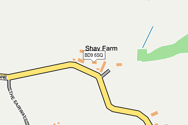
BD9 6SQ lies on Shay Lane in Bradford. BD9 6SQ is located in the Heaton electoral ward, within the metropolitan district of Bradford and the English Parliamentary constituency of Bradford West. The Sub Integrated Care Board (ICB) Location is NHS West Yorkshire ICB - 36J and the police force is West Yorkshire. This postcode has been in use since January 1980.


GetTheData
Source: OS OpenMap – Local (Ordnance Survey)
Source: OS VectorMap District (Ordnance Survey)
Licence: Open Government Licence (requires attribution)
| Easting | 413455 |
| Northing | 436289 |
| Latitude | 53.822702 |
| Longitude | -1.797091 |
GetTheData
Source: Open Postcode Geo
Licence: Open Government Licence
| Street | Shay Lane |
| Town/City | Bradford |
| Country | England |
| Postcode District | BD9 |
| ➜ BD9 open data dashboard ➜ See where BD9 is on a map | |
GetTheData
Source: Land Registry Price Paid Data
Licence: Open Government Licence
Elevation or altitude of BD9 6SQ as distance above sea level:
| Metres | Feet | |
|---|---|---|
| Elevation | 180m | 591ft |
Elevation is measured from the approximate centre of the postcode, to the nearest point on an OS contour line from OS Terrain 50, which has contour spacing of ten vertical metres.
➜ How high above sea level am I? Find the elevation of your current position using your device's GPS.
GetTheData
Source: Open Postcode Elevation
Licence: Open Government Licence
| Ward | Heaton |
| Constituency | Bradford West |
GetTheData
Source: ONS Postcode Database
Licence: Open Government Licence
| June 2022 | Anti-social behaviour | On or near Shay Grange | 273m |
| April 2022 | Burglary | On or near Shay Grange | 273m |
| April 2022 | Anti-social behaviour | On or near Shay Grange | 273m |
| ➜ Get more crime data in our Crime section | |||
GetTheData
Source: data.police.uk
Licence: Open Government Licence
| Bingley Rd Thorn Lane (Bingley Road) | Heaton | 617m |
| Bingley Rd Thorn Lane (Bingley Road) | Heaton | 635m |
| Bingley Rd Ryelands Grove (Bingley Road) | Heaton | 704m |
| Bingley Rd Ryelands Grove (Bingley Road) | Heaton | 707m |
| School Services (Belle Vue Girls School Grounds) | Heaton | 802m |
| Saltaire Station | 1.8km |
| Frizinghall Station | 1.9km |
| Shipley Station | 1.9km |
GetTheData
Source: NaPTAN
Licence: Open Government Licence
| Percentage of properties with Next Generation Access | 50.0% |
| Percentage of properties with Superfast Broadband | 0.0% |
| Percentage of properties with Ultrafast Broadband | 0.0% |
| Percentage of properties with Full Fibre Broadband | 0.0% |
Superfast Broadband is between 30Mbps and 300Mbps
Ultrafast Broadband is > 300Mbps
| Percentage of properties unable to receive 2Mbps | 0.0% |
| Percentage of properties unable to receive 5Mbps | 0.0% |
| Percentage of properties unable to receive 10Mbps | 50.0% |
| Percentage of properties unable to receive 30Mbps | 100.0% |
GetTheData
Source: Ofcom
Licence: Ofcom Terms of Use (requires attribution)
GetTheData
Source: ONS Postcode Database
Licence: Open Government Licence


➜ Get more ratings from the Food Standards Agency
GetTheData
Source: Food Standards Agency
Licence: FSA terms & conditions
| Last Collection | |||
|---|---|---|---|
| Location | Mon-Fri | Sat | Distance |
| Nabwood Grove | 17:30 | 12:30 | 1,004m |
| 110 Leylands Lane | 18:00 | 11:45 | 1,054m |
| Branch | 17:45 | 12:45 | 1,266m |
GetTheData
Source: Dracos
Licence: Creative Commons Attribution-ShareAlike
| Facility | Distance |
|---|---|
| Express Golf Centre Shay Lane, Bradford Golf | 201m |
| Northcliffe Golf Club High Bank Lane, Shipley Golf | 539m |
| Bradford Salem Rfc Shay Lane, Heaton, Bradford Grass Pitches | 576m |
GetTheData
Source: Active Places
Licence: Open Government Licence
| School | Phase of Education | Distance |
|---|---|---|
| High Park School Thorn Lane, Heaton, Bradford, BD9 6RY | Not applicable | 842m |
| Heaton St Barnabas' CofE Aided Primary School Rossefield Road, Heaton, Bradford, BD9 4DA | Primary | 904m |
| Chellow Heights Special School Thorn Lane, Bingley Road, Chellow Heights School Thorn Lane, Bingley Road, Bradford, BD9 6AL | Not applicable | 989m |
GetTheData
Source: Edubase
Licence: Open Government Licence
The below table lists the International Territorial Level (ITL) codes (formerly Nomenclature of Territorial Units for Statistics (NUTS) codes) and Local Administrative Units (LAU) codes for BD9 6SQ:
| ITL 1 Code | Name |
|---|---|
| TLE | Yorkshire and The Humber |
| ITL 2 Code | Name |
| TLE4 | West Yorkshire |
| ITL 3 Code | Name |
| TLE41 | Bradford |
| LAU 1 Code | Name |
| E08000032 | Bradford |
GetTheData
Source: ONS Postcode Directory
Licence: Open Government Licence
The below table lists the Census Output Area (OA), Lower Layer Super Output Area (LSOA), and Middle Layer Super Output Area (MSOA) for BD9 6SQ:
| Code | Name | |
|---|---|---|
| OA | E00053875 | |
| LSOA | E01010675 | Bradford 029D |
| MSOA | E02002211 | Bradford 029 |
GetTheData
Source: ONS Postcode Directory
Licence: Open Government Licence
| BD9 6RD | Shay Grange | 265m |
| BD9 6RT | Bingley Road | 664m |
| BD9 5QX | Shay Drive | 665m |
| BD9 6SJ | Shay Close | 671m |
| BD18 4LJ | High Bank Lane | 676m |
| BD9 6SA | Bingley Road | 687m |
| BD9 5PP | Shay Drive | 701m |
| BD9 5PL | Roydscliffe Drive | 714m |
| BD18 4QZ | Avondale Road | 720m |
| BD9 6RU | Bingley Road | 735m |
GetTheData
Source: Open Postcode Geo; Land Registry Price Paid Data
Licence: Open Government Licence