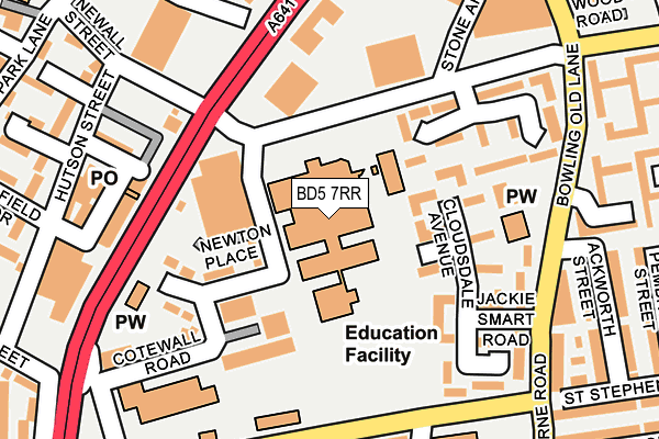
BD5 7RR is located in the Little Horton electoral ward, within the metropolitan district of Bradford and the English Parliamentary constituency of Bradford East. The Sub Integrated Care Board (ICB) Location is NHS West Yorkshire ICB - 36J and the police force is West Yorkshire. This postcode has been in use since January 1991.


GetTheData
Source: OS OpenMap – Local (Ordnance Survey)
Source: OS VectorMap District (Ordnance Survey)
Licence: Open Government Licence (requires attribution)
| Easting | 416098 |
| Northing | 431611 |
| Latitude | 53.780582 |
| Longitude | -1.757185 |
GetTheData
Source: Open Postcode Geo
Licence: Open Government Licence
| Country | England |
| Postcode District | BD5 |
| ➜ BD5 open data dashboard ➜ See where BD5 is on a map ➜ Where is Bradford? | |
GetTheData
Source: Land Registry Price Paid Data
Licence: Open Government Licence
Elevation or altitude of BD5 7RR as distance above sea level:
| Metres | Feet | |
|---|---|---|
| Elevation | 140m | 459ft |
Elevation is measured from the approximate centre of the postcode, to the nearest point on an OS contour line from OS Terrain 50, which has contour spacing of ten vertical metres.
➜ How high above sea level am I? Find the elevation of your current position using your device's GPS.
GetTheData
Source: Open Postcode Elevation
Licence: Open Government Licence
| Ward | Little Horton |
| Constituency | Bradford East |
GetTheData
Source: ONS Postcode Database
Licence: Open Government Licence
| June 2022 | Violence and sexual offences | On or near Newton Place | 92m |
| June 2022 | Other crime | On or near Wootton Street | 100m |
| June 2022 | Burglary | On or near Garvey View | 103m |
| ➜ Get more crime data in our Crime section | |||
GetTheData
Source: data.police.uk
Licence: Open Government Licence
| Manchester Rd Ripley Street (Manchester Road) | West Bowling | 144m |
| Manchester Rd Newall Street (Manchester Road) | West Bowling | 160m |
| Manchester Rd Pakington Street (Manchester Road) | West Bowling | 166m |
| Manchester Rd Jacob Street (Manchester Road) | West Bowling | 175m |
| St Stephens Rd Bowling Old Lane (St Stephen's Road) | West Bowling | 190m |
| Bradford Interchange Station | 1.3km |
| Bradford Forster Square Station | 1.8km |
| Low Moor Station | 3.4km |
GetTheData
Source: NaPTAN
Licence: Open Government Licence
GetTheData
Source: ONS Postcode Database
Licence: Open Government Licence


➜ Get more ratings from the Food Standards Agency
GetTheData
Source: Food Standards Agency
Licence: FSA terms & conditions
| Last Collection | |||
|---|---|---|---|
| Location | Mon-Fri | Sat | Distance |
| Chapel Green | 17:30 | 12:30 | 132m |
| 9 - 11 Gaythorne Road | 17:30 | 11:45 | 218m |
| West Bowling P.o. Box | 17:15 | 11:45 | 386m |
GetTheData
Source: Dracos
Licence: Creative Commons Attribution-ShareAlike
| Facility | Distance |
|---|---|
| Dixons City Academy Ripley Street, Bradford Health and Fitness Gym, Sports Hall, Artificial Grass Pitch, Studio | 0m |
| Newby Primary School Ryan Street, Bradford Sports Hall | 219m |
| Dixons Sixth Form Academy Bowling Old Lane, Bowling Old Lane, Bradford Sports Hall | 259m |
GetTheData
Source: Active Places
Licence: Open Government Licence
| School | Phase of Education | Distance |
|---|---|---|
| Dixons City Academy Ripley Street, Bradford, BD5 7RR | Secondary | 0m |
| Newby Primary School Ryan Street, Manchester Road, Bradford, BD5 7DQ | Primary | 236m |
| Dixons Free Sixth Form Bowling Old Lane, Bradford, BD5 7JR | 16 plus | 259m |
GetTheData
Source: Edubase
Licence: Open Government Licence
The below table lists the International Territorial Level (ITL) codes (formerly Nomenclature of Territorial Units for Statistics (NUTS) codes) and Local Administrative Units (LAU) codes for BD5 7RR:
| ITL 1 Code | Name |
|---|---|
| TLE | Yorkshire and The Humber |
| ITL 2 Code | Name |
| TLE4 | West Yorkshire |
| ITL 3 Code | Name |
| TLE41 | Bradford |
| LAU 1 Code | Name |
| E08000032 | Bradford |
GetTheData
Source: ONS Postcode Directory
Licence: Open Government Licence
The below table lists the Census Output Area (OA), Lower Layer Super Output Area (LSOA), and Middle Layer Super Output Area (MSOA) for BD5 7RR:
| Code | Name | |
|---|---|---|
| OA | E00176130 | |
| LSOA | E01010732 | Bradford 048B |
| MSOA | E02002230 | Bradford 048 |
GetTheData
Source: ONS Postcode Directory
Licence: Open Government Licence
| BD5 7DN | Wootton Street | 111m |
| BD5 7DL | Coates Street | 119m |
| BD5 7TD | Bowling Old Lane | 159m |
| BD5 7LH | Manchester Road | 172m |
| BD5 7DJ | Cotewall Road | 185m |
| BD5 7LR | Manchester Road | 186m |
| BD5 7DR | Defarge Court | 208m |
| BD5 7LX | Jacob Street | 212m |
| BD5 7QA | Newall Street | 230m |
| BD5 7ES | Gaythorne Road | 232m |
GetTheData
Source: Open Postcode Geo; Land Registry Price Paid Data
Licence: Open Government Licence