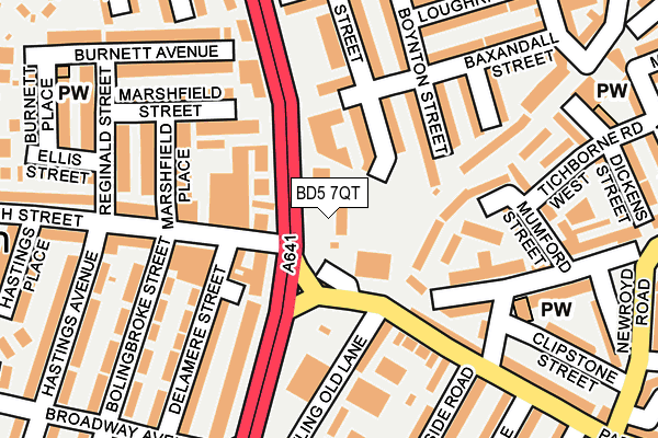
BD5 7QT is located in the Little Horton electoral ward, within the metropolitan district of Bradford and the English Parliamentary constituency of Bradford East. The Sub Integrated Care Board (ICB) Location is NHS West Yorkshire ICB - 36J and the police force is West Yorkshire. This postcode has been in use since July 2009.


GetTheData
Source: OS OpenMap – Local (Ordnance Survey)
Source: OS VectorMap District (Ordnance Survey)
Licence: Open Government Licence (requires attribution)
| Easting | 415941 |
| Northing | 431056 |
| Latitude | 53.775599 |
| Longitude | -1.759596 |
GetTheData
Source: Open Postcode Geo
Licence: Open Government Licence
| Country | England |
| Postcode District | BD5 |
| ➜ BD5 open data dashboard ➜ See where BD5 is on a map ➜ Where is Bradford? | |
GetTheData
Source: Land Registry Price Paid Data
Licence: Open Government Licence
Elevation or altitude of BD5 7QT as distance above sea level:
| Metres | Feet | |
|---|---|---|
| Elevation | 170m | 558ft |
Elevation is measured from the approximate centre of the postcode, to the nearest point on an OS contour line from OS Terrain 50, which has contour spacing of ten vertical metres.
➜ How high above sea level am I? Find the elevation of your current position using your device's GPS.
GetTheData
Source: Open Postcode Elevation
Licence: Open Government Licence
| Ward | Little Horton |
| Constituency | Bradford East |
GetTheData
Source: ONS Postcode Database
Licence: Open Government Licence
| October 2023 | Violence and sexual offences | On or near Clipstone Street | 310m |
| July 2023 | Anti-social behaviour | On or near Clipstone Street | 310m |
| July 2023 | Public order | On or near Clipstone Street | 310m |
| ➜ Get more crime data in our Crime section | |||
GetTheData
Source: data.police.uk
Licence: Open Government Licence
| Manchester Rd Marsh Street (Manchester Road) | West Bowling | 71m |
| Manchester Rd Parkside Road (Manchester Road) | West Bowling | 146m |
| Manchester Rd Donisthorpe Street (Manchester Road) | West Bowling | 152m |
| Manchester Rd Burnett Avenue (Manchester Road) | West Bowling | 195m |
| Manchester Rd Donisthorpe Street (Manchester Road) | West Bowling | 197m |
| Bradford Interchange Station | 1.8km |
| Bradford Forster Square Station | 2.4km |
| Low Moor Station | 2.9km |
GetTheData
Source: NaPTAN
Licence: Open Government Licence
GetTheData
Source: ONS Postcode Database
Licence: Open Government Licence


➜ Get more ratings from the Food Standards Agency
GetTheData
Source: Food Standards Agency
Licence: FSA terms & conditions
| Last Collection | |||
|---|---|---|---|
| Location | Mon-Fri | Sat | Distance |
| Woodroyd Works | 17:30 | 12:00 | 363m |
| West Bowling P.o. Box | 17:15 | 11:45 | 418m |
| 9 - 11 Gaythorne Road | 17:30 | 11:45 | 586m |
GetTheData
Source: Dracos
Licence: Creative Commons Attribution-ShareAlike
| Facility | Distance |
|---|---|
| Emsleys Recreation Ground Raymond Street, Bradford Grass Pitches | 370m |
| Newby Primary School Ryan Street, Bradford Sports Hall | 393m |
| Parkside Centre Parkside Road, Bradford Sports Hall, Studio | 479m |
GetTheData
Source: Active Places
Licence: Open Government Licence
| School | Phase of Education | Distance |
|---|---|---|
| Newby Primary School Ryan Street, Manchester Road, Bradford, BD5 7DQ | Primary | 384m |
| The Fountain School 109 - 111 New Cross Street, Bradford, West Yorkshire, Bradford, BD5 8BP | Not applicable | 385m |
| Bankfoot Primary School Bolingbroke Street, Bankfoot, Bradford, BD5 9NR | Primary | 390m |
GetTheData
Source: Edubase
Licence: Open Government Licence
The below table lists the International Territorial Level (ITL) codes (formerly Nomenclature of Territorial Units for Statistics (NUTS) codes) and Local Administrative Units (LAU) codes for BD5 7QT:
| ITL 1 Code | Name |
|---|---|
| TLE | Yorkshire and The Humber |
| ITL 2 Code | Name |
| TLE4 | West Yorkshire |
| ITL 3 Code | Name |
| TLE41 | Bradford |
| LAU 1 Code | Name |
| E08000032 | Bradford |
GetTheData
Source: ONS Postcode Directory
Licence: Open Government Licence
The below table lists the Census Output Area (OA), Lower Layer Super Output Area (LSOA), and Middle Layer Super Output Area (MSOA) for BD5 7QT:
| Code | Name | |
|---|---|---|
| OA | E00054153 | |
| LSOA | E01010737 | Bradford 048E |
| MSOA | E02002230 | Bradford 048 |
GetTheData
Source: ONS Postcode Directory
Licence: Open Government Licence
| BD5 7QP | Manchester Road | 68m |
| BD5 7AS | Ryan Street | 86m |
| BD5 8AF | Darnay Lane | 110m |
| BD5 7BS | Boynton Street | 117m |
| BD5 7AR | Baxandall Street | 121m |
| BD5 8HN | Bowling Old Lane | 127m |
| BD5 8DJ | Manchester Road | 142m |
| BD5 8DN | Parkside Road | 143m |
| BD5 9ND | Marshfield Place | 147m |
| BD5 7QS | Manchester Road | 148m |
GetTheData
Source: Open Postcode Geo; Land Registry Price Paid Data
Licence: Open Government Licence