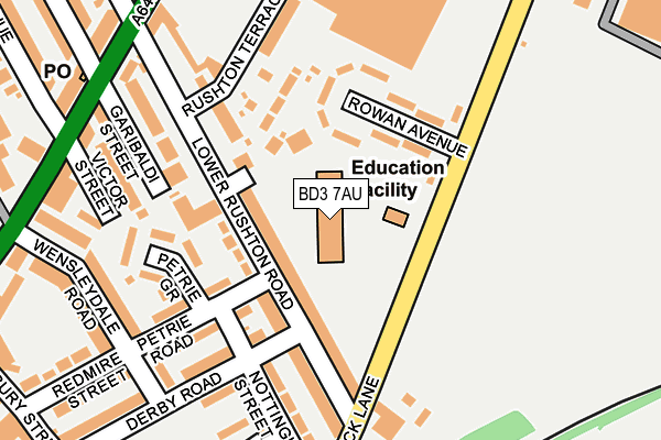
BD3 7AU is located in the Bradford Moor electoral ward, within the metropolitan district of Bradford and the English Parliamentary constituency of Bradford East. The Sub Integrated Care Board (ICB) Location is NHS West Yorkshire ICB - 36J and the police force is West Yorkshire. This postcode has been in use since September 2002.


GetTheData
Source: OS OpenMap – Local (Ordnance Survey)
Source: OS VectorMap District (Ordnance Survey)
Licence: Open Government Licence (requires attribution)
| Easting | 419278 |
| Northing | 433344 |
| Latitude | 53.796051 |
| Longitude | -1.708820 |
GetTheData
Source: Open Postcode Geo
Licence: Open Government Licence
| Country | England |
| Postcode District | BD3 |
| ➜ BD3 open data dashboard ➜ See where BD3 is on a map ➜ Where is Bradford? | |
GetTheData
Source: Land Registry Price Paid Data
Licence: Open Government Licence
Elevation or altitude of BD3 7AU as distance above sea level:
| Metres | Feet | |
|---|---|---|
| Elevation | 170m | 558ft |
Elevation is measured from the approximate centre of the postcode, to the nearest point on an OS contour line from OS Terrain 50, which has contour spacing of ten vertical metres.
➜ How high above sea level am I? Find the elevation of your current position using your device's GPS.
GetTheData
Source: Open Postcode Elevation
Licence: Open Government Licence
| Ward | Bradford Moor |
| Constituency | Bradford East |
GetTheData
Source: ONS Postcode Database
Licence: Open Government Licence
| June 2022 | Criminal damage and arson | On or near Sports/Recreation Area | 12m |
| June 2022 | Public order | On or near Sports/Recreation Area | 12m |
| June 2022 | Criminal damage and arson | On or near Rowan Avenue | 109m |
| ➜ Get more crime data in our Crime section | |||
GetTheData
Source: data.police.uk
Licence: Open Government Licence
| Dick Lane Lower Rushden Rd (Dick Lane) | Tyersal | 118m |
| Dick Lane Nottingham St (Dick Lane) | Tyersal | 217m |
| Dick Lane Barberry Ave (Dick Lane) | Thornbury | 271m |
| Leeds Rd Wensleydale Road (Leeds Road) | Thornbury | 273m |
| Leeds Road Thornhill Place (Leeds Road) | Thornbury | 277m |
| New Pudsey Station | 2.1km |
| Bradford Interchange Station | 2.7km |
| Bradford Forster Square Station | 2.9km |
GetTheData
Source: NaPTAN
Licence: Open Government Licence
GetTheData
Source: ONS Postcode Database
Licence: Open Government Licence

➜ Get more ratings from the Food Standards Agency
GetTheData
Source: Food Standards Agency
Licence: FSA terms & conditions
| Last Collection | |||
|---|---|---|---|
| Location | Mon-Fri | Sat | Distance |
| Woodhall Avenue P.o. Box | 17:00 | 12:15 | 598m |
| 10 - 12 Tyersal Road | 18:00 | 10:45 | 670m |
| Tyersal | 17:30 | 10:45 | 709m |
GetTheData
Source: Dracos
Licence: Creative Commons Attribution-ShareAlike
| Facility | Distance |
|---|---|
| Laisterdyke Leadership Academy Thornbury Road, Bradford Grass Pitches, Sports Hall | 382m |
| Puregym (Bradford Thornbury) Dick Lane, Bradford Swimming Pool, Health and Fitness Gym, Studio | 590m |
| Phoenix Park Leisure And Golf Course (Closed) Dick Lane, Thornbury, Bradford Golf | 593m |
GetTheData
Source: Active Places
Licence: Open Government Licence
| School | Phase of Education | Distance |
|---|---|---|
| Thornbury Primary Leadership Academy Dick Lane, Bradford, BD3 7AU | Primary | 0m |
| Laisterdyke Leadership Academy Thornbury Road, Bradford, BD3 8HE | Secondary | 382m |
| Dixons Marchbank Primary Marchbank Road, Barkerend Road, Bradford, BD3 8QQ | Primary | 917m |
GetTheData
Source: Edubase
Licence: Open Government Licence
The below table lists the International Territorial Level (ITL) codes (formerly Nomenclature of Territorial Units for Statistics (NUTS) codes) and Local Administrative Units (LAU) codes for BD3 7AU:
| ITL 1 Code | Name |
|---|---|
| TLE | Yorkshire and The Humber |
| ITL 2 Code | Name |
| TLE4 | West Yorkshire |
| ITL 3 Code | Name |
| TLE41 | Bradford |
| LAU 1 Code | Name |
| E08000032 | Bradford |
GetTheData
Source: ONS Postcode Directory
Licence: Open Government Licence
The below table lists the Census Output Area (OA), Lower Layer Super Output Area (LSOA), and Middle Layer Super Output Area (MSOA) for BD3 7AU:
| Code | Name | |
|---|---|---|
| OA | E00053624 | |
| LSOA | E01010618 | Bradford 038A |
| MSOA | E02002220 | Bradford 038 |
GetTheData
Source: ONS Postcode Directory
Licence: Open Government Licence
| BD3 8PU | Lower Rushton Road | 55m |
| BD3 8PP | Gurbax Court | 86m |
| BD3 8PT | Courtenay Close | 117m |
| BD3 7AH | Rowan Avenue | 125m |
| BD3 8PZ | Lower Rushton Road | 133m |
| BD3 8PX | Lower Rushton Road | 144m |
| BD3 8NQ | Petrie Road | 157m |
| BD3 8NH | Petrie Grove | 159m |
| BD3 8QA | Derby Road | 167m |
| BD3 8PY | Rushton Terrace | 183m |
GetTheData
Source: Open Postcode Geo; Land Registry Price Paid Data
Licence: Open Government Licence