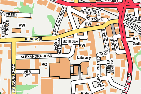
BD18 3EA is located in the Shipley electoral ward, within the metropolitan district of Bradford and the English Parliamentary constituency of Shipley. The Sub Integrated Care Board (ICB) Location is NHS West Yorkshire ICB - 36J and the police force is West Yorkshire. This postcode has been in use since January 1980.


GetTheData
Source: OS OpenMap – Local (Ordnance Survey)
Source: OS VectorMap District (Ordnance Survey)
Licence: Open Government Licence (requires attribution)
| Easting | 414627 |
| Northing | 437467 |
| Latitude | 53.833258 |
| Longitude | -1.779232 |
GetTheData
Source: Open Postcode Geo
Licence: Open Government Licence
| Country | England |
| Postcode District | BD18 |
| ➜ BD18 open data dashboard ➜ See where BD18 is on a map ➜ Where is Shipley? | |
GetTheData
Source: Land Registry Price Paid Data
Licence: Open Government Licence
Elevation or altitude of BD18 3EA as distance above sea level:
| Metres | Feet | |
|---|---|---|
| Elevation | 90m | 295ft |
Elevation is measured from the approximate centre of the postcode, to the nearest point on an OS contour line from OS Terrain 50, which has contour spacing of ten vertical metres.
➜ How high above sea level am I? Find the elevation of your current position using your device's GPS.
GetTheData
Source: Open Postcode Elevation
Licence: Open Government Licence
| Ward | Shipley |
| Constituency | Shipley |
GetTheData
Source: ONS Postcode Database
Licence: Open Government Licence
| January 2024 | Shoplifting | On or near Parking Area | 370m |
| January 2024 | Shoplifting | On or near Parking Area | 370m |
| January 2024 | Shoplifting | On or near Parking Area | 370m |
| ➜ Get more crime data in our Crime section | |||
GetTheData
Source: data.police.uk
Licence: Open Government Licence
| Market Square | Shipley | 145m |
| Market Square | Shipley | 146m |
| Market Square | Shipley | 146m |
| Market Square | Shipley | 147m |
| Market Square | Shipley | 160m |
| Shipley Station | 0.4km |
| Saltaire Station | 0.9km |
| Frizinghall Station | 1.6km |
GetTheData
Source: NaPTAN
Licence: Open Government Licence
GetTheData
Source: ONS Postcode Database
Licence: Open Government Licence


➜ Get more ratings from the Food Standards Agency
GetTheData
Source: Food Standards Agency
Licence: FSA terms & conditions
| Last Collection | |||
|---|---|---|---|
| Location | Mon-Fri | Sat | Distance |
| Kirklees House | 18:30 | 12:30 | 145m |
| Market Square | 18:00 | 12:30 | 150m |
| Shipley Delivery Office | 18:30 | 12:45 | 240m |
GetTheData
Source: Dracos
Licence: Creative Commons Attribution-ShareAlike
| Facility | Distance |
|---|---|
| Jimmys Health & Fitness Centre (Closed) Dale Street, Shipley Health and Fitness Gym | 210m |
| Shipley Swimming Pool And Gym Alexandra Road, Shipley Swimming Pool, Sports Hall, Health and Fitness Gym | 222m |
| Workouts Gyms (Shipley) (Closed) Wharf Street, Shipley Health and Fitness Gym | 297m |
GetTheData
Source: Active Places
Licence: Open Government Licence
| School | Phase of Education | Distance |
|---|---|---|
| Shipley CofE Primary School Otley Road, Shipley, BD18 2PT | Primary | 474m |
| Wycliffe CofE Primary School Saltaire Road, Shipley, BD18 3HZ | Primary | 559m |
| Bradford Alternative Provision Academy Baker Street, Saltaire, Shipley, BD18 3JE | Not applicable | 604m |
GetTheData
Source: Edubase
Licence: Open Government Licence
The below table lists the International Territorial Level (ITL) codes (formerly Nomenclature of Territorial Units for Statistics (NUTS) codes) and Local Administrative Units (LAU) codes for BD18 3EA:
| ITL 1 Code | Name |
|---|---|
| TLE | Yorkshire and The Humber |
| ITL 2 Code | Name |
| TLE4 | West Yorkshire |
| ITL 3 Code | Name |
| TLE41 | Bradford |
| LAU 1 Code | Name |
| E08000032 | Bradford |
GetTheData
Source: ONS Postcode Directory
Licence: Open Government Licence
The below table lists the Census Output Area (OA), Lower Layer Super Output Area (LSOA), and Middle Layer Super Output Area (MSOA) for BD18 3EA:
| Code | Name | |
|---|---|---|
| OA | E00054427 | |
| LSOA | E01010788 | Bradford 020D |
| MSOA | E02002202 | Bradford 020 |
GetTheData
Source: ONS Postcode Directory
Licence: Open Government Licence
| BD18 3EQ | Windsor Road | 36m |
| BD18 3QH | Wellcroft | 56m |
| BD18 3SX | Cross Rosse Street | 100m |
| BD18 3EL | Kirkgate | 133m |
| BD18 3RL | Central Avenue | 134m |
| BD18 3ER | Alexandra Road | 147m |
| BD18 3QX | Westgate | 151m |
| BD18 3SP | Commercial Street | 175m |
| BD18 3QS | Atkinson Street | 175m |
| BD18 3QB | Market Square | 178m |
GetTheData
Source: Open Postcode Geo; Land Registry Price Paid Data
Licence: Open Government Licence