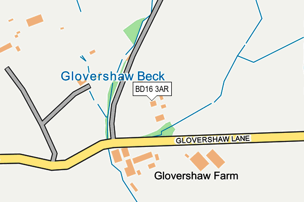
BD16 3AR is located in the Baildon electoral ward, within the metropolitan district of Bradford and the English Parliamentary constituency of Shipley. The Sub Integrated Care Board (ICB) Location is NHS West Yorkshire ICB - 36J and the police force is West Yorkshire. This postcode has been in use since January 1980.


GetTheData
Source: OS OpenMap – Local (Ordnance Survey)
Source: OS VectorMap District (Ordnance Survey)
Licence: Open Government Licence (requires attribution)
| Easting | 413169 |
| Northing | 440537 |
| Latitude | 53.860904 |
| Longitude | -1.801258 |
GetTheData
Source: Open Postcode Geo
Licence: Open Government Licence
| Country | England |
| Postcode District | BD16 |
| ➜ BD16 open data dashboard ➜ See where BD16 is on a map | |
GetTheData
Source: Land Registry Price Paid Data
Licence: Open Government Licence
Elevation or altitude of BD16 3AR as distance above sea level:
| Metres | Feet | |
|---|---|---|
| Elevation | 190m | 623ft |
Elevation is measured from the approximate centre of the postcode, to the nearest point on an OS contour line from OS Terrain 50, which has contour spacing of ten vertical metres.
➜ How high above sea level am I? Find the elevation of your current position using your device's GPS.
GetTheData
Source: Open Postcode Elevation
Licence: Open Government Licence
| Ward | Baildon |
| Constituency | Shipley |
GetTheData
Source: ONS Postcode Database
Licence: Open Government Licence
| June 2022 | Criminal damage and arson | On or near Spring Lane | 64m |
| May 2022 | Public order | On or near Spring Lane | 64m |
| May 2022 | Drugs | On or near Spring Lane | 64m |
| ➜ Get more crime data in our Crime section | |||
GetTheData
Source: data.police.uk
Licence: Open Government Licence
| Otley Rd Spring Lane (Otley Road) | Eldwick | 578m |
| Otley Rd Spring Lane (Otley Road) | Eldwick | 579m |
| Otley Road Terminus (Otley Road) | Eldwick | 680m |
| Otley Rd Lyndale Road (Otley Road) | Eldwick | 696m |
| Otley Rd Lyndale Road (Otley Road) | Eldwick | 725m |
| Saltaire Station | 2.6km |
| Bingley Station | 2.7km |
| Crossflatts Station | 2.9km |
GetTheData
Source: NaPTAN
Licence: Open Government Licence
GetTheData
Source: ONS Postcode Database
Licence: Open Government Licence


➜ Get more ratings from the Food Standards Agency
GetTheData
Source: Food Standards Agency
Licence: FSA terms & conditions
| Last Collection | |||
|---|---|---|---|
| Location | Mon-Fri | Sat | Distance |
| Eldwick Beck | 17:00 | 12:15 | 664m |
| Eldwick P.o. Box | 17:00 | 12:15 | 931m |
| Otley Road | 17:00 | 12:30 | 1,438m |
GetTheData
Source: Dracos
Licence: Creative Commons Attribution-ShareAlike
| Facility | Distance |
|---|---|
| Eldwick Primary Old School Playing Field Story Stones, Bingley Grass Pitches | 645m |
| Eldwick Tennis Club Otley Road, Bingley Outdoor Tennis Courts | 885m |
| Eldwick Rec Ground Otley Road, Eldwick , Bingley Grass Pitches | 918m |
GetTheData
Source: Active Places
Licence: Open Government Licence
| School | Phase of Education | Distance |
|---|---|---|
| Eldwick Primary School Warren Lane, Gilstead, Bingley, BD16 3LE | Primary | 1.4km |
| Lady Lane Park School & Nursery Lady Lane, Bingley, BD16 4AP | Not applicable | 1.9km |
| Sandal Primary School West Lane, Baildon, Shipley, BD17 5DH | Primary | 2.1km |
GetTheData
Source: Edubase
Licence: Open Government Licence
The below table lists the International Territorial Level (ITL) codes (formerly Nomenclature of Territorial Units for Statistics (NUTS) codes) and Local Administrative Units (LAU) codes for BD16 3AR:
| ITL 1 Code | Name |
|---|---|
| TLE | Yorkshire and The Humber |
| ITL 2 Code | Name |
| TLE4 | West Yorkshire |
| ITL 3 Code | Name |
| TLE41 | Bradford |
| LAU 1 Code | Name |
| E08000032 | Bradford |
GetTheData
Source: ONS Postcode Directory
Licence: Open Government Licence
The below table lists the Census Output Area (OA), Lower Layer Super Output Area (LSOA), and Middle Layer Super Output Area (MSOA) for BD16 3AR:
| Code | Name | |
|---|---|---|
| OA | E00053353 | |
| LSOA | E01010573 | Bradford 013A |
| MSOA | E02002195 | Bradford 013 |
GetTheData
Source: ONS Postcode Directory
Licence: Open Government Licence
| BD16 3AU | Spring Lane | 196m |
| BD16 3AS | Spring Lane | 454m |
| BD16 3BW | Paddock Lane | 478m |
| BD16 3BN | Pennygate | 530m |
| BD16 3EY | Saltaire Road | 564m |
| BD16 3HA | Eldwick Beck | 567m |
| BD16 3AX | Otley Road | 571m |
| BD16 3EX | Saltaire Road | 577m |
| BD16 3HB | The Green | 608m |
| BD16 3HG | Hunterscombe Court | 608m |
GetTheData
Source: Open Postcode Geo; Land Registry Price Paid Data
Licence: Open Government Licence