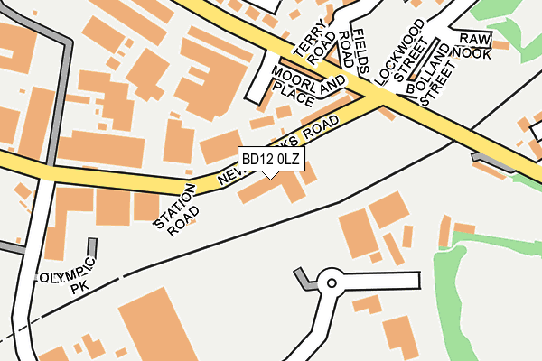
BD12 0LZ is located in the Wyke electoral ward, within the metropolitan district of Bradford and the English Parliamentary constituency of Bradford South. The Sub Integrated Care Board (ICB) Location is NHS West Yorkshire ICB - 36J and the police force is West Yorkshire. This postcode has been in use since June 2001.


GetTheData
Source: OS OpenMap – Local (Ordnance Survey)
Source: OS VectorMap District (Ordnance Survey)
Licence: Open Government Licence (requires attribution)
| Easting | 416268 |
| Northing | 428205 |
| Latitude | 53.749964 |
| Longitude | -1.754784 |
GetTheData
Source: Open Postcode Geo
Licence: Open Government Licence
| Country | England |
| Postcode District | BD12 |
| ➜ BD12 open data dashboard ➜ See where BD12 is on a map ➜ Where is Bradford? | |
GetTheData
Source: Land Registry Price Paid Data
Licence: Open Government Licence
Elevation or altitude of BD12 0LZ as distance above sea level:
| Metres | Feet | |
|---|---|---|
| Elevation | 140m | 459ft |
Elevation is measured from the approximate centre of the postcode, to the nearest point on an OS contour line from OS Terrain 50, which has contour spacing of ten vertical metres.
➜ How high above sea level am I? Find the elevation of your current position using your device's GPS.
GetTheData
Source: Open Postcode Elevation
Licence: Open Government Licence
| Ward | Wyke |
| Constituency | Bradford South |
GetTheData
Source: ONS Postcode Database
Licence: Open Government Licence
| December 2023 | Anti-social behaviour | On or near East Road | 482m |
| December 2023 | Violence and sexual offences | On or near East Road | 482m |
| November 2023 | Violence and sexual offences | On or near Caldene Avenue | 443m |
| ➜ Get more crime data in our Crime section | |||
GetTheData
Source: data.police.uk
Licence: Open Government Licence
| Cleckheaton Road New Works Rd (Cleckheaton Road) | Low Moor | 136m |
| Cleckheaton Road Terry Rd (Cleckheaton Road) | Low Moor | 147m |
| Cleckheaton Rd Furnace Road (Cleckheaton Road) | Oakenshaw | 278m |
| Cleckheaton Rd Furnace Road (Cleckheaton Road) | Oakenshaw | 378m |
| Cleckheaton Road Chapel Rd (Cleckheaton Road) | Low Moor | 399m |
| Low Moor Station | 0.1km |
| Bradford Interchange Station | 4.6km |
GetTheData
Source: NaPTAN
Licence: Open Government Licence
GetTheData
Source: ONS Postcode Database
Licence: Open Government Licence


➜ Get more ratings from the Food Standards Agency
GetTheData
Source: Food Standards Agency
Licence: FSA terms & conditions
| Last Collection | |||
|---|---|---|---|
| Location | Mon-Fri | Sat | Distance |
| Carr Lane | 17:00 | 12:00 | 504m |
| Low Moor Business Box | 18:30 | 11:45 | 583m |
| 451 Cleckheaton Road | 17:45 | 11:45 | 664m |
GetTheData
Source: Dracos
Licence: Creative Commons Attribution-ShareAlike
| Facility | Distance |
|---|---|
| Victoria Park (Oakenshaw) Cleckheaton Road, Oakenshaw, Bradford Grass Pitches | 305m |
| Fifth Street Recreation Ground Fifth Street, Low Moor, Bradford Grass Pitches | 603m |
| Woodlands Sports Hall & Cricket Club Albert Terrace, Oakenshaw, Bradford Sports Hall, Grass Pitches | 616m |
GetTheData
Source: Active Places
Licence: Open Government Licence
| School | Phase of Education | Distance |
|---|---|---|
| Low Moor CofE Primary School Park House Road, Low Moor, Bradford, BD12 0NN | Primary | 698m |
| Hill Top CofE Primary School Common Road, Low Moor, Bradford, BD12 0TL | Primary | 1.1km |
| Worthinghead Primary School Wyke Lane, Wyke, Bradford, BD12 9EL | Primary | 1.1km |
GetTheData
Source: Edubase
Licence: Open Government Licence
The below table lists the International Territorial Level (ITL) codes (formerly Nomenclature of Territorial Units for Statistics (NUTS) codes) and Local Administrative Units (LAU) codes for BD12 0LZ:
| ITL 1 Code | Name |
|---|---|
| TLE | Yorkshire and The Humber |
| ITL 2 Code | Name |
| TLE4 | West Yorkshire |
| ITL 3 Code | Name |
| TLE41 | Bradford |
| LAU 1 Code | Name |
| E08000032 | Bradford |
GetTheData
Source: ONS Postcode Directory
Licence: Open Government Licence
The below table lists the Census Output Area (OA), Lower Layer Super Output Area (LSOA), and Middle Layer Super Output Area (MSOA) for BD12 0LZ:
| Code | Name | |
|---|---|---|
| OA | E00054793 | |
| LSOA | E01010866 | Bradford 060E |
| MSOA | E02002242 | Bradford 060 |
GetTheData
Source: ONS Postcode Directory
Licence: Open Government Licence
| BD12 0LB | New Works Road | 81m |
| BD12 0LA | Moorland View | 99m |
| BD12 0LE | Moorland Place | 105m |
| BD12 0LQ | Cleckheaton Road | 124m |
| BD12 0LH | Cleckheaton Road | 146m |
| BD12 0LJ | Cleckheaton Road | 152m |
| BD12 0LG | Potter Close | 186m |
| BD12 0LL | Terry Road | 189m |
| BD12 0JY | Cleckheaton Road | 204m |
| BD12 0LN | Fields Road | 204m |
GetTheData
Source: Open Postcode Geo; Land Registry Price Paid Data
Licence: Open Government Licence