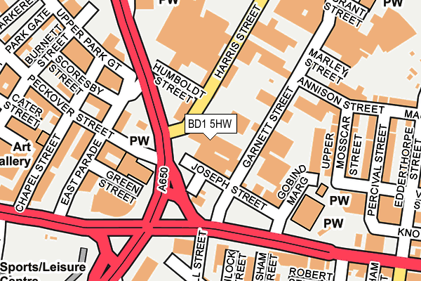
BD1 5HW lies on Harris Street in Bradford. BD1 5HW is located in the Bowling and Barkerend electoral ward, within the metropolitan district of Bradford and the English Parliamentary constituency of Bradford East. The Sub Integrated Care Board (ICB) Location is NHS West Yorkshire ICB - 36J and the police force is West Yorkshire. This postcode has been in use since January 1980.


GetTheData
Source: OS OpenMap – Local (Ordnance Survey)
Source: OS VectorMap District (Ordnance Survey)
Licence: Open Government Licence (requires attribution)
| Easting | 417121 |
| Northing | 433232 |
| Latitude | 53.795134 |
| Longitude | -1.741575 |
GetTheData
Source: Open Postcode Geo
Licence: Open Government Licence
| Street | Harris Street |
| Town/City | Bradford |
| Country | England |
| Postcode District | BD1 |
| ➜ BD1 open data dashboard ➜ See where BD1 is on a map ➜ Where is Bradford? | |
GetTheData
Source: Land Registry Price Paid Data
Licence: Open Government Licence
Elevation or altitude of BD1 5HW as distance above sea level:
| Metres | Feet | |
|---|---|---|
| Elevation | 120m | 394ft |
Elevation is measured from the approximate centre of the postcode, to the nearest point on an OS contour line from OS Terrain 50, which has contour spacing of ten vertical metres.
➜ How high above sea level am I? Find the elevation of your current position using your device's GPS.
GetTheData
Source: Open Postcode Elevation
Licence: Open Government Licence
| Ward | Bowling And Barkerend |
| Constituency | Bradford East |
GetTheData
Source: ONS Postcode Database
Licence: Open Government Licence
46, HARRIS STREET, BRADFORD, BD1 5HW 2003 13 JUN £113,500 |
GetTheData
Source: HM Land Registry Price Paid Data
Licence: Contains HM Land Registry data © Crown copyright and database right 2024. This data is licensed under the Open Government Licence v3.0.
| January 2024 | Anti-social behaviour | On or near East Parade | 165m |
| January 2024 | Anti-social behaviour | On or near East Parade | 165m |
| January 2024 | Criminal damage and arson | On or near East Parade | 165m |
| ➜ Get more crime data in our Crime section | |||
GetTheData
Source: data.police.uk
Licence: Open Government Licence
| Barkerend Road Harris St (Barkerend Road) | Barkerend | 199m |
| Barkerend Rd Nuttall Road (Barkerend Road) | Barkerend | 205m |
| Barkerend Road Harris St (Barkerend Road) | Barkerend | 210m |
| Barkerend Rd Nuttall Road (Barkerend Road) | Barkerend | 222m |
| Leeds Roa Garnett Street (Leeds Road) | Barkerend | 227m |
| Bradford Interchange Station | 0.7km |
| Bradford Forster Square Station | 0.8km |
| Frizinghall Station | 3.3km |
GetTheData
Source: NaPTAN
Licence: Open Government Licence
GetTheData
Source: ONS Postcode Database
Licence: Open Government Licence


➜ Get more ratings from the Food Standards Agency
GetTheData
Source: Food Standards Agency
Licence: FSA terms & conditions
| Last Collection | |||
|---|---|---|---|
| Location | Mon-Fri | Sat | Distance |
| Parkgate | 18:30 | 12:30 | 282m |
| Well Street | 18:30 | 12:30 | 321m |
| 2 Seaton Street | 18:30 | 12:15 | 426m |
GetTheData
Source: Dracos
Licence: Creative Commons Attribution-ShareAlike
| Facility | Distance |
|---|---|
| Heartbeat Health & Fitness (Bradford) (Closed) Upper Park Gate, Bradford Studio, Health and Fitness Gym | 142m |
| Bodyflex Gymnasium East Parade, Bradford Health and Fitness Gym | 249m |
| Upper Seymour Street Recreation Ground Upper Seymour Street, Bradford Grass Pitches | 445m |
GetTheData
Source: Active Places
Licence: Open Government Licence
| School | Phase of Education | Distance |
|---|---|---|
| Training and Skills Centre Office Suite 2/3, Accent Business Centre, 132 Barkerend Road, Bradford, BD3 9BE | Not applicable | 173m |
| Barkerend Primary Leadership Academy Hendford Drive, Pollard Park, Bradford, BD3 0QT | Primary | 456m |
| Carlton Bolling Undercliffe Lane, Bradford, BD3 0DU | Secondary | 797m |
GetTheData
Source: Edubase
Licence: Open Government Licence
The below table lists the International Territorial Level (ITL) codes (formerly Nomenclature of Territorial Units for Statistics (NUTS) codes) and Local Administrative Units (LAU) codes for BD1 5HW:
| ITL 1 Code | Name |
|---|---|
| TLE | Yorkshire and The Humber |
| ITL 2 Code | Name |
| TLE4 | West Yorkshire |
| ITL 3 Code | Name |
| TLE41 | Bradford |
| LAU 1 Code | Name |
| E08000032 | Bradford |
GetTheData
Source: ONS Postcode Directory
Licence: Open Government Licence
The below table lists the Census Output Area (OA), Lower Layer Super Output Area (LSOA), and Middle Layer Super Output Area (MSOA) for BD1 5HW:
| Code | Name | |
|---|---|---|
| OA | E00053596 | |
| LSOA | E01010606 | Bradford 039A |
| MSOA | E02002221 | Bradford 039 |
GetTheData
Source: ONS Postcode Directory
Licence: Open Government Licence
| BD1 5JA | Harris Street | 88m |
| BD3 9HB | Garnett Street | 126m |
| BD3 9HJ | Annison Street | 144m |
| BD1 5DW | Upper Park Gate | 174m |
| BD3 9HR | Joseph Street | 175m |
| BD3 9JS | Upper Mosscar Street | 180m |
| BD1 5EN | Scoresby Street | 188m |
| BD3 9BH | Barkerend Road | 194m |
| BD1 5EP | East Parade | 197m |
| BD1 5HD | East Parade | 202m |
GetTheData
Source: Open Postcode Geo; Land Registry Price Paid Data
Licence: Open Government Licence