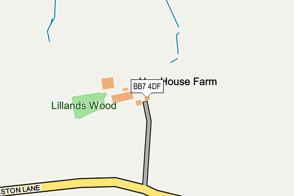
BB7 4DF is located in the Chatburn electoral ward, within the local authority district of Ribble Valley and the English Parliamentary constituency of Ribble Valley. The Sub Integrated Care Board (ICB) Location is NHS Lancashire and South Cumbria ICB - 01A and the police force is Lancashire. This postcode has been in use since January 1980.


GetTheData
Source: OS OpenMap – Local (Ordnance Survey)
Source: OS VectorMap District (Ordnance Survey)
Licence: Open Government Licence (requires attribution)
| Easting | 379444 |
| Northing | 444668 |
| Latitude | 53.897770 |
| Longitude | -2.314305 |
GetTheData
Source: Open Postcode Geo
Licence: Open Government Licence
| Country | England |
| Postcode District | BB7 |
| ➜ BB7 open data dashboard ➜ See where BB7 is on a map | |
GetTheData
Source: Land Registry Price Paid Data
Licence: Open Government Licence
Elevation or altitude of BB7 4DF as distance above sea level:
| Metres | Feet | |
|---|---|---|
| Elevation | 160m | 525ft |
Elevation is measured from the approximate centre of the postcode, to the nearest point on an OS contour line from OS Terrain 50, which has contour spacing of ten vertical metres.
➜ How high above sea level am I? Find the elevation of your current position using your device's GPS.
GetTheData
Source: Open Postcode Elevation
Licence: Open Government Licence
| Ward | Chatburn |
| Constituency | Ribble Valley |
GetTheData
Source: ONS Postcode Database
Licence: Open Government Licence
| November 2021 | Anti-social behaviour | On or near Twiston Lane | 238m |
| June 2021 | Anti-social behaviour | On or near Twiston Lane | 238m |
| June 2021 | Anti-social behaviour | On or near Twiston Lane | 238m |
| ➜ Get more crime data in our Crime section | |||
GetTheData
Source: data.police.uk
Licence: Open Government Licence
| Smithfield Farm (Twiston Lane) | Downham | 646m |
| Gerna Farm (Pendle Road) | Downham | 1,020m |
| Old Well Hall (Main Street) | Downham | 1,029m |
| St Leonards Church (Pendle Road) | Downham | 1,038m |
| Laneside Farm (Pendle Road) | Downham | 1,042m |
GetTheData
Source: NaPTAN
Licence: Open Government Licence
| Percentage of properties with Next Generation Access | 100.0% |
| Percentage of properties with Superfast Broadband | 20.0% |
| Percentage of properties with Ultrafast Broadband | 0.0% |
| Percentage of properties with Full Fibre Broadband | 0.0% |
Superfast Broadband is between 30Mbps and 300Mbps
Ultrafast Broadband is > 300Mbps
| Percentage of properties unable to receive 2Mbps | 0.0% |
| Percentage of properties unable to receive 5Mbps | 0.0% |
| Percentage of properties unable to receive 10Mbps | 20.0% |
| Percentage of properties unable to receive 30Mbps | 80.0% |
GetTheData
Source: Ofcom
Licence: Ofcom Terms of Use (requires attribution)
GetTheData
Source: ONS Postcode Database
Licence: Open Government Licence


➜ Get more ratings from the Food Standards Agency
GetTheData
Source: Food Standards Agency
Licence: FSA terms & conditions
| Last Collection | |||
|---|---|---|---|
| Location | Mon-Fri | Sat | Distance |
| 144 Chatburn Road | 16:00 | 11:30 | 4,933m |
GetTheData
Source: Dracos
Licence: Creative Commons Attribution-ShareAlike
| Facility | Distance |
|---|---|
| Coulthurst Jubilee Field Back Lane, Rimington, Clitheroe Grass Pitches, Artificial Grass Pitch | 1.6km |
| Chatburn Cricket And Football Club Sawley Road, Chatburn, Clitheroe Grass Pitches | 2.6km |
| Bowland High School Sawley Road, Grindleton, Clitheroe Sports Hall, Grass Pitches, Studio, Health and Fitness Gym, Artificial Grass Pitch | 2.9km |
GetTheData
Source: Active Places
Licence: Open Government Licence
| School | Phase of Education | Distance |
|---|---|---|
| Chatburn Church of England Primary School Sawley Road, Chatburn, Clitheroe, BB7 4AS | Primary | 2.5km |
| Bowland High Riversmead, Sawley Road, Grindleton, Clitheroe, BB7 4QS | Secondary | 2.9km |
| Grindleton Church of England Voluntary Aided Primary School Sawley Road, Grindleton, Clitheroe, BB7 4QS | Primary | 3.4km |
GetTheData
Source: Edubase
Licence: Open Government Licence
The below table lists the International Territorial Level (ITL) codes (formerly Nomenclature of Territorial Units for Statistics (NUTS) codes) and Local Administrative Units (LAU) codes for BB7 4DF:
| ITL 1 Code | Name |
|---|---|
| TLD | North West (England) |
| ITL 2 Code | Name |
| TLD4 | Lancashire |
| ITL 3 Code | Name |
| TLD45 | Mid Lancashire |
| LAU 1 Code | Name |
| E07000124 | Ribble Valley |
GetTheData
Source: ONS Postcode Directory
Licence: Open Government Licence
The below table lists the Census Output Area (OA), Lower Layer Super Output Area (LSOA), and Middle Layer Super Output Area (MSOA) for BB7 4DF:
| Code | Name | |
|---|---|---|
| OA | E00128521 | |
| LSOA | E01025321 | Ribble Valley 005A |
| MSOA | E02005274 | Ribble Valley 005 |
GetTheData
Source: ONS Postcode Directory
Licence: Open Government Licence
| BB7 4DP | Rimington Lane | 912m |
| BB7 4DR | Station Road | 1442m |
| BB7 4EL | Back Lane | 1478m |
| BB7 4DS | Rimington Lane | 1520m |
| BB7 4EN | Carr Croft | 1522m |
| BB7 4DE | Twiston Lane | 1688m |
| BB7 4LQ | Gisburn Road | 1721m |
| BB7 4DT | 1759m | |
| BB7 4DB | 1930m | |
| BB7 4DD | 1969m |
GetTheData
Source: Open Postcode Geo; Land Registry Price Paid Data
Licence: Open Government Licence