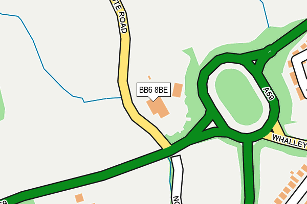
BB6 8BE is located in the Brockhall & Dinckley electoral ward, within the local authority district of Ribble Valley and the English Parliamentary constituency of Ribble Valley. The Sub Integrated Care Board (ICB) Location is NHS Lancashire and South Cumbria ICB - 01A and the police force is Lancashire. This postcode has been in use since January 1980.


GetTheData
Source: OS OpenMap – Local (Ordnance Survey)
Source: OS VectorMap District (Ordnance Survey)
Licence: Open Government Licence (requires attribution)
| Easting | 370624 |
| Northing | 434874 |
| Latitude | 53.809319 |
| Longitude | -2.447583 |
GetTheData
Source: Open Postcode Geo
Licence: Open Government Licence
| Country | England |
| Postcode District | BB6 |
| ➜ BB6 open data dashboard ➜ See where BB6 is on a map ➜ Where is Langho? | |
GetTheData
Source: Land Registry Price Paid Data
Licence: Open Government Licence
Elevation or altitude of BB6 8BE as distance above sea level:
| Metres | Feet | |
|---|---|---|
| Elevation | 70m | 230ft |
Elevation is measured from the approximate centre of the postcode, to the nearest point on an OS contour line from OS Terrain 50, which has contour spacing of ten vertical metres.
➜ How high above sea level am I? Find the elevation of your current position using your device's GPS.
GetTheData
Source: Open Postcode Elevation
Licence: Open Government Licence
| Ward | Brockhall & Dinckley |
| Constituency | Ribble Valley |
GetTheData
Source: ONS Postcode Database
Licence: Open Government Licence
| June 2022 | Bicycle theft | On or near Whalley Road | 120m |
| May 2022 | Other theft | On or near Whalley Road | 120m |
| April 2022 | Violence and sexual offences | On or near Whalley Road | 120m |
| ➜ Get more crime data in our Crime section | |||
GetTheData
Source: data.police.uk
Licence: Open Government Licence
| Northcote Road (Whalley New Road) | Langho | 351m |
| Petre Arms (Whalley New Road) | Langho | 369m |
| Northcote Road (Whalley New Road) | Langho | 373m |
| Petre Arms (Whalley New Road) | Langho | 454m |
| Spring Mill (Whalley New Road) | Langho | 518m |
| Langho Station | 0.5km |
| Whalley Station | 2.8km |
| Ramsgreave & Wilpshire Station | 3.9km |
GetTheData
Source: NaPTAN
Licence: Open Government Licence
GetTheData
Source: ONS Postcode Database
Licence: Open Government Licence


➜ Get more ratings from the Food Standards Agency
GetTheData
Source: Food Standards Agency
Licence: FSA terms & conditions
| Last Collection | |||
|---|---|---|---|
| Location | Mon-Fri | Sat | Distance |
| Station Whalley | 16:15 | 12:30 | 2,817m |
| Hurst Green Post Office | 16:00 | 11:30 | 3,681m |
| Park Lane | 16:30 | 11:15 | 3,742m |
GetTheData
Source: Dracos
Licence: Creative Commons Attribution-ShareAlike
| Facility | Distance |
|---|---|
| Northcote Lane Northcote Road, Langho Grass Pitches | 213m |
| Mytton Fold Golf Club Whalley Road, Langho, Blackburn Golf | 523m |
| St Marys Rc Primary School Langho Whalley Road, Langho, Blackburn Grass Pitches | 839m |
GetTheData
Source: Active Places
Licence: Open Government Licence
| School | Phase of Education | Distance |
|---|---|---|
| Langho and Billington St Leonards Church of England Primary School Whalley Road, Langho, Blackburn, BB6 8AB | Primary | 589m |
| St Mary's Roman Catholic Primary School, Langho Whalley Road, Langho, Blackburn, BB6 8EQ | Primary | 798m |
| St Augustine's Roman Catholic High School, a Voluntary Academy Elker Lane, Billington, Elker Lane, Billington, Clitheroe, BB7 9JA | Secondary | 1.5km |
GetTheData
Source: Edubase
Licence: Open Government Licence
The below table lists the International Territorial Level (ITL) codes (formerly Nomenclature of Territorial Units for Statistics (NUTS) codes) and Local Administrative Units (LAU) codes for BB6 8BE:
| ITL 1 Code | Name |
|---|---|
| TLD | North West (England) |
| ITL 2 Code | Name |
| TLD4 | Lancashire |
| ITL 3 Code | Name |
| TLD45 | Mid Lancashire |
| LAU 1 Code | Name |
| E07000124 | Ribble Valley |
GetTheData
Source: ONS Postcode Directory
Licence: Open Government Licence
The below table lists the Census Output Area (OA), Lower Layer Super Output Area (LSOA), and Middle Layer Super Output Area (MSOA) for BB6 8BE:
| Code | Name | |
|---|---|---|
| OA | E00128575 | |
| LSOA | E01025333 | Ribble Valley 007C |
| MSOA | E02005276 | Ribble Valley 007 |
GetTheData
Source: ONS Postcode Directory
Licence: Open Government Licence
| BB6 8FE | Petre Wood Close | 291m |
| BB6 8BG | Northcote Road | 319m |
| BB6 8AA | Whalley Road | 363m |
| BB6 8FD | Petre Wood Crescent | 369m |
| BB6 8BY | Whalley Road | 464m |
| BB6 8ED | Olive Bank | 505m |
| BB6 8EA | Station View | 512m |
| BB6 8DD | Whalley Road | 527m |
| BB6 8DB | Taylor Buildings | 531m |
| BB6 8DA | Jubilee Terrace | 555m |
GetTheData
Source: Open Postcode Geo; Land Registry Price Paid Data
Licence: Open Government Licence