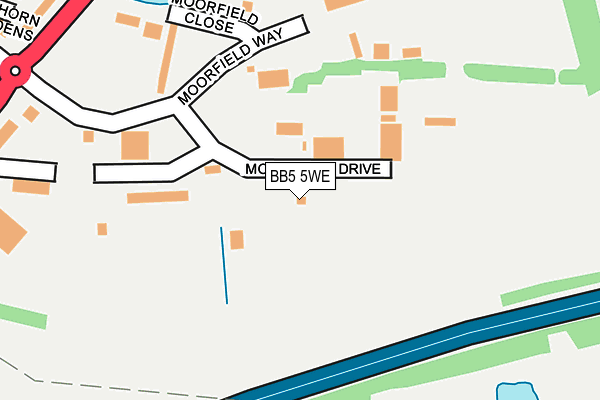
BB5 5WE is located in the Altham electoral ward, within the local authority district of Hyndburn and the English Parliamentary constituency of Hyndburn. The Sub Integrated Care Board (ICB) Location is NHS Lancashire and South Cumbria ICB - 01A and the police force is Lancashire. This postcode has been in use since December 1995.


GetTheData
Source: OS OpenMap – Local (Ordnance Survey)
Source: OS VectorMap District (Ordnance Survey)
Licence: Open Government Licence (requires attribution)
| Easting | 375908 |
| Northing | 431172 |
| Latitude | 53.776334 |
| Longitude | -2.367052 |
GetTheData
Source: Open Postcode Geo
Licence: Open Government Licence
| Country | England |
| Postcode District | BB5 |
| ➜ BB5 open data dashboard ➜ See where BB5 is on a map ➜ Where is Clayton-le-Moors? | |
GetTheData
Source: Land Registry Price Paid Data
Licence: Open Government Licence
Elevation or altitude of BB5 5WE as distance above sea level:
| Metres | Feet | |
|---|---|---|
| Elevation | 140m | 459ft |
Elevation is measured from the approximate centre of the postcode, to the nearest point on an OS contour line from OS Terrain 50, which has contour spacing of ten vertical metres.
➜ How high above sea level am I? Find the elevation of your current position using your device's GPS.
GetTheData
Source: Open Postcode Elevation
Licence: Open Government Licence
| Ward | Altham |
| Constituency | Hyndburn |
GetTheData
Source: ONS Postcode Database
Licence: Open Government Licence
| June 2022 | Vehicle crime | On or near Moorfield Drive | 113m |
| June 2022 | Anti-social behaviour | On or near Canal Way | 301m |
| April 2022 | Vehicle crime | On or near Moorfield Drive | 113m |
| ➜ Get more crime data in our Crime section | |||
GetTheData
Source: data.police.uk
Licence: Open Government Licence
| St Marys Burial Ground (Burnley Road) | Altham | 336m |
| St Marys Burial Ground (Burnley Road) | Altham | 358m |
| Higher Firs Drive (Burnley Road) | Altham | 415m |
| Higher Firs Drive (Burnley Road) | Altham | 416m |
| Hawthorn Bank (Burnley Road) | Altham | 549m |
| Huncoat Station | 1.4km |
| Accrington Station | 2.6km |
| Church & Oswaldtwistle Station | 3.3km |
GetTheData
Source: NaPTAN
Licence: Open Government Licence
GetTheData
Source: ONS Postcode Database
Licence: Open Government Licence


➜ Get more ratings from the Food Standards Agency
GetTheData
Source: Food Standards Agency
Licence: FSA terms & conditions
| Last Collection | |||
|---|---|---|---|
| Location | Mon-Fri | Sat | Distance |
| 216 Willows Lane | 17:00 | 12:45 | 420m |
| Clayton Le Moors Post Office | 16:45 | 12:15 | 958m |
| Harwood Bar | 16:30 | 11:15 | 2,049m |
GetTheData
Source: Dracos
Licence: Creative Commons Attribution-ShareAlike
| Facility | Distance |
|---|---|
| Whinney Hill Football Club Burnley Road, Altham, Accrington Grass Pitches | 648m |
| Mount Pleasant Primary School (Clayton Le Moors) Earl Street, Clayton Le Moors, Accrington Grass Pitches | 990m |
| Wilson Playing Fields Track Clayton Hall Drive, Clayton-le-moors Athletics, Grass Pitches | 1.1km |
GetTheData
Source: Active Places
Licence: Open Government Licence
| School | Phase of Education | Distance |
|---|---|---|
| St Mary's Roman Catholic Primary School, Clayton-le-Moors Devonshire Drive, Clayton-le-Moors, Accrington, BB5 5RJ | Primary | 842m |
| Clayton-le-Moors Mount Pleasant Primary School Earl Street, Clayton-le-Moors, Accrington, BB5 5NH | Primary | 1.1km |
| Clayton-le-Moors All Saints' Church of England Primary School Church Street, Clayton-le-Moors, Accrington, BB5 5HT | Primary | 1.5km |
GetTheData
Source: Edubase
Licence: Open Government Licence
The below table lists the International Territorial Level (ITL) codes (formerly Nomenclature of Territorial Units for Statistics (NUTS) codes) and Local Administrative Units (LAU) codes for BB5 5WE:
| ITL 1 Code | Name |
|---|---|
| TLD | North West (England) |
| ITL 2 Code | Name |
| TLD4 | Lancashire |
| ITL 3 Code | Name |
| TLD46 | East Lancashire |
| LAU 1 Code | Name |
| E07000120 | Hyndburn |
GetTheData
Source: ONS Postcode Directory
Licence: Open Government Licence
The below table lists the Census Output Area (OA), Lower Layer Super Output Area (LSOA), and Middle Layer Super Output Area (MSOA) for BB5 5WE:
| Code | Name | |
|---|---|---|
| OA | E00127062 | |
| LSOA | E01025033 | Hyndburn 002B |
| MSOA | E02005213 | Hyndburn 002 |
GetTheData
Source: ONS Postcode Directory
Licence: Open Government Licence
| BB5 5TX | Burnley Road | 241m |
| BB5 5TZ | Burnley Road | 345m |
| BB5 5WL | Hawthorn Gardens | 428m |
| BB5 5WP | Henfield Close | 467m |
| BB5 5UY | Pendle View | 494m |
| BB5 5WS | Sefton Close | 528m |
| BB5 5WQ | Martholme Avenue | 531m |
| BB5 5WN | Rosebank | 531m |
| BB5 5TS | Burnley Road | 590m |
| BB5 5XJ | Higher Firs Drive | 608m |
GetTheData
Source: Open Postcode Geo; Land Registry Price Paid Data
Licence: Open Government Licence