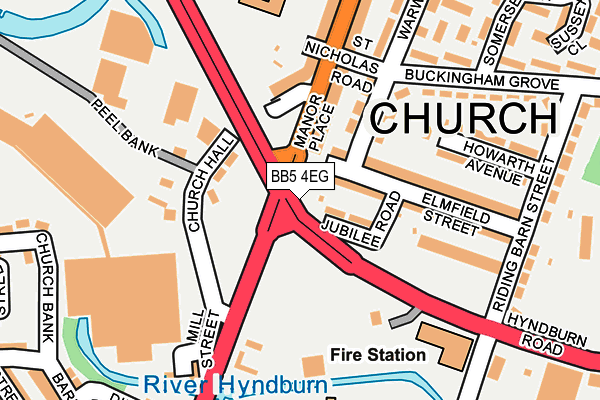
BB5 4EG is located in the Church electoral ward, within the local authority district of Hyndburn and the English Parliamentary constituency of Hyndburn. The Sub Integrated Care Board (ICB) Location is NHS Lancashire and South Cumbria ICB - 01A and the police force is Lancashire. This postcode has been in use since March 2016.


GetTheData
Source: OS OpenMap – Local (Ordnance Survey)
Source: OS VectorMap District (Ordnance Survey)
Licence: Open Government Licence (requires attribution)
| Easting | 374711 |
| Northing | 429066 |
| Latitude | 53.757334 |
| Longitude | -2.385041 |
GetTheData
Source: Open Postcode Geo
Licence: Open Government Licence
| Country | England |
| Postcode District | BB5 |
| ➜ BB5 open data dashboard ➜ See where BB5 is on a map | |
GetTheData
Source: Land Registry Price Paid Data
Licence: Open Government Licence
Elevation or altitude of BB5 4EG as distance above sea level:
| Metres | Feet | |
|---|---|---|
| Elevation | 120m | 394ft |
Elevation is measured from the approximate centre of the postcode, to the nearest point on an OS contour line from OS Terrain 50, which has contour spacing of ten vertical metres.
➜ How high above sea level am I? Find the elevation of your current position using your device's GPS.
GetTheData
Source: Open Postcode Elevation
Licence: Open Government Licence
| Ward | Church |
| Constituency | Hyndburn |
GetTheData
Source: ONS Postcode Database
Licence: Open Government Licence
| January 2024 | Anti-social behaviour | On or near Edward Street | 476m |
| December 2023 | Other theft | On or near Barrington Court | 244m |
| December 2023 | Violence and sexual offences | On or near Barrington Court | 244m |
| ➜ Get more crime data in our Crime section | |||
GetTheData
Source: data.police.uk
Licence: Open Government Licence
| Hyndburn Road (Dill Hall Lane) | Peel Bank | 79m |
| St Nicholas Road (Dill Hall Lane) | Peel Bank | 205m |
| Sports Centre (Henry Street) | Church | 220m |
| Elmfield Street (Riding Barn Street) | Peel Bank | 234m |
| Buckingham Grove | Peel Bank | 270m |
| Church & Oswaldtwistle Station | 0.9km |
| Accrington Station | 1.1km |
| Rishton Station | 2.4km |
GetTheData
Source: NaPTAN
Licence: Open Government Licence
GetTheData
Source: ONS Postcode Database
Licence: Open Government Licence


➜ Get more ratings from the Food Standards Agency
GetTheData
Source: Food Standards Agency
Licence: FSA terms & conditions
| Last Collection | |||
|---|---|---|---|
| Location | Mon-Fri | Sat | Distance |
| West End Post Office | 17:00 | 11:45 | 1,593m |
| Oswaldtwistle P.o. | 16:30 | 12:00 | 1,773m |
| Thwaites Road | 16:00 | 11:00 | 1,784m |
GetTheData
Source: Dracos
Licence: Creative Commons Attribution-ShareAlike
| Facility | Distance |
|---|---|
| St Nicholas Church Of England Primary School St. Nicholas Road, Church, Accrington Grass Pitches | 227m |
| Hyndburn Leisure Centre Henry Street, Church, Accrington Sports Hall, Swimming Pool, Health and Fitness Gym, Artificial Grass Pitch, Studio, Squash Courts | 262m |
| Sacred Heart Roman Catholic Primary School Bradshaw Row, Church, Accrington Grass Pitches | 428m |
GetTheData
Source: Active Places
Licence: Open Government Licence
| School | Phase of Education | Distance |
|---|---|---|
| St Nicholas Church of England Primary School St Nicholas Road, Church, Accrington, BB5 4DN | Primary | 230m |
| Sacred Heart Roman Catholic Primary School, Church Bradshaw Row, Church, Accrington, BB5 4HG | Primary | 428m |
| Accrington Hyndburn Park Primary School Park Road, Accrington, BB5 1ST | Primary | 487m |
GetTheData
Source: Edubase
Licence: Open Government Licence
The below table lists the International Territorial Level (ITL) codes (formerly Nomenclature of Territorial Units for Statistics (NUTS) codes) and Local Administrative Units (LAU) codes for BB5 4EG:
| ITL 1 Code | Name |
|---|---|
| TLD | North West (England) |
| ITL 2 Code | Name |
| TLD4 | Lancashire |
| ITL 3 Code | Name |
| TLD46 | East Lancashire |
| LAU 1 Code | Name |
| E07000120 | Hyndburn |
GetTheData
Source: ONS Postcode Directory
Licence: Open Government Licence
The below table lists the Census Output Area (OA), Lower Layer Super Output Area (LSOA), and Middle Layer Super Output Area (MSOA) for BB5 4EG:
| Code | Name | |
|---|---|---|
| OA | E00127123 | |
| LSOA | E01025044 | Hyndburn 005A |
| MSOA | E02005216 | Hyndburn 005 |
GetTheData
Source: ONS Postcode Directory
Licence: Open Government Licence
| BB5 4DY | Jubilee Road | 53m |
| BB5 4EB | Church Hall | 82m |
| BB5 4DX | Manor Place | 86m |
| BB5 4DZ | Elmfield Street | 118m |
| BB5 4EA | Elmfield Street | 136m |
| BB5 4DT | Dill Hall Lane | 194m |
| BB5 4AF | Howarth Avenue | 197m |
| BB5 4EJ | Mill Street | 199m |
| BB5 4DU | Dill Hall Lane | 207m |
| BB5 4AA | Hyndburn Road | 214m |
GetTheData
Source: Open Postcode Geo; Land Registry Price Paid Data
Licence: Open Government Licence