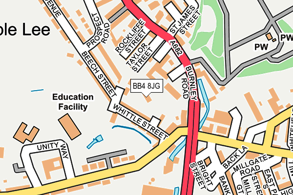
BB4 8JG is located in the Cribden electoral ward, within the local authority district of Rossendale and the English Parliamentary constituency of Rossendale and Darwen. The Sub Integrated Care Board (ICB) Location is NHS Lancashire and South Cumbria ICB - 01A and the police force is Lancashire. This postcode has been in use since September 2002.


GetTheData
Source: OS OpenMap – Local (Ordnance Survey)
Source: OS VectorMap District (Ordnance Survey)
Licence: Open Government Licence (requires attribution)
| Easting | 381135 |
| Northing | 423231 |
| Latitude | 53.705163 |
| Longitude | -2.287251 |
GetTheData
Source: Open Postcode Geo
Licence: Open Government Licence
| Country | England |
| Postcode District | BB4 |
| ➜ BB4 open data dashboard ➜ See where BB4 is on a map ➜ Where is Rawtenstall? | |
GetTheData
Source: Land Registry Price Paid Data
Licence: Open Government Licence
Elevation or altitude of BB4 8JG as distance above sea level:
| Metres | Feet | |
|---|---|---|
| Elevation | 180m | 591ft |
Elevation is measured from the approximate centre of the postcode, to the nearest point on an OS contour line from OS Terrain 50, which has contour spacing of ten vertical metres.
➜ How high above sea level am I? Find the elevation of your current position using your device's GPS.
GetTheData
Source: Open Postcode Elevation
Licence: Open Government Licence
| Ward | Cribden |
| Constituency | Rossendale And Darwen |
GetTheData
Source: ONS Postcode Database
Licence: Open Government Licence
| December 2023 | Criminal damage and arson | On or near Schofield Close | 353m |
| August 2023 | Other theft | On or near Schofield Close | 353m |
| August 2023 | Anti-social behaviour | On or near Schofield Close | 353m |
| ➜ Get more crime data in our Crime section | |||
GetTheData
Source: data.police.uk
Licence: Open Government Licence
| Learn Direct (Burnley Road) | Rawtenstall | 85m |
| Rockcliffe Street (Burnley Road) | Rawtenstall | 157m |
| Holland Avenue | Rawtenstall | 194m |
| Bank St (Bank Street) | Rawtenstall | 197m |
| Bank Street | Rawtenstall | 198m |
| Rawtenstall (East Lancashire Railway) | Longholme | 769m |
GetTheData
Source: NaPTAN
Licence: Open Government Licence
| Percentage of properties with Next Generation Access | 100.0% |
| Percentage of properties with Superfast Broadband | 100.0% |
| Percentage of properties with Ultrafast Broadband | 0.0% |
| Percentage of properties with Full Fibre Broadband | 0.0% |
Superfast Broadband is between 30Mbps and 300Mbps
Ultrafast Broadband is > 300Mbps
| Percentage of properties unable to receive 2Mbps | 0.0% |
| Percentage of properties unable to receive 5Mbps | 0.0% |
| Percentage of properties unable to receive 10Mbps | 0.0% |
| Percentage of properties unable to receive 30Mbps | 0.0% |
GetTheData
Source: Ofcom
Licence: Ofcom Terms of Use (requires attribution)
GetTheData
Source: ONS Postcode Database
Licence: Open Government Licence


➜ Get more ratings from the Food Standards Agency
GetTheData
Source: Food Standards Agency
Licence: FSA terms & conditions
| Last Collection | |||
|---|---|---|---|
| Location | Mon-Fri | Sat | Distance |
| Rossendale Delivery Office | 17:45 | 13:00 | 417m |
| Railway Station | 16:45 | 12:30 | 714m |
| Helmshore Post Office | 16:45 | 11:45 | 1,337m |
GetTheData
Source: Dracos
Licence: Creative Commons Attribution-ShareAlike
| Facility | Distance |
|---|---|
| St Marys School Haslingden Old Road, Rossendale Grass Pitches | 172m |
| Kay Street Baptist Church Kay Street, Rossendale Sports Hall | 421m |
| Alder Grange School Calder Road, Rossendale Sports Hall, Health and Fitness Gym, Grass Pitches, Artificial Grass Pitch | 452m |
GetTheData
Source: Active Places
Licence: Open Government Licence
| School | Phase of Education | Distance |
|---|---|---|
| St Mary's CofE Primary School Rawtenstall Haslingden Old Road, Rawtenstall, St. Marys C of E School, ROSSENDALE, BB4 8RZ | Primary | 172m |
| St James-the-Less Roman Catholic Primary School, Rawtenstall Unity Way, Rawtenstall, Rossendale, BB4 8SU | Primary | 272m |
| Rawtenstall St Paul's Church of England Primary School Calder Road, Rawtenstall, BB4 8HW | Primary | 382m |
GetTheData
Source: Edubase
Licence: Open Government Licence
The below table lists the International Territorial Level (ITL) codes (formerly Nomenclature of Territorial Units for Statistics (NUTS) codes) and Local Administrative Units (LAU) codes for BB4 8JG:
| ITL 1 Code | Name |
|---|---|
| TLD | North West (England) |
| ITL 2 Code | Name |
| TLD4 | Lancashire |
| ITL 3 Code | Name |
| TLD46 | East Lancashire |
| LAU 1 Code | Name |
| E07000125 | Rossendale |
GetTheData
Source: ONS Postcode Directory
Licence: Open Government Licence
The below table lists the Census Output Area (OA), Lower Layer Super Output Area (LSOA), and Middle Layer Super Output Area (MSOA) for BB4 8JG:
| Code | Name | |
|---|---|---|
| OA | E00128688 | |
| LSOA | E01025356 | Rossendale 004A |
| MSOA | E02005281 | Rossendale 004 |
GetTheData
Source: ONS Postcode Directory
Licence: Open Government Licence
| BB4 8SB | Whittle Street | 38m |
| BB4 8SD | Curtis Street | 56m |
| BB4 8JW | Greenfield Street | 69m |
| BB4 8SE | Gladstone Buildings | 81m |
| BB4 8HB | Taylor Street | 92m |
| BB4 8HD | Rockliffe Street | 103m |
| BB4 8JP | Prospect Hill | 108m |
| BB4 8JL | Beech Street | 110m |
| BB4 8EW | Burnley Road | 124m |
| BB4 8EY | Lark Hill | 155m |
GetTheData
Source: Open Postcode Geo; Land Registry Price Paid Data
Licence: Open Government Licence