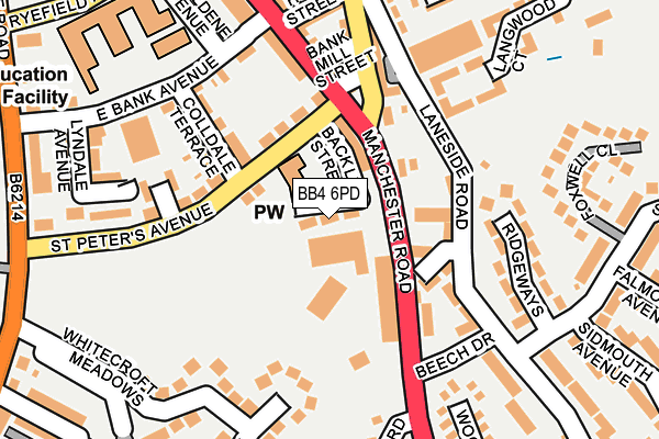
BB4 6PD lies on Hall Street in Haslingden, Rossendale. BB4 6PD is located in the Greenfield electoral ward, within the local authority district of Rossendale and the English Parliamentary constituency of Hyndburn. The Sub Integrated Care Board (ICB) Location is NHS Lancashire and South Cumbria ICB - 01A and the police force is Lancashire. This postcode has been in use since January 1980.


GetTheData
Source: OS OpenMap – Local (Ordnance Survey)
Source: OS VectorMap District (Ordnance Survey)
Licence: Open Government Licence (requires attribution)
| Easting | 378904 |
| Northing | 422709 |
| Latitude | 53.700385 |
| Longitude | -2.321011 |
GetTheData
Source: Open Postcode Geo
Licence: Open Government Licence
| Street | Hall Street |
| Locality | Haslingden |
| Town/City | Rossendale |
| Country | England |
| Postcode District | BB4 |
| ➜ BB4 open data dashboard ➜ See where BB4 is on a map ➜ Where is Haslingden? | |
GetTheData
Source: Land Registry Price Paid Data
Licence: Open Government Licence
Elevation or altitude of BB4 6PD as distance above sea level:
| Metres | Feet | |
|---|---|---|
| Elevation | 230m | 755ft |
Elevation is measured from the approximate centre of the postcode, to the nearest point on an OS contour line from OS Terrain 50, which has contour spacing of ten vertical metres.
➜ How high above sea level am I? Find the elevation of your current position using your device's GPS.
GetTheData
Source: Open Postcode Elevation
Licence: Open Government Licence
| Ward | Greenfield |
| Constituency | Hyndburn |
GetTheData
Source: ONS Postcode Database
Licence: Open Government Licence
| June 2022 | Vehicle crime | On or near Hall Street | 18m |
| June 2022 | Vehicle crime | On or near Hall Street | 18m |
| June 2022 | Criminal damage and arson | On or near Bank Mill Street | 151m |
| ➜ Hall Street crime map and outcomes | |||
GetTheData
Source: data.police.uk
Licence: Open Government Licence
| Bender Factory (Manchester Road) | Haslingden | 64m |
| Hope Street (Manchester Road) | Haslingden | 129m |
| Bender Factory (Manchester Road) | Haslingden | 139m |
| Hope Street (Manchester Road) | Haslingden | 222m |
| East Bank Ave (Helmshore Road) | Haslingden | 287m |
GetTheData
Source: NaPTAN
Licence: Open Government Licence
| Percentage of properties with Next Generation Access | 100.0% |
| Percentage of properties with Superfast Broadband | 100.0% |
| Percentage of properties with Ultrafast Broadband | 0.0% |
| Percentage of properties with Full Fibre Broadband | 0.0% |
Superfast Broadband is between 30Mbps and 300Mbps
Ultrafast Broadband is > 300Mbps
| Percentage of properties unable to receive 2Mbps | 0.0% |
| Percentage of properties unable to receive 5Mbps | 0.0% |
| Percentage of properties unable to receive 10Mbps | 0.0% |
| Percentage of properties unable to receive 30Mbps | 0.0% |
GetTheData
Source: Ofcom
Licence: Ofcom Terms of Use (requires attribution)
GetTheData
Source: ONS Postcode Database
Licence: Open Government Licence


➜ Get more ratings from the Food Standards Agency
GetTheData
Source: Food Standards Agency
Licence: FSA terms & conditions
| Last Collection | |||
|---|---|---|---|
| Location | Mon-Fri | Sat | Distance |
| Sidmouth Avenue | 17:30 | 12:15 | 367m |
| Haslingden Post Office | 17:15 | 12:00 | 563m |
| Railway Station | 16:45 | 12:30 | 2,054m |
GetTheData
Source: Dracos
Licence: Creative Commons Attribution-ShareAlike
| Facility | Distance |
|---|---|
| St Peters Playing Field St. Peters Avenue, Haslingden, Rossendale Grass Pitches | 99m |
| Haslingden Pool (Closed) East Bank Avenue, Haslingden, Rossendale Swimming Pool | 193m |
| St Mary's Roman Catholic Primary School - Haslingden Lime Road, Haslingden, Rossendale Grass Pitches | 440m |
GetTheData
Source: Active Places
Licence: Open Government Licence
| School | Phase of Education | Distance |
|---|---|---|
| Haslingden Primary School Ryefield Avenue, Haslingden, Rossendale, BB4 4BJ | Primary | 274m |
| St Mary's Roman Catholic Primary School, Haslingden Lime Road, Haslingden, Rossendale, BB4 5NP | Primary | 498m |
| Hillside Nursery School Cedar Avenue, Haslingden, Rossendale, BB4 5NH | Nursery | 584m |
GetTheData
Source: Edubase
Licence: Open Government Licence
The below table lists the International Territorial Level (ITL) codes (formerly Nomenclature of Territorial Units for Statistics (NUTS) codes) and Local Administrative Units (LAU) codes for BB4 6PD:
| ITL 1 Code | Name |
|---|---|
| TLD | North West (England) |
| ITL 2 Code | Name |
| TLD4 | Lancashire |
| ITL 3 Code | Name |
| TLD46 | East Lancashire |
| LAU 1 Code | Name |
| E07000125 | Rossendale |
GetTheData
Source: ONS Postcode Directory
Licence: Open Government Licence
The below table lists the Census Output Area (OA), Lower Layer Super Output Area (LSOA), and Middle Layer Super Output Area (MSOA) for BB4 6PD:
| Code | Name | |
|---|---|---|
| OA | E00128738 | |
| LSOA | E01025364 | Rossendale 002B |
| MSOA | E02005279 | Rossendale 002 |
GetTheData
Source: ONS Postcode Directory
Licence: Open Government Licence
| BB4 6PA | Back Lee Street | 67m |
| BB4 6NZ | St Peters Avenue | 94m |
| BB4 6TD | Sizehouse Village | 108m |
| BB4 6NY | Colldale Terrace | 120m |
| BB4 5PR | Northcote Street | 129m |
| BB4 6NT | Manchester Road | 133m |
| BB4 6PB | Bank Mill Street | 145m |
| BB4 4BS | St Peters Avenue | 160m |
| BB4 4BT | St Peters Place | 170m |
| BB4 6NX | East Bank Avenue | 177m |
GetTheData
Source: Open Postcode Geo; Land Registry Price Paid Data
Licence: Open Government Licence