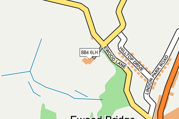
BB4 6LH is located in the Greenfield electoral ward, within the local authority district of Rossendale and the English Parliamentary constituency of Hyndburn. The Sub Integrated Care Board (ICB) Location is NHS Lancashire and South Cumbria ICB - 01A and the police force is Lancashire. This postcode has been in use since January 1980.


GetTheData
Source: OS OpenMap – Local (Ordnance Survey)
Source: OS VectorMap District (Ordnance Survey)
Licence: Open Government Licence (requires attribution)
| Easting | 379270 |
| Northing | 421176 |
| Latitude | 53.686621 |
| Longitude | -2.315364 |
GetTheData
Source: Open Postcode Geo
Licence: Open Government Licence
| Country | England |
| Postcode District | BB4 |
| ➜ BB4 open data dashboard ➜ See where BB4 is on a map ➜ Where is Ewood Bridge? | |
GetTheData
Source: Land Registry Price Paid Data
Licence: Open Government Licence
Elevation or altitude of BB4 6LH as distance above sea level:
| Metres | Feet | |
|---|---|---|
| Elevation | 190m | 623ft |
Elevation is measured from the approximate centre of the postcode, to the nearest point on an OS contour line from OS Terrain 50, which has contour spacing of ten vertical metres.
➜ How high above sea level am I? Find the elevation of your current position using your device's GPS.
GetTheData
Source: Open Postcode Elevation
Licence: Open Government Licence
| Ward | Greenfield |
| Constituency | Hyndburn |
GetTheData
Source: ONS Postcode Database
Licence: Open Government Licence
| June 2022 | Burglary | On or near Hilltop Drive | 140m |
| June 2022 | Violence and sexual offences | On or near Manchester Road | 446m |
| May 2022 | Vehicle crime | On or near Lindon Park Road | 234m |
| ➜ Get more crime data in our Crime section | |||
GetTheData
Source: data.police.uk
Licence: Open Government Licence
| Old Sch House (Manchester Road) | Ewood Bridge | 278m |
| Old Sch House (Manchester Road) | Ewood Bridge | 290m |
| Manchester Rd (Manchester Road) | Ewood Bridge | 430m |
| Haslingden High School (Greens Lane) | Broadway | 443m |
| Manchester Rd (Manchester Road) | Ewood Bridge | 453m |
GetTheData
Source: NaPTAN
Licence: Open Government Licence
GetTheData
Source: ONS Postcode Database
Licence: Open Government Licence


➜ Get more ratings from the Food Standards Agency
GetTheData
Source: Food Standards Agency
Licence: FSA terms & conditions
| Last Collection | |||
|---|---|---|---|
| Location | Mon-Fri | Sat | Distance |
| Sidmouth Avenue | 17:30 | 12:15 | 1,354m |
| Haslingden Post Office | 17:15 | 12:00 | 2,113m |
| Railway Station | 16:45 | 12:30 | 2,165m |
GetTheData
Source: Dracos
Licence: Creative Commons Attribution-ShareAlike
| Facility | Distance |
|---|---|
| Rossendale Golf Club Ltd Ewood Lane, Haslingden, Rossendale Golf | 0m |
| Haslingden High School Broadway, Haslingden, Rossendale Artificial Grass Pitch, Grass Pitches, Sports Hall, Studio | 450m |
| Ewood Bridge (Stand Athletic Fc) (Closed) Ashen Bottom, Rossendale Grass Pitches | 486m |
GetTheData
Source: Active Places
Licence: Open Government Licence
| School | Phase of Education | Distance |
|---|---|---|
| Haslingden High School and Sixth Form Broadway, Haslingden, Rossendale, BB4 4EY | Secondary | 450m |
| Valley College Clod Lane, Haslingden, Rossendale, BB4 6LR | Not applicable | 469m |
| Tor View School Clod Lane, Haslingden, Rossendale, BB4 6LR | Not applicable | 528m |
GetTheData
Source: Edubase
Licence: Open Government Licence
The below table lists the International Territorial Level (ITL) codes (formerly Nomenclature of Territorial Units for Statistics (NUTS) codes) and Local Administrative Units (LAU) codes for BB4 6LH:
| ITL 1 Code | Name |
|---|---|
| TLD | North West (England) |
| ITL 2 Code | Name |
| TLD4 | Lancashire |
| ITL 3 Code | Name |
| TLD46 | East Lancashire |
| LAU 1 Code | Name |
| E07000125 | Rossendale |
GetTheData
Source: ONS Postcode Directory
Licence: Open Government Licence
The below table lists the Census Output Area (OA), Lower Layer Super Output Area (LSOA), and Middle Layer Super Output Area (MSOA) for BB4 6LH:
| Code | Name | |
|---|---|---|
| OA | E00128745 | |
| LSOA | E01025365 | Rossendale 008C |
| MSOA | E02005285 | Rossendale 008 |
GetTheData
Source: ONS Postcode Directory
Licence: Open Government Licence
| BB4 6NB | Hilltop Drive | 146m |
| BB4 6LZ | Lindon Park Road | 241m |
| BB4 6LB | Manchester Road | 296m |
| BB4 6LQ | Bridge Street | 311m |
| BB4 6LE | Parkinson Fold | 389m |
| BB4 6LL | Manchester Road | 401m |
| BB4 4EF | Rydal Road | 422m |
| BB4 6LF | Irwell Vale Road | 473m |
| BB4 4EE | Rydal Road | 485m |
| BB4 6LU | Thirlmere Avenue | 500m |
GetTheData
Source: Open Postcode Geo; Land Registry Price Paid Data
Licence: Open Government Licence