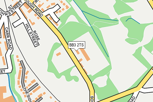
BB3 2TS is located in the Darwen South electoral ward, within the unitary authority of Blackburn with Darwen and the English Parliamentary constituency of Rossendale and Darwen. The Sub Integrated Care Board (ICB) Location is NHS Lancashire and South Cumbria ICB - 00Q and the police force is Lancashire. This postcode has been in use since January 1980.


GetTheData
Source: OS OpenMap – Local (Ordnance Survey)
Source: OS VectorMap District (Ordnance Survey)
Licence: Open Government Licence (requires attribution)
| Easting | 369982 |
| Northing | 421447 |
| Latitude | 53.688604 |
| Longitude | -2.456023 |
GetTheData
Source: Open Postcode Geo
Licence: Open Government Licence
| Country | England |
| Postcode District | BB3 |
| ➜ BB3 open data dashboard ➜ See where BB3 is on a map ➜ Where is Darwen? | |
GetTheData
Source: Land Registry Price Paid Data
Licence: Open Government Licence
Elevation or altitude of BB3 2TS as distance above sea level:
| Metres | Feet | |
|---|---|---|
| Elevation | 200m | 656ft |
Elevation is measured from the approximate centre of the postcode, to the nearest point on an OS contour line from OS Terrain 50, which has contour spacing of ten vertical metres.
➜ How high above sea level am I? Find the elevation of your current position using your device's GPS.
GetTheData
Source: Open Postcode Elevation
Licence: Open Government Licence
| Ward | Darwen South |
| Constituency | Rossendale And Darwen |
GetTheData
Source: ONS Postcode Database
Licence: Open Government Licence
| September 2022 | Burglary | On or near Vicarage Drive | 460m |
| June 2022 | Violence and sexual offences | On or near Carr Road | 270m |
| June 2022 | Burglary | On or near Grimshaw Street | 298m |
| ➜ Get more crime data in our Crime section | |||
GetTheData
Source: data.police.uk
Licence: Open Government Licence
| Sough Road | Darwen | 51m |
| Sough Road | Darwen | 65m |
| Grimshaw Street (Sough Road) | Darwen | 182m |
| Grimshaw Street (Sough Road) | Darwen | 190m |
| Pole Lane | Darwen | 218m |
| Darwen Station | 1.2km |
| Entwistle Station | 4.5km |
| Cherry Tree Station | 6.4km |
GetTheData
Source: NaPTAN
Licence: Open Government Licence
GetTheData
Source: ONS Postcode Database
Licence: Open Government Licence


➜ Get more ratings from the Food Standards Agency
GetTheData
Source: Food Standards Agency
Licence: FSA terms & conditions
| Last Collection | |||
|---|---|---|---|
| Location | Mon-Fri | Sat | Distance |
| 68 Birch Hall Avenue | 16:30 | 11:00 | 963m |
| Royal Arms | 12:00 | 09:00 | 3,482m |
| Entwistle Station | 16:45 | 11:35 | 4,571m |
GetTheData
Source: Dracos
Licence: Creative Commons Attribution-ShareAlike
| Facility | Distance |
|---|---|
| Urban Elite Fitness (Closed) Bolton Road, Britannia Mill, Darwen Health and Fitness Gym | 754m |
| Darwen Aldridge Community Academy Sudell Road, Darwen Sports Hall, Studio, Artificial Grass Pitch, Health and Fitness Gym | 813m |
| Sudell Primary School Ellison Fold Terrace, Darwen Grass Pitches | 842m |
GetTheData
Source: Active Places
Licence: Open Government Licence
| School | Phase of Education | Distance |
|---|---|---|
| Darwen St Peter's Church of England Primary School Turncroft Road, BB3 2BW, DARWEN, BB3 2BW | Primary | 331m |
| Turncroft Nursery School Highfield Road, Darwen, BB3 2DN | Nursery | 552m |
| Darwen Aldridge Community Academy Sudell Road, Darwen, BB3 3HD | Secondary | 764m |
GetTheData
Source: Edubase
Licence: Open Government Licence
The below table lists the International Territorial Level (ITL) codes (formerly Nomenclature of Territorial Units for Statistics (NUTS) codes) and Local Administrative Units (LAU) codes for BB3 2TS:
| ITL 1 Code | Name |
|---|---|
| TLD | North West (England) |
| ITL 2 Code | Name |
| TLD4 | Lancashire |
| ITL 3 Code | Name |
| TLD41 | Blackburn with Darwen |
| LAU 1 Code | Name |
| E06000008 | Blackburn with Darwen |
GetTheData
Source: ONS Postcode Directory
Licence: Open Government Licence
The below table lists the Census Output Area (OA), Lower Layer Super Output Area (LSOA), and Middle Layer Super Output Area (MSOA) for BB3 2TS:
| Code | Name | |
|---|---|---|
| OA | E00063600 | |
| LSOA | E01012616 | Blackburn with Darwen 017C |
| MSOA | E02002631 | Blackburn with Darwen 017 |
GetTheData
Source: ONS Postcode Directory
Licence: Open Government Licence
| BB3 2BQ | Prince Lee Meadows | 172m |
| BB3 2BP | Turncroft Road | 235m |
| BB3 2BJ | Rosehill Street | 244m |
| BB3 2BD | The Sidings | 244m |
| BB3 2HA | Sough Road | 258m |
| BB3 2BL | Rosehill Terrace | 265m |
| BB3 2BW | Turncroft Road | 274m |
| BB3 2DZ | Carr Road | 284m |
| BB3 2BH | St Johns Street | 307m |
| BB3 2BN | Sough Road | 321m |
GetTheData
Source: Open Postcode Geo; Land Registry Price Paid Data
Licence: Open Government Licence