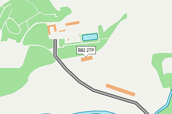
BB2 2TP is located in the Billinge & Beardwood electoral ward, within the unitary authority of Blackburn with Darwen and the English Parliamentary constituency of Blackburn. The Sub Integrated Care Board (ICB) Location is NHS Lancashire and South Cumbria ICB - 00Q and the police force is Lancashire. This postcode has been in use since January 1980.


GetTheData
Source: OS OpenMap – Local (Ordnance Survey)
Source: OS VectorMap District (Ordnance Survey)
Licence: Open Government Licence (requires attribution)
| Easting | 365917 |
| Northing | 427341 |
| Latitude | 53.741343 |
| Longitude | -2.518223 |
GetTheData
Source: Open Postcode Geo
Licence: Open Government Licence
| Country | England |
| Postcode District | BB2 |
| ➜ BB2 open data dashboard ➜ See where BB2 is on a map | |
GetTheData
Source: Land Registry Price Paid Data
Licence: Open Government Licence
Elevation or altitude of BB2 2TP as distance above sea level:
| Metres | Feet | |
|---|---|---|
| Elevation | 90m | 295ft |
Elevation is measured from the approximate centre of the postcode, to the nearest point on an OS contour line from OS Terrain 50, which has contour spacing of ten vertical metres.
➜ How high above sea level am I? Find the elevation of your current position using your device's GPS.
GetTheData
Source: Open Postcode Elevation
Licence: Open Government Licence
| Ward | Billinge & Beardwood |
| Constituency | Blackburn |
GetTheData
Source: ONS Postcode Database
Licence: Open Government Licence
| June 2022 | Anti-social behaviour | On or near Sports/Recreation Area | 380m |
| June 2022 | Violence and sexual offences | On or near Sports/Recreation Area | 380m |
| June 2022 | Anti-social behaviour | On or near Sports/Recreation Area | 380m |
| ➜ Get more crime data in our Crime section | |||
GetTheData
Source: data.police.uk
Licence: Open Government Licence
| Witton Park (Preston Old Road) | Witton | 542m |
| Witton Park (Preston Old Road) | Witton | 552m |
| Tower Road (Preston Old Road) | Cherry Tree | 556m |
| Tower Road (Preston Old Road) | Cherry Tree | 559m |
| Witton Park High School (Buncer Lane) | Wensley Fold | 640m |
| Cherry Tree Station | 0.9km |
| Mill Hill (Lancs) Station | 1.3km |
| Pleasington Station | 2.1km |
GetTheData
Source: NaPTAN
Licence: Open Government Licence
GetTheData
Source: ONS Postcode Database
Licence: Open Government Licence


➜ Get more ratings from the Food Standards Agency
GetTheData
Source: Food Standards Agency
Licence: FSA terms & conditions
| Last Collection | |||
|---|---|---|---|
| Location | Mon-Fri | Sat | Distance |
| Cherry Tree | 17:00 | 12:00 | 977m |
| Gorse Road | 17:30 | 13:00 | 1,121m |
| Mill Hill Post Office | 17:15 | 12:15 | 1,264m |
GetTheData
Source: Dracos
Licence: Creative Commons Attribution-ShareAlike
| Facility | Distance |
|---|---|
| Witton Park Arena Preston Old Road, Blackburn Athletics, Health and Fitness Gym, Studio | 308m |
| Witton Country Park Preston Old Road, Blackburn Artificial Grass Pitch, Grass Pitches | 394m |
| Witton Park Academy Buncer Lane, Blackburn Health and Fitness Gym, Sports Hall, Studio, Artificial Grass Pitch, Grass Pitches, Outdoor Tennis Courts | 493m |
GetTheData
Source: Active Places
Licence: Open Government Licence
| School | Phase of Education | Distance |
|---|---|---|
| Witton Park Academy Buncer Lane, Blackburn, BB2 6TD | Secondary | 492m |
| St Peter's Roman Catholic Primary School, Blackburn Hawkins Street, Blackburn, BB2 2RY | Primary | 884m |
| Griffin Park Primary School Cavendish Place, Blackburn, BB2 2PN | Primary | 1km |
GetTheData
Source: Edubase
Licence: Open Government Licence
The below table lists the International Territorial Level (ITL) codes (formerly Nomenclature of Territorial Units for Statistics (NUTS) codes) and Local Administrative Units (LAU) codes for BB2 2TP:
| ITL 1 Code | Name |
|---|---|
| TLD | North West (England) |
| ITL 2 Code | Name |
| TLD4 | Lancashire |
| ITL 3 Code | Name |
| TLD41 | Blackburn with Darwen |
| LAU 1 Code | Name |
| E06000008 | Blackburn with Darwen |
GetTheData
Source: ONS Postcode Directory
Licence: Open Government Licence
The below table lists the Census Output Area (OA), Lower Layer Super Output Area (LSOA), and Middle Layer Super Output Area (MSOA) for BB2 2TP:
| Code | Name | |
|---|---|---|
| OA | E00063438 | |
| LSOA | E01012584 | Blackburn with Darwen 010A |
| MSOA | E02002624 | Blackburn with Darwen 010 |
GetTheData
Source: ONS Postcode Directory
Licence: Open Government Licence
| BB2 2TR | Preston Old Road | 535m |
| BB2 5LE | Tower Road | 562m |
| BB2 2TX | Preston Old Road | 576m |
| BB2 2TA | Cartmel Road | 636m |
| BB2 2TY | Cecilia Road | 650m |
| BB2 2ST | Preston Old Road | 662m |
| BB2 2TB | Franklin Road | 666m |
| BB2 2TZ | St Francis Road | 670m |
| BB2 2SS | Preston Old Road | 684m |
| BB2 6TE | Buncer Lane | 684m |
GetTheData
Source: Open Postcode Geo; Land Registry Price Paid Data
Licence: Open Government Licence