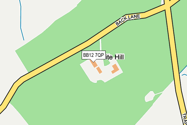
BB12 7QP lies on Back Lane in Read, Burnley. BB12 7QP is located in the East Whalley, Read & Simonstone electoral ward, within the local authority district of Ribble Valley and the English Parliamentary constituency of Ribble Valley. The Sub Integrated Care Board (ICB) Location is NHS Lancashire and South Cumbria ICB - 01A and the police force is Lancashire. This postcode has been in use since January 1980.


GetTheData
Source: OS OpenMap – Local (Ordnance Survey)
Source: OS VectorMap District (Ordnance Survey)
Licence: Open Government Licence (requires attribution)
| Easting | 377375 |
| Northing | 436182 |
| Latitude | 53.821414 |
| Longitude | -2.345162 |
GetTheData
Source: Open Postcode Geo
Licence: Open Government Licence
| Street | Back Lane |
| Locality | Read |
| Town/City | Burnley |
| Country | England |
| Postcode District | BB12 |
| ➜ BB12 open data dashboard ➜ See where BB12 is on a map | |
GetTheData
Source: Land Registry Price Paid Data
Licence: Open Government Licence
Elevation or altitude of BB12 7QP as distance above sea level:
| Metres | Feet | |
|---|---|---|
| Elevation | 230m | 755ft |
Elevation is measured from the approximate centre of the postcode, to the nearest point on an OS contour line from OS Terrain 50, which has contour spacing of ten vertical metres.
➜ How high above sea level am I? Find the elevation of your current position using your device's GPS.
GetTheData
Source: Open Postcode Elevation
Licence: Open Government Licence
| Ward | East Whalley, Read & Simonstone |
| Constituency | Ribble Valley |
GetTheData
Source: ONS Postcode Database
Licence: Open Government Licence
| Whalley Road (Watt Street) | Sabden | 1,167m |
| Watt Street (Whalley Road) | Sabden | 1,183m |
| Simonstone Road (Padiham Road) | Sabden | 1,230m |
| Thorn Street (Padiham Road) | Sabden | 1,243m |
| White Hart (Padiham Road) | Sabden | 1,339m |
| Whalley Station | 4.4km |
| Hapton Station | 4.8km |
| Rose Grove Station | 5.7km |
GetTheData
Source: NaPTAN
Licence: Open Government Licence
| Percentage of properties with Next Generation Access | 100.0% |
| Percentage of properties with Superfast Broadband | 0.0% |
| Percentage of properties with Ultrafast Broadband | 0.0% |
| Percentage of properties with Full Fibre Broadband | 0.0% |
Superfast Broadband is between 30Mbps and 300Mbps
Ultrafast Broadband is > 300Mbps
| Percentage of properties unable to receive 2Mbps | 0.0% |
| Percentage of properties unable to receive 5Mbps | 0.0% |
| Percentage of properties unable to receive 10Mbps | 0.0% |
| Percentage of properties unable to receive 30Mbps | 100.0% |
GetTheData
Source: Ofcom
Licence: Ofcom Terms of Use (requires attribution)
GetTheData
Source: ONS Postcode Database
Licence: Open Government Licence


➜ Get more ratings from the Food Standards Agency
GetTheData
Source: Food Standards Agency
Licence: FSA terms & conditions
| Last Collection | |||
|---|---|---|---|
| Location | Mon-Fri | Sat | Distance |
| Padiham Post Office | 18:00 | 11:00 | 3,027m |
| Burnley Road | 17:30 | 11:00 | 3,038m |
| Laneside | 16:00 | 10:00 | 3,151m |
GetTheData
Source: Dracos
Licence: Creative Commons Attribution-ShareAlike
| Facility | Distance |
|---|---|
| St Marys Roman Catholic Primary School Sabden Watt Street, Sabden, Clitheroe Grass Pitches | 1km |
| Nutter Barn Pitch (Sabden Fc) Pendleside Close, Sabden Grass Pitches | 1.2km |
| The Holme Whalley Road, Sabden, Clitheroe Grass Pitches | 1.3km |
GetTheData
Source: Active Places
Licence: Open Government Licence
| School | Phase of Education | Distance |
|---|---|---|
| St Mary's Roman Catholic Primary School, Sabden Watt Street, Sabden, Clitheroe, BB7 9ED | Primary | 1.1km |
| Sabden Primary School Whalley Road, Sabden, BB7 9DZ | Primary | 1.4km |
| Simonstone St Peter's Church of England Primary School School Lane, Simonstone, Burnley, BB12 7HR | Primary | 1.7km |
GetTheData
Source: Edubase
Licence: Open Government Licence
The below table lists the International Territorial Level (ITL) codes (formerly Nomenclature of Territorial Units for Statistics (NUTS) codes) and Local Administrative Units (LAU) codes for BB12 7QP:
| ITL 1 Code | Name |
|---|---|
| TLD | North West (England) |
| ITL 2 Code | Name |
| TLD4 | Lancashire |
| ITL 3 Code | Name |
| TLD45 | Mid Lancashire |
| LAU 1 Code | Name |
| E07000124 | Ribble Valley |
GetTheData
Source: ONS Postcode Directory
Licence: Open Government Licence
The below table lists the Census Output Area (OA), Lower Layer Super Output Area (LSOA), and Middle Layer Super Output Area (MSOA) for BB12 7QP:
| Code | Name | |
|---|---|---|
| OA | E00128607 | |
| LSOA | E01025341 | Ribble Valley 005C |
| MSOA | E02005274 | Ribble Valley 005 |
GetTheData
Source: ONS Postcode Directory
Licence: Open Government Licence
| BB12 7SA | Back Lane | 469m |
| BB12 7QW | Trapp Lane | 611m |
| BB12 7QR | Whins Lane | 810m |
| BB12 7QS | Wicken Tree Row | 831m |
| BB7 9DU | Laneside | 852m |
| BB7 9DX | Lamb Row | 890m |
| BB12 7QU | South View | 930m |
| BB7 9EF | The Fields | 976m |
| BB7 9ED | Watt Street | 986m |
| BB12 7QT | Whins Lane | 993m |
GetTheData
Source: Open Postcode Geo; Land Registry Price Paid Data
Licence: Open Government Licence