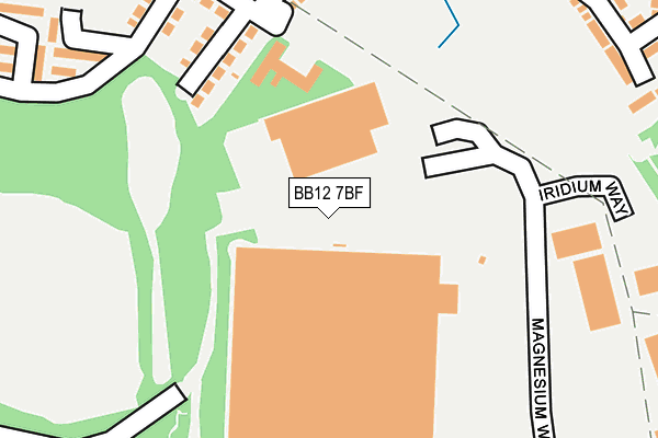
BB12 7BF lies on Magnesium Way in Hapton, Burnley. BB12 7BF is located in the Hapton with Park electoral ward, within the local authority district of Burnley and the English Parliamentary constituency of Burnley. The Sub Integrated Care Board (ICB) Location is NHS Lancashire and South Cumbria ICB - 01A and the police force is Lancashire. This postcode has been in use since June 2014.


GetTheData
Source: OS OpenMap – Local (Ordnance Survey)
Source: OS VectorMap District (Ordnance Survey)
Licence: Open Government Licence (requires attribution)
| Easting | 380236 |
| Northing | 432482 |
| Latitude | 53.788291 |
| Longitude | -2.301465 |
GetTheData
Source: Open Postcode Geo
Licence: Open Government Licence
| Street | Magnesium Way |
| Locality | Hapton |
| Town/City | Burnley |
| Country | England |
| Postcode District | BB12 |
| ➜ BB12 open data dashboard ➜ See where BB12 is on a map | |
GetTheData
Source: Land Registry Price Paid Data
Licence: Open Government Licence
Elevation or altitude of BB12 7BF as distance above sea level:
| Metres | Feet | |
|---|---|---|
| Elevation | 120m | 394ft |
Elevation is measured from the approximate centre of the postcode, to the nearest point on an OS contour line from OS Terrain 50, which has contour spacing of ten vertical metres.
➜ How high above sea level am I? Find the elevation of your current position using your device's GPS.
GetTheData
Source: Open Postcode Elevation
Licence: Open Government Licence
| Ward | Hapton With Park |
| Constituency | Burnley |
GetTheData
Source: ONS Postcode Database
Licence: Open Government Licence
| July 2023 | Violence and sexual offences | On or near Low Bank | 494m |
| February 2023 | Burglary | On or near Low Bank | 494m |
| October 2022 | Burglary | On or near Low Bank | 494m |
| ➜ Get more crime data in our Crime section | |||
GetTheData
Source: data.police.uk
Licence: Open Government Licence
| Cambridge Drive Turn Round (Cambridge Drive) | Hapton | 282m |
| Shawbrook Walk (Lancaster Drive) | Hapton | 380m |
| Lancaster Drive | Hapton | 524m |
| Lancaster Drive | Hapton | 524m |
| Mills (Fox Street) | Lowerhouse | 540m |
| Rose Grove Station | 1.3km |
| Hapton Station | 1.3km |
| Burnley Barracks Station | 2.9km |
GetTheData
Source: NaPTAN
Licence: Open Government Licence
GetTheData
Source: ONS Postcode Database
Licence: Open Government Licence


➜ Get more ratings from the Food Standards Agency
GetTheData
Source: Food Standards Agency
Licence: FSA terms & conditions
| Last Collection | |||
|---|---|---|---|
| Location | Mon-Fri | Sat | Distance |
| 81 Rosegrove Lane | 16:00 | 11:00 | 1,053m |
| Burnley Road | 17:30 | 11:00 | 1,669m |
| Farrington Road | 18:00 | 11:00 | 1,674m |
GetTheData
Source: Dracos
Licence: Creative Commons Attribution-ShareAlike
| Facility | Distance |
|---|---|
| Hameldon Community College (Site 1) (Closed) Byron Street, Burnley Grass Pitches, Sports Hall | 800m |
| Lowerhouse Cricket Club - The Brooks Foundation Ground David Wren Way Off Lowerhouse Lane, Burnley Grass Pitches | 875m |
| Burnley High School Byron Street, Burnley Grass Pitches, Sports Hall | 963m |
GetTheData
Source: Active Places
Licence: Open Government Licence
| School | Phase of Education | Distance |
|---|---|---|
| Whitegate Nursery School Victoria Road, Padiham, Burnley, BB12 8TG | Nursery | 822m |
| Burnley High School Byron Street, Burnley, BB12 6NX | Secondary | 963m |
| Shuttleworth College Burnley Road, Padiham, Burnley, BB12 8ST | Secondary | 1km |
GetTheData
Source: Edubase
Licence: Open Government Licence
The below table lists the International Territorial Level (ITL) codes (formerly Nomenclature of Territorial Units for Statistics (NUTS) codes) and Local Administrative Units (LAU) codes for BB12 7BF:
| ITL 1 Code | Name |
|---|---|
| TLD | North West (England) |
| ITL 2 Code | Name |
| TLD4 | Lancashire |
| ITL 3 Code | Name |
| TLD46 | East Lancashire |
| LAU 1 Code | Name |
| E07000117 | Burnley |
GetTheData
Source: ONS Postcode Directory
Licence: Open Government Licence
The below table lists the Census Output Area (OA), Lower Layer Super Output Area (LSOA), and Middle Layer Super Output Area (MSOA) for BB12 7BF:
| Code | Name | |
|---|---|---|
| OA | E00126322 | |
| LSOA | E01024888 | Burnley 011C |
| MSOA | E02005186 | Burnley 011 |
GetTheData
Source: ONS Postcode Directory
Licence: Open Government Licence
| BB12 7EJ | Iridium Close | 102m |
| BB12 6PU | Printers Fold | 253m |
| BB12 7DW | Balliol Close | 292m |
| BB12 6PS | High Close | 355m |
| BB12 7DJ | Harrow Close | 390m |
| BB12 7DL | Stonyhurst Close | 394m |
| BB12 6PH | Printers Fold | 397m |
| BB12 7DF | Kings Drive | 420m |
| BB12 7DN | Winchester Road | 446m |
| BB12 7DH | Eton Close | 453m |
GetTheData
Source: Open Postcode Geo; Land Registry Price Paid Data
Licence: Open Government Licence