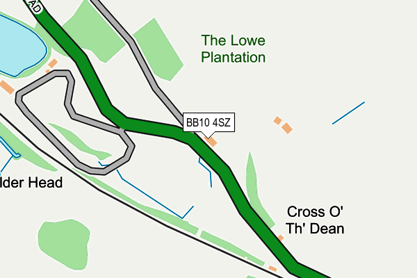
BB10 4SZ lies on Copy Cottages in Cliviger, Burnley. BB10 4SZ is located in the Cliviger with Worsthorne electoral ward, within the local authority district of Burnley and the English Parliamentary constituency of Burnley. The Sub Integrated Care Board (ICB) Location is NHS Lancashire and South Cumbria ICB - 01A and the police force is Lancashire. This postcode has been in use since January 1980.


GetTheData
Source: OS OpenMap – Local (Ordnance Survey)
Source: OS VectorMap District (Ordnance Survey)
Licence: Open Government Licence (requires attribution)
| Easting | 388320 |
| Northing | 427617 |
| Latitude | 53.744796 |
| Longitude | -2.178578 |
GetTheData
Source: Open Postcode Geo
Licence: Open Government Licence
| Street | Copy Cottages |
| Locality | Cliviger |
| Town/City | Burnley |
| Country | England |
| Postcode District | BB10 |
| ➜ BB10 open data dashboard ➜ See where BB10 is on a map | |
GetTheData
Source: Land Registry Price Paid Data
Licence: Open Government Licence
Elevation or altitude of BB10 4SZ as distance above sea level:
| Metres | Feet | |
|---|---|---|
| Elevation | 230m | 755ft |
Elevation is measured from the approximate centre of the postcode, to the nearest point on an OS contour line from OS Terrain 50, which has contour spacing of ten vertical metres.
➜ How high above sea level am I? Find the elevation of your current position using your device's GPS.
GetTheData
Source: Open Postcode Elevation
Licence: Open Government Licence
| Ward | Cliviger With Worsthorne |
| Constituency | Burnley |
GetTheData
Source: ONS Postcode Database
Licence: Open Government Licence
| June 2022 | Vehicle crime | On or near Burnley Road | 405m |
| February 2022 | Vehicle crime | On or near Burnley Road | 405m |
| December 2021 | Violence and sexual offences | On or near Burnley Road | 405m |
| ➜ Get more crime data in our Crime section | |||
GetTheData
Source: data.police.uk
Licence: Open Government Licence
| Lowe Plantation (Burnley Road) | Holme Chapel | 24m |
| Lowe Plantation (Burnley Road) | Holme Chapel | 29m |
| Rattenclough Layby (Burnley Road) | Holme Chapel | 219m |
| Royd Wood (Burnley Road) | Holme Chapel | 239m |
| Bradget Hey (Burnley Road) | Holme Chapel | 468m |
| Burnley Manchester Road Station | 6.4km |
GetTheData
Source: NaPTAN
Licence: Open Government Licence
| Percentage of properties with Next Generation Access | 100.0% |
| Percentage of properties with Superfast Broadband | 0.0% |
| Percentage of properties with Ultrafast Broadband | 0.0% |
| Percentage of properties with Full Fibre Broadband | 0.0% |
Superfast Broadband is between 30Mbps and 300Mbps
Ultrafast Broadband is > 300Mbps
| Percentage of properties unable to receive 2Mbps | 0.0% |
| Percentage of properties unable to receive 5Mbps | 0.0% |
| Percentage of properties unable to receive 10Mbps | 100.0% |
| Percentage of properties unable to receive 30Mbps | 100.0% |
GetTheData
Source: Ofcom
Licence: Ofcom Terms of Use (requires attribution)
GetTheData
Source: ONS Postcode Database
Licence: Open Government Licence


➜ Get more ratings from the Food Standards Agency
GetTheData
Source: Food Standards Agency
Licence: FSA terms & conditions
| Last Collection | |||
|---|---|---|---|
| Location | Mon-Fri | Sat | Distance |
| Portsmouth P.o. | 17:00 | 11:30 | 1,646m |
| Daisy Bank | 17:00 | 11:30 | 2,421m |
| Pudsey | 16:45 | 11:30 | 2,589m |
GetTheData
Source: Dracos
Licence: Creative Commons Attribution-ShareAlike
| Facility | Distance |
|---|---|
| Weir Playing Field Heald Lane, Weir, Bacup Grass Pitches | 2.5km |
| Mount Lane Playing Fields Mount Lane, Cliviger, Burnley Grass Pitches | 2.7km |
| Northern Primary School Plantation View, Bacup Grass Pitches | 3.3km |
GetTheData
Source: Active Places
Licence: Open Government Licence
| School | Phase of Education | Distance |
|---|---|---|
| St John's CofE Primary School, Cliviger Burnley Road, Cliviger, Burnley, BB10 4SU | Primary | 1.2km |
| Cornholme Junior, Infant and Nursery School Greenfield Terrace, Cornholme, Todmorden, OL14 8PL | Primary | 2.3km |
| Northern Primary School Burnley Road, Bacup, OL13 8PH | Primary | 3.3km |
GetTheData
Source: Edubase
Licence: Open Government Licence
The below table lists the International Territorial Level (ITL) codes (formerly Nomenclature of Territorial Units for Statistics (NUTS) codes) and Local Administrative Units (LAU) codes for BB10 4SZ:
| ITL 1 Code | Name |
|---|---|
| TLD | North West (England) |
| ITL 2 Code | Name |
| TLD4 | Lancashire |
| ITL 3 Code | Name |
| TLD46 | East Lancashire |
| LAU 1 Code | Name |
| E07000117 | Burnley |
GetTheData
Source: ONS Postcode Directory
Licence: Open Government Licence
The below table lists the Census Output Area (OA), Lower Layer Super Output Area (LSOA), and Middle Layer Super Output Area (MSOA) for BB10 4SZ:
| Code | Name | |
|---|---|---|
| OA | E00126227 | |
| LSOA | E01024870 | Burnley 009D |
| MSOA | E02005184 | Burnley 009 |
GetTheData
Source: ONS Postcode Directory
Licence: Open Government Licence
| BB10 4TA | Burnley Road | 487m |
| BB10 4SY | Burnley Road | 914m |
| BB10 4SU | Burnley Road | 1402m |
| BB10 4ST | Burnley Road | 1660m |
| BB10 4SS | Grange Road | 1890m |
| OL13 8QZ | Heald Lane | 1898m |
| OL13 8RB | Burnley Road | 1914m |
| OL14 8PB | Ivy Place | 1924m |
| OL13 8RA | Old Clough | 1967m |
| BB10 4SP | Burnley Road | 1974m |
GetTheData
Source: Open Postcode Geo; Land Registry Price Paid Data
Licence: Open Government Licence