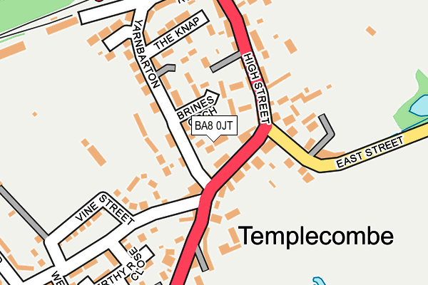
BA8 0JT lies on West Court in Templecombe. BA8 0JT is located in the Blackmoor Vale electoral ward, within the unitary authority of Somerset and the English Parliamentary constituency of Somerton and Frome. The Sub Integrated Care Board (ICB) Location is NHS Somerset ICB - 11X and the police force is Avon and Somerset. This postcode has been in use since January 1980.


GetTheData
Source: OS OpenMap – Local (Ordnance Survey)
Source: OS VectorMap District (Ordnance Survey)
Licence: Open Government Licence (requires attribution)
| Easting | 370940 |
| Northing | 122332 |
| Latitude | 50.999639 |
| Longitude | -2.415499 |
GetTheData
Source: Open Postcode Geo
Licence: Open Government Licence
| Street | West Court |
| Town/City | Templecombe |
| Country | England |
| Postcode District | BA8 |
| ➜ BA8 open data dashboard ➜ See where BA8 is on a map ➜ Where is Templecombe? | |
GetTheData
Source: Land Registry Price Paid Data
Licence: Open Government Licence
Elevation or altitude of BA8 0JT as distance above sea level:
| Metres | Feet | |
|---|---|---|
| Elevation | 90m | 295ft |
Elevation is measured from the approximate centre of the postcode, to the nearest point on an OS contour line from OS Terrain 50, which has contour spacing of ten vertical metres.
➜ How high above sea level am I? Find the elevation of your current position using your device's GPS.
GetTheData
Source: Open Postcode Elevation
Licence: Open Government Licence
| Ward | Blackmoor Vale |
| Constituency | Somerton And Frome |
GetTheData
Source: ONS Postcode Database
Licence: Open Government Licence
| September 2023 | Other theft | On or near High Street | 38m |
| September 2023 | Anti-social behaviour | On or near Parking Area | 251m |
| July 2023 | Criminal damage and arson | On or near Vine Grove | 122m |
| ➜ Get more crime data in our Crime section | |||
GetTheData
Source: data.police.uk
Licence: Open Government Licence
| Butchers Shop (High Street) | Templecombe | 99m |
| Butchers Shop (High Street) | Templecombe | 105m |
| Station Road (High Street) | Templecombe | 218m |
| Station Road (High Street) | Templecombe | 224m |
| The Station (Station Road) | Templecombe | 228m |
| Templecombe Station | 0.3km |
GetTheData
Source: NaPTAN
Licence: Open Government Licence
| Percentage of properties with Next Generation Access | 100.0% |
| Percentage of properties with Superfast Broadband | 100.0% |
| Percentage of properties with Ultrafast Broadband | 0.0% |
| Percentage of properties with Full Fibre Broadband | 0.0% |
Superfast Broadband is between 30Mbps and 300Mbps
Ultrafast Broadband is > 300Mbps
| Percentage of properties unable to receive 2Mbps | 0.0% |
| Percentage of properties unable to receive 5Mbps | 0.0% |
| Percentage of properties unable to receive 10Mbps | 0.0% |
| Percentage of properties unable to receive 30Mbps | 0.0% |
GetTheData
Source: Ofcom
Licence: Ofcom Terms of Use (requires attribution)
GetTheData
Source: ONS Postcode Database
Licence: Open Government Licence


➜ Get more ratings from the Food Standards Agency
GetTheData
Source: Food Standards Agency
Licence: FSA terms & conditions
| Last Collection | |||
|---|---|---|---|
| Location | Mon-Fri | Sat | Distance |
| Vine Street | 12:00 | 10:30 | 80m |
| Templecombe Post Office | 17:30 | 10:15 | 200m |
| Westcombe | 12:00 | 10:30 | 337m |
GetTheData
Source: Dracos
Licence: Creative Commons Attribution-ShareAlike
| Facility | Distance |
|---|---|
| Templecombe Recreation Ground Vine Street, Templecombe Grass Pitches, Outdoor Tennis Courts | 186m |
| Vernalls Field Horsington, Templecombe Grass Pitches | 2km |
| Horsington Church School South Cheriton, Templecombe Grass Pitches | 2.3km |
GetTheData
Source: Active Places
Licence: Open Government Licence
| School | Phase of Education | Distance |
|---|---|---|
| Abbas and Templecombe Church School School Lane, Templecombe, BA8 0HP | Primary | 319m |
| Horsington Church School Horsington, Templecombe, BA8 0BW | Primary | 2.3km |
| St Nicholas CofE Primary School, Henstridge Ash Walk, Henstridge, St Nicholas C of E Primary School, Templecombe, BA8 0QD | Primary | 2.7km |
GetTheData
Source: Edubase
Licence: Open Government Licence
The below table lists the International Territorial Level (ITL) codes (formerly Nomenclature of Territorial Units for Statistics (NUTS) codes) and Local Administrative Units (LAU) codes for BA8 0JT:
| ITL 1 Code | Name |
|---|---|
| TLK | South West (England) |
| ITL 2 Code | Name |
| TLK2 | Dorset and Somerset |
| ITL 3 Code | Name |
| TLK23 | Somerset CC |
| LAU 1 Code | Name |
| E07000189 | South Somerset |
GetTheData
Source: ONS Postcode Directory
Licence: Open Government Licence
The below table lists the Census Output Area (OA), Lower Layer Super Output Area (LSOA), and Middle Layer Super Output Area (MSOA) for BA8 0JT:
| Code | Name | |
|---|---|---|
| OA | E00148503 | |
| LSOA | E01029156 | South Somerset 008B |
| MSOA | E02006082 | South Somerset 008 |
GetTheData
Source: ONS Postcode Directory
Licence: Open Government Licence
| BA8 0JE | High Street | 25m |
| BA8 0JF | High Street | 60m |
| BA8 0JH | Yarn Barton | 63m |
| BA8 0JL | Brines Orchard | 70m |
| BA8 0JU | Vine Grove | 103m |
| BA8 0JS | Coronation Villas | 112m |
| BA8 0JQ | High Street | 114m |
| BA8 0JY | Vine Street | 119m |
| BA8 0AX | Templars Barton | 121m |
| BA8 0JX | East Street | 133m |
GetTheData
Source: Open Postcode Geo; Land Registry Price Paid Data
Licence: Open Government Licence