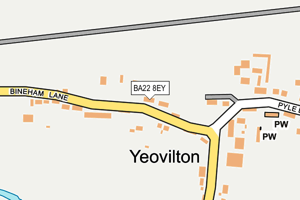
BA22 8EY is located in the Castle Cary electoral ward, within the unitary authority of Somerset and the English Parliamentary constituency of Yeovil. The Sub Integrated Care Board (ICB) Location is NHS Somerset ICB - 11X and the police force is Avon and Somerset. This postcode has been in use since January 1980.


GetTheData
Source: OS OpenMap – Local (Ordnance Survey)
Source: OS VectorMap District (Ordnance Survey)
Licence: Open Government Licence (requires attribution)
| Easting | 354441 |
| Northing | 123040 |
| Latitude | 51.004932 |
| Longitude | -2.650697 |
GetTheData
Source: Open Postcode Geo
Licence: Open Government Licence
| Country | England |
| Postcode District | BA22 |
| ➜ BA22 open data dashboard ➜ See where BA22 is on a map ➜ Where is Yeovilton? | |
GetTheData
Source: Land Registry Price Paid Data
Licence: Open Government Licence
Elevation or altitude of BA22 8EY as distance above sea level:
| Metres | Feet | |
|---|---|---|
| Elevation | 20m | 66ft |
Elevation is measured from the approximate centre of the postcode, to the nearest point on an OS contour line from OS Terrain 50, which has contour spacing of ten vertical metres.
➜ How high above sea level am I? Find the elevation of your current position using your device's GPS.
GetTheData
Source: Open Postcode Elevation
Licence: Open Government Licence
| Ward | Castle Cary |
| Constituency | Yeovil |
GetTheData
Source: ONS Postcode Database
Licence: Open Government Licence
| December 2021 | Other crime | On or near Weir Lane | 336m |
| July 2021 | Anti-social behaviour | On or near Weir Lane | 336m |
| May 2021 | Violence and sexual offences | On or near Weir Lane | 336m |
| ➜ Get more crime data in our Crime section | |||
GetTheData
Source: data.police.uk
Licence: Open Government Licence
| Broadmeadows (Weir Lane) | Limington | 175m |
| Broadmeadows (Weir Lane) | Limington | 179m |
| Rnas (Pyle Lane) | Limington | 307m |
| Rnas (Pyle Lane) | Limington | 327m |
| Yeovilton Air Station | Yeovilton | 871m |
GetTheData
Source: NaPTAN
Licence: Open Government Licence
| Percentage of properties with Next Generation Access | 100.0% |
| Percentage of properties with Superfast Broadband | 0.0% |
| Percentage of properties with Ultrafast Broadband | 0.0% |
| Percentage of properties with Full Fibre Broadband | 0.0% |
Superfast Broadband is between 30Mbps and 300Mbps
Ultrafast Broadband is > 300Mbps
| Percentage of properties unable to receive 2Mbps | 0.0% |
| Percentage of properties unable to receive 5Mbps | 0.0% |
| Percentage of properties unable to receive 10Mbps | 0.0% |
| Percentage of properties unable to receive 30Mbps | 100.0% |
GetTheData
Source: Ofcom
Licence: Ofcom Terms of Use (requires attribution)
GetTheData
Source: ONS Postcode Database
Licence: Open Government Licence


➜ Get more ratings from the Food Standards Agency
GetTheData
Source: Food Standards Agency
Licence: FSA terms & conditions
| Last Collection | |||
|---|---|---|---|
| Location | Mon-Fri | Sat | Distance |
| Air Museum | 12:00 | 12:00 | 1,481m |
| Mudford Post Office | 17:30 | 11:00 | 4,918m |
GetTheData
Source: Dracos
Licence: Creative Commons Attribution-ShareAlike
| Facility | Distance |
|---|---|
| Royal Naval Air Station Yeovilton Royal Naval Air Station, Yeovilton, Yeovil Sports Hall, Swimming Pool, Health and Fitness Gym, Squash Courts, Outdoor Tennis Courts | 813m |
| Rnas Yeovilton Sports Field Vixen Close , Yeovilton, Yeovil Athletics, Artificial Grass Pitch, Grass Pitches, Outdoor Tennis Courts, Squash Courts | 1.3km |
| Ilchester Sports Field Ilchester, Yeovil Grass Pitches | 2.6km |
GetTheData
Source: Active Places
Licence: Open Government Licence
| School | Phase of Education | Distance |
|---|---|---|
| Chilton Bridge School Chilton Bridge School, Chilton Cantelo, Yeovil, BA22 8BE | Not applicable | 1.8km |
| Ilchester Community School Somerton Road, Ilchester, Yeovil, BA22 8JL | Primary | 2.4km |
| Chilthorne Domer Church School Main Street, Chilthorne Domer, Yeovil, BA22 8RD | Primary | 4.5km |
GetTheData
Source: Edubase
Licence: Open Government Licence
The below table lists the International Territorial Level (ITL) codes (formerly Nomenclature of Territorial Units for Statistics (NUTS) codes) and Local Administrative Units (LAU) codes for BA22 8EY:
| ITL 1 Code | Name |
|---|---|
| TLK | South West (England) |
| ITL 2 Code | Name |
| TLK2 | Dorset and Somerset |
| ITL 3 Code | Name |
| TLK23 | Somerset CC |
| LAU 1 Code | Name |
| E07000189 | South Somerset |
GetTheData
Source: ONS Postcode Directory
Licence: Open Government Licence
The below table lists the Census Output Area (OA), Lower Layer Super Output Area (LSOA), and Middle Layer Super Output Area (MSOA) for BA22 8EY:
| Code | Name | |
|---|---|---|
| OA | E00166005 | |
| LSOA | E01029199 | South Somerset 006D |
| MSOA | E02006080 | South Somerset 006 |
GetTheData
Source: ONS Postcode Directory
Licence: Open Government Licence
| BA22 8EZ | Bineham Lane | 92m |
| BA22 8EX | 209m | |
| BA22 8EU | Weir Lane | 240m |
| BA22 8EQ | 869m | |
| BA22 8EH | 940m | |
| BA22 8EL | Duck Lane | 987m |
| BA22 8EG | 1044m | |
| BA22 8EF | Fairview Terrace | 1112m |
| BA22 8EP | Glanfield Terrace | 1343m |
| BA22 8EE | 1626m |
GetTheData
Source: Open Postcode Geo; Land Registry Price Paid Data
Licence: Open Government Licence