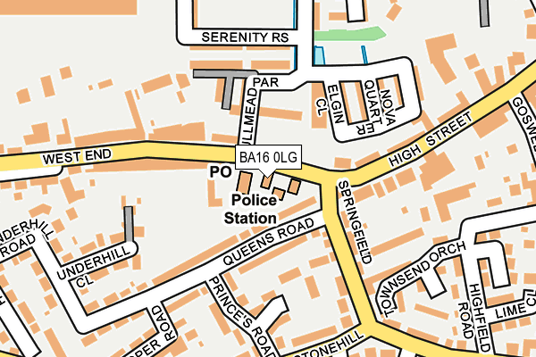
BA16 0LG is located in the Street electoral ward, within the unitary authority of Somerset and the English Parliamentary constituency of Wells. The Sub Integrated Care Board (ICB) Location is NHS Somerset ICB - 11X and the police force is Avon and Somerset. This postcode has been in use since January 1980.


GetTheData
Source: OS OpenMap – Local (Ordnance Survey)
Source: OS VectorMap District (Ordnance Survey)
Licence: Open Government Licence (requires attribution)
| Easting | 347758 |
| Northing | 136248 |
| Latitude | 51.123120 |
| Longitude | -2.747849 |
GetTheData
Source: Open Postcode Geo
Licence: Open Government Licence
| Country | England |
| Postcode District | BA16 |
| ➜ BA16 open data dashboard ➜ See where BA16 is on a map ➜ Where is Street? | |
GetTheData
Source: Land Registry Price Paid Data
Licence: Open Government Licence
Elevation or altitude of BA16 0LG as distance above sea level:
| Metres | Feet | |
|---|---|---|
| Elevation | 20m | 66ft |
Elevation is measured from the approximate centre of the postcode, to the nearest point on an OS contour line from OS Terrain 50, which has contour spacing of ten vertical metres.
➜ How high above sea level am I? Find the elevation of your current position using your device's GPS.
GetTheData
Source: Open Postcode Elevation
Licence: Open Government Licence
| Ward | Street |
| Constituency | Wells |
GetTheData
Source: ONS Postcode Database
Licence: Open Government Licence
3, WEST END, STREET, BA16 0LG 2023 31 MAR £367,500 |
GetTheData
Source: HM Land Registry Price Paid Data
Licence: Contains HM Land Registry data © Crown copyright and database right 2024. This data is licensed under the Open Government Licence v3.0.
| January 2024 | Violence and sexual offences | On or near Parking Area | 298m |
| November 2023 | Violence and sexual offences | On or near Parking Area | 298m |
| November 2023 | Violence and sexual offences | On or near Durston Close | 380m |
| ➜ Get more crime data in our Crime section | |||
GetTheData
Source: data.police.uk
Licence: Open Government Licence
| West End | Street | 122m |
| West End | Street | 216m |
| Leigh Furlong Road (Middle Leigh) | Street | 244m |
| Leigh Furlong Road (Middle Leigh) | Street | 266m |
| Stonehill | Street | 279m |
GetTheData
Source: NaPTAN
Licence: Open Government Licence
GetTheData
Source: ONS Postcode Database
Licence: Open Government Licence


➜ Get more ratings from the Food Standards Agency
GetTheData
Source: Food Standards Agency
Licence: FSA terms & conditions
| Last Collection | |||
|---|---|---|---|
| Location | Mon-Fri | Sat | Distance |
| Cranhill Road | 16:00 | 11:30 | 422m |
| Street Post Office | 18:00 | 12:00 | 640m |
| Clarks Village | 16:00 | 11:30 | 788m |
GetTheData
Source: Dracos
Licence: Creative Commons Attribution-ShareAlike
| Facility | Distance |
|---|---|
| Fitness Factory (Street) (Closed) The Tanyard, Leigh Road, Street Studio, Health and Fitness Gym | 620m |
| Brookside Academy Brooks Road, Street Grass Pitches | 712m |
| The Tannery Ground (Street Fc) Middle Brooks, Street Grass Pitches | 791m |
GetTheData
Source: Active Places
Licence: Open Government Licence
| School | Phase of Education | Distance |
|---|---|---|
| Brookside Community Primary School Brooks Road, Street, BA16 0PR | Primary | 712m |
| Hindhayes Infant School Leigh Road, Street, BA16 0HB | Primary | 776m |
| Avalon School Brooks Road, Street, BA16 0PS | Not applicable | 856m |
GetTheData
Source: Edubase
Licence: Open Government Licence
The below table lists the International Territorial Level (ITL) codes (formerly Nomenclature of Territorial Units for Statistics (NUTS) codes) and Local Administrative Units (LAU) codes for BA16 0LG:
| ITL 1 Code | Name |
|---|---|
| TLK | South West (England) |
| ITL 2 Code | Name |
| TLK2 | Dorset and Somerset |
| ITL 3 Code | Name |
| TLK23 | Somerset CC |
| LAU 1 Code | Name |
| E07000187 | Mendip |
GetTheData
Source: ONS Postcode Directory
Licence: Open Government Licence
The below table lists the Census Output Area (OA), Lower Layer Super Output Area (LSOA), and Middle Layer Super Output Area (MSOA) for BA16 0LG:
| Code | Name | |
|---|---|---|
| OA | E00148067 | |
| LSOA | E01029070 | Mendip 014A |
| MSOA | E02006060 | Mendip 014 |
GetTheData
Source: ONS Postcode Directory
Licence: Open Government Licence
| BA16 0NG | Queens Road | 58m |
| BA16 0LT | Teetotal Row | 65m |
| BA16 0FG | Bullmead Parade | 96m |
| BA16 0NW | Quantock Court | 104m |
| BA16 0FX | Lime Tree Square | 105m |
| BA16 0GW | Quarryman Close | 111m |
| BA16 0FS | Elgin Grove | 118m |
| BA16 0NN | Quantock Court | 120m |
| BA16 0FN | Torlon Grove | 135m |
| BA16 0LW | West End | 139m |
GetTheData
Source: Open Postcode Geo; Land Registry Price Paid Data
Licence: Open Government Licence