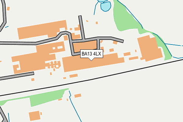
BA13 4LX is located in the Westbury East electoral ward, within the unitary authority of Wiltshire and the English Parliamentary constituency of South West Wiltshire. The Sub Integrated Care Board (ICB) Location is NHS Bath and North East Somerset, Swindon and Wiltshire ICB - 92 and the police force is Wiltshire. This postcode has been in use since September 2005.


GetTheData
Source: OS OpenMap – Local (Ordnance Survey)
Source: OS VectorMap District (Ordnance Survey)
Licence: Open Government Licence (requires attribution)
| Easting | 388686 |
| Northing | 152486 |
| Latitude | 51.271406 |
| Longitude | -2.163560 |
GetTheData
Source: Open Postcode Geo
Licence: Open Government Licence
| Country | England |
| Postcode District | BA13 |
| ➜ BA13 open data dashboard ➜ See where BA13 is on a map | |
GetTheData
Source: Land Registry Price Paid Data
Licence: Open Government Licence
Elevation or altitude of BA13 4LX as distance above sea level:
| Metres | Feet | |
|---|---|---|
| Elevation | 60m | 197ft |
Elevation is measured from the approximate centre of the postcode, to the nearest point on an OS contour line from OS Terrain 50, which has contour spacing of ten vertical metres.
➜ How high above sea level am I? Find the elevation of your current position using your device's GPS.
GetTheData
Source: Open Postcode Elevation
Licence: Open Government Licence
| Ward | Westbury East |
| Constituency | South West Wiltshire |
GetTheData
Source: ONS Postcode Database
Licence: Open Government Licence
| Bitham Park | Westbury | 1,069m |
| Cemetery (Bratton Road) | Westbury | 1,162m |
| Cemetery (Bratton Road) | Westbury | 1,165m |
| Co-op Supermarket (Trwobridge Road) | Westbury | 1,366m |
| The Mead | Westbury | 1,376m |
| Westbury (Wilts) Station | 2.5km |
| Dilton Marsh Station | 4km |
GetTheData
Source: NaPTAN
Licence: Open Government Licence
GetTheData
Source: ONS Postcode Database
Licence: Open Government Licence


➜ Get more ratings from the Food Standards Agency
GetTheData
Source: Food Standards Agency
Licence: FSA terms & conditions
| Last Collection | |||
|---|---|---|---|
| Location | Mon-Fri | Sat | Distance |
| Arundell Close | 17:00 | 12:15 | 1,088m |
| The Mead | 17:00 | 12:15 | 1,458m |
| Newtown | 17:00 | 12:15 | 1,497m |
GetTheData
Source: Dracos
Licence: Creative Commons Attribution-ShareAlike
| Facility | Distance |
|---|---|
| Westbury Golf Club Trowbridge Road, Trowbridge Road, Westbury Golf | 0m |
| Westbury Rugby Football Club Trowbridge Road, Trowbridge Road, Westbury Grass Pitches | 210m |
| Bcc Westbury Social Club (Closed) Trowbridge Road, Westbury Grass Pitches | 975m |
GetTheData
Source: Active Places
Licence: Open Government Licence
| School | Phase of Education | Distance |
|---|---|---|
| Bitham Brook Primary School Arundell Close, Westbury, BA13 3UA | Primary | 1.3km |
| Westbury Infant School Eden Vale Road, Westbury, BA13 3NY | Primary | 2.4km |
| Matravers School Springfield Road, Westbury, BA13 3QH | Secondary | 2.4km |
GetTheData
Source: Edubase
Licence: Open Government Licence
The below table lists the International Territorial Level (ITL) codes (formerly Nomenclature of Territorial Units for Statistics (NUTS) codes) and Local Administrative Units (LAU) codes for BA13 4LX:
| ITL 1 Code | Name |
|---|---|
| TLK | South West (England) |
| ITL 2 Code | Name |
| TLK1 | Gloucestershire, Wiltshire and Bath/Bristol area |
| ITL 3 Code | Name |
| TLK15 | Wiltshire |
| LAU 1 Code | Name |
| E06000054 | Wiltshire |
GetTheData
Source: ONS Postcode Directory
Licence: Open Government Licence
The below table lists the Census Output Area (OA), Lower Layer Super Output Area (LSOA), and Middle Layer Super Output Area (MSOA) for BA13 4LX:
| Code | Name | |
|---|---|---|
| OA | E00163831 | |
| LSOA | E01032121 | Wiltshire 039E |
| MSOA | E02006690 | Wiltshire 039 |
GetTheData
Source: ONS Postcode Directory
Licence: Open Government Licence
| BA13 4NB | Park Lane | 846m |
| BA13 4TG | Bratton Road | 987m |
| BA13 3UB | The Knoll | 995m |
| BA13 3UH | Cheyney Walk | 1112m |
| BA13 3UE | Danvers Way | 1114m |
| BA13 3UA | Arundell Close | 1132m |
| BA13 3XY | Nightingale Drive | 1218m |
| BA13 3EB | Bratton Road | 1222m |
| BA13 3UF | Danvers Way | 1228m |
| BA13 3UD | Bremeridge Road | 1304m |
GetTheData
Source: Open Postcode Geo; Land Registry Price Paid Data
Licence: Open Government Licence